Huntingdon County Information Page

Borough · Huntingdon County

Mount Union

137 stories on file, each with its sources. 1.2 square miles of land in the ridge and valley country of central Pennsylvania.

2,308
Population
2020 Census, P.L. 94-171
1.16 sq mi
Land area
2020 Census gazetteer
0.08 sq mi
Water
2020 Census gazetteer
610 ft
Elevation
Community reference point, checked against USGS
Borough
Type
GEOID 4206151984

Nearby

Straight-line miles between map centers, 2020 Census boundary file

The founding record

Mount Union was laid out in 1850, by Gen. George W. Speer and John Dougherty, and was designed by the proprietors as a place of transfer from their contemplated Drake's Ferry and East Broad Top Railroad, for which a charter was granted by the Legislature in 1819, to the Pennsylvania canal. The name, Mount Union, concentrates the physical, geological, commercial, mineral and manufacturing features of a wild and beautiful region. The East Broad Top railroad intersects the Pennsylvania railroad at Mount Union and has added five hundred tons of coal and forty tons of pig-metal daily to the tonnage of the latter. This will be more than doubled when a branch railway of two and a-half miles into the Rocky ridge coal basin and a dozen miles to the iron mines of Fulton county, shall be built. From a letter written by John Dougherty, esq., to Prof. Dewees, of the State Geological Survey, on the 28th day of January, 1875, giving a sketch of the history of Matilda Furnace, opposite Mount Union, in Mifflin county, we take the following extract in relation to the iron ores of the southern part of Huntingdon county, from the Juniata river to Fort Littleton: " In the vicinity of Mount Union, fossil ore yielding 40 per cent, of iron can be mined in slopes of 500 to 700 feet above water level. Milton Scott Lytle, History of Huntingdon County (Lancaster: William H. Roy, 1876) · character 531,873 of the scanned text

Quoted from a work published before 1929 and therefore in the public domain in the United States. Spelling and punctuation are as printed, including nineteenth century spellings of place names. Scanned text carries optical character recognition errors; the character offset is given so the passage can be found and checked in the original.

137 stories

Stories from Mount Union

A ferry on the Juniata near Mount Union, as Myer Souders describes it
A ferry on the Juniata near Mount Union, as Myer Souders describes itShared by Myer Souders

Did you know? The crossing at Drake's Ferry, just above Mount Union, went from a ferry to a series of bridges.

Samuel Drake established the ferry in 1783, a short distance above the town. His tavern and stables on the north side of the river were a noted stopping place, where travelers arrived in the evening and left in the morning. A county bridge later stood there, and the flood of October 1847 took it out. "Drake's Ferry and Mill Creek bridges are both gone," the Huntingdon Journal reported. In February 1848 the county let a new bridge to John Robertson for $3,395. In 1876 the county advertised again, for a wooden bridge across the Juniata at Drake's Ferry, near Mount Union, and in November 1877 the Journal reported the new bridge completed, with the occasion celebrated by a sumptuous dinner.

Myer Souders shared this photograph with us. He tells us it shows the ferry near Mount Union before the 1870s. Look at the horse and wagon riding across, and the men with their poles.

Checked and confirmed. CONFIRMED 2026-10-09 against the sources listed: every factual sentence was tied to a verbatim passage and a script confirmed each passage is in its source. Information shared with us by readers is given as theirs, not as fact: Myer Souders.

Open this story on its own page →

Photograph not reproduced here. The image that goes with this story is held by huntingdoncountyhistory.com and its credit does not permit republication, so it is cited rather than copied. See the original.

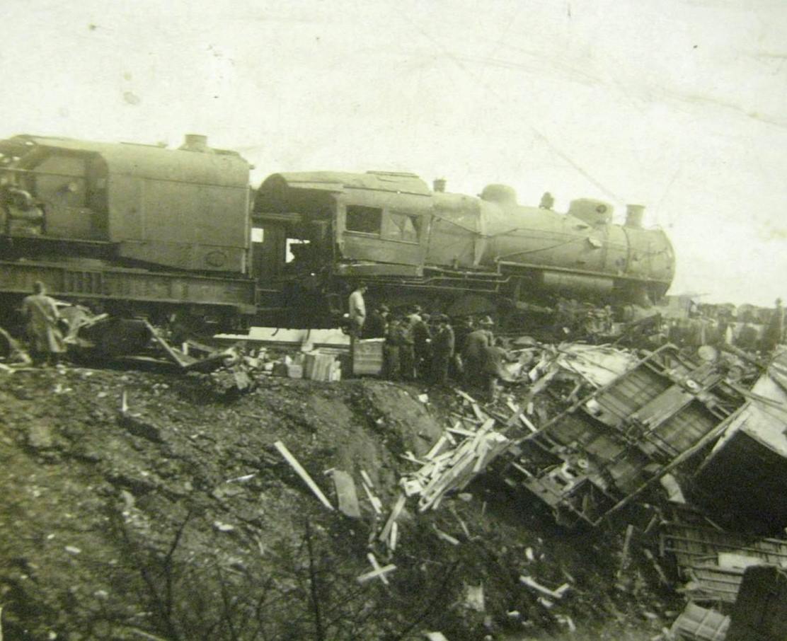
February 27, 1917, eight minutes past midnight. The eastbound Mercantile Express, Pennsylvania Railroad train No. 6 out of Altoona, stood at the Mount Union station. It had come in late with brake trouble and the crew was testing the airbrakes when a fast preference freight came out of a dense fog and struck it from behind, splitting the rear steel sleeper.

Twenty people were killed, nineteen passengers and the train's porter. Every one of them was in the sleeping car Bellwood, telescoped so completely that the crew outside could not reach anyone inside it.

Among the dead was Chester A. Minds of Ramey, a Clearfield County coal operator and a former University of Pennsylvania football star, travelling east with his family to the funeral of his wife's father. The Evening Public Ledger reported that Minds and six members of his family died in that car.

An accommodation train carrying workmen home from the Mount Union powder plant had pulled away from the same platform moments before the crash. A relief train left Altoona at one in the morning with the Pennsylvania's Central Division superintendent, doctors and nurses aboard, and picked up more physicians at Huntingdon on the way down.

One detail the papers could not leave alone: the first car of the freight that hit the express was loaded with coffins, shipped from a Pittsburgh firm to a business house in the east. They were thrown across the wreckage.

Checked against the record. CORRECTED, and one claim in the original was simply wrong. WRONG, now fixed: the original called it a 'coal freight'. Every contemporary account calls it a fast PREFERENCE freight. The coal in this story belongs to a victim, not to the train: Chester A. Minds was a coal operator in the Clearfield region. That is the likeliest route by which 'coal' migrated onto the freight. CUT for want of a source: the original sa…

Open this story on its own page →

Perspective View of House Looking North. Gable End Not Visible in Photograph Was the Canal Side. - John Sharrar House, West Water Street near Division Street
Perspective View of House Looking North. Gable End Not Visible in Photograph Was the Canal Side. - John Sharrar House, West Water Street near Division StreetLibrary of Congress, Historic American Buildings Survey / Historic American Engineering Record. No known copyright restrictions. pa2853.photos.038950p

This stone house stands on West Water Street near Division. The federal survey records it as the John Sharrar House and dates it to about 1841. The photographer noted that the gable end you cannot see in this picture was the canal side, because the Pennsylvania Mainline Canal came through here in 1829 and Mount Union started life as a canal village.

Here is the honest problem. The county's 1937 history says the town was laid out in 1840 by William Pollock, for John Sharrer. The Historic American Buildings Survey says the town plan was laid out and lots offered for sale in 1849. Both are serious sources and they do not agree, and we are not going to pick the one we like better.

So we asked. Then we went and looked in the newspaper the town was reading at the time, and it answers most of it. The Huntingdon Journal for 4 and 11 September 1849 carries the advertisement itself: the "Adjourned Sale of Mount Union TOWN LOTS", postponed from the 23rd by bad weather to Saturday 15 September, every second or third lot to be sold without reserve in the business part of Mount Union. It is signed George W. Speer and John Dougherty, dated 1 September 1849.

So the lots went up for sale in 1849, which is what the federal survey said. Lytle's 1876 county history named exactly the right two men and put it a year late. And the 1937 book is not simply wrong either, because the name is older than the sale: the same paper for 5 July 1843 carries John Sharer advertising an unclaimed trunk left at his warehouse "at Mount Union, Huntingdon county, Pa." That is the same John Sharrer the 1937 book says the town was laid out for, running a warehouse here six years before the lot sale.

One honest limit: this run of the Journal begins in 1843, so 1843 is the earliest the paper can show us, not the earliest it was true.

Checked against the record. This post asked readers to settle a disagreement between the county's 1937 history (laid out 1840 by William Pollock for John Sharrer) and the federal survey (laid out and lots offered for sale in 1849). The contemporary newspaper answers most of it. The Huntingdon Journal for 4 and 11 September 1849 prints the lot sale advertisement over the names of George W. Speer and John Dougherty, dated 1 September 1849 - confi…

Open this story on its own page →

Before every bridge there was a ferry, and this one carried the road that made the town.

Samuel Drake, Sr., a New Jersey man who had served in the Revolution, established Drake's Ferry in 1783 at the east end of Jack's Narrows just west of town. The tavern and stables stood on the north side of the river, just west of where the county bridge is now. It was, says the Juniata Valley encyclopedia, the only crossing over the Juniata provided for the travelling public on the great thoroughfare from Standing Stone, now Huntingdon, to Chambersburg, Hagerstown, Harper's Ferry and Baltimore. That was the principal route of traffic in the first quarter of the nineteenth century, and it had begun as an Indian trail used afterwards by traders and wagoners. Travellers generally arrived in the evening and left in the morning, so the tavern got a night out of every crossing.

The road to it was laid out by order of the court at Bedford. Six viewers reported in April 1787 that they had run a public road from the Burnt Cabins to Drake's Ferry, twenty four miles and forty nine perches, through what is now Dublin, Cromwell and Shirley townships. One of the six signed with his mark.

What ended the ferry was not the railroad. It was the canal. Welch, writing in the town in 1909, says the ferry flourished before the canal was built, and the 1897 encyclopedia is exact about it: the ferry was operated for many years, and not until the building of the canal, about the year 1830, was it abandoned.

The best part is what became of the ferryman. James Drake, Samuel's eldest son, was born at the ferry in 1787 and lived there until it was abandoned. He helped with the work until he was old enough to take charge, and ran it himself until about 1830, when the construction of the canal through the Narrows took place, of which he was the first foreman. The man who lost the ferry built the thing that ended it. He then moved out to the farm and put up the log house at the forks of the road at the mouth of Long Hollow.

The published account of the canal's opening picked out this spot above all others: the sublime and romantic scenery, particularly at Drake's Ferry, “is not excelled in any part of Pennsylvania.”

A railroad was supposed to come here too. Meetings were held along the proposed route early in 1848, one of them at Scottsville on 28 February, and on 25 March the legislature passed an act incorporating the Drake's Ferry and East Broad Top Railroad Company. No steps were ever taken to build it. Mount Union was laid out in 1850 by George W. Speer and John Dougherty, designed as the place where that railroad, which did not exist, would transfer to the canal, which was already finished. The town was planned around a junction of two things, and one of them was never built.

Checked against the record. THE PAGE HAD THE WRONG CAUSE, AND SO DID THIS PROJECT'S CHECKING SCRIPT. The page said the stone house fell “just as the railroad age overtook the ferry age”, which puts the ferry's end in the late 1850s. Three county histories put it a generation earlier and blame the canal. Welch in 1909 says the ferry flourished before the canal was built. The Commemorative Biographical Encyclopedia of 1897 says it plainly: the fe…

Read the full story, with 3 passages quoted from the county histories →

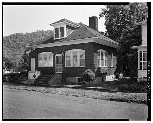
View of Office Looking South. - General Refractories Company, Office, Market Street, Mount Union
View of Office Looking South. - General Refractories Company, Office, Market Street, Mount UnionLibrary of Congress, Historic American Buildings Survey / Historic American Engineering Record. No known copyright restrictions. pa2851.photos.038947p

Look at the sign in the yard.

This little brick building on Market Street was the General Refractories Company office. When the company closed its Mount Union yard in the early 1950s, the brickyard and seven houses next to it were leveled. Three buildings were spared, for a reason that had nothing to do with sentiment: the office, the superintendent's house and a weigh shed happened to sit on a line with the residential streets instead of with the plant. The shed became somebody's house. The office became the local Red Cross headquarters. The plant site itself was cleared and became the town's park and athletic field.

The Red Cross goes a long way back here. Huntingdon County has had a chapter at Mount Union since the First World War, covering everything east and south of Jacks Mountain, and in the 1920s it was running classes in town in sewing and cooking for the newest families.

Sources

  1. HABS PA-5973 p.35
  2. HABS PA-5974 pp.6-7
  3. Sesqui 1937, American Red Cross (Mount Union chapter, territory east and south of Jacks Mountain)
  4. Mt. Union Times, 4 September 1924, cited in HABS PA-5974 p.6
  5. LOC caption pa2851.photos.038947p

Open this story on its own page →

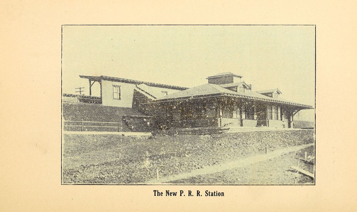
“The New P. R. R. Station”, as Charles Welch's history of Mount Union captioned it in 1909.
“The New P. R. R. Station”, as Charles Welch's history of Mount Union captioned it in 1909.Welch, History of Mount Union, 1909 stg08

The PRR station in 1908, the year after the railroad stopped running its express trains past it.

The high line viaduct over the old canal bed was built in 1906 and 1907, and it let the main line bypass the town. What was left beside this building was the railroad's original right of way, by then a yard siding where freight and passengers were transferred to and from the narrow gauge East Broad Top coming up from the south. That transfer is what this station was for.

It is often said the railroad is why the brick companies came here. The record puts the rock first. What drew them, say the National Register nominations for both plants, was the ganister: virtually unlimited reserves of quartzite on the mountaintops, combined with direct rail connections to Broad Top coal for fuel and to the steel centres that bought the brick. Rock and rails together, and the rock named first.

The town was already carrying something remarkable by 1908. The W. H. Haws plant, built here in 1899, was the first works in the United States put up purely to make refractory brick.

The railroad kept spending. By October 1915 the Pennsylvania had passed $100,000 in improvements at Mount Union, finished the new tower, and completed a double siding the three miles to Mapleton so all the shifting could be done there.

Checked against the record. A CLAIM CORRECTED BY THE TOWN'S OWN NOMINATION. This page opened by calling 1908 the year “when the Pennsylvania Railroad's main line was Mount Union's front door”. By 1908 it was not. The National Register nomination for the historic district records that a high line viaduct was built over the old Pennsylvania canal bed in 1906 and 1907 specifically so the main line could bypass the town with its express trains, and…

Read the full story, with 3 passages quoted from the county histories →

Did you know? The building that killed six men at Mount Union had been catching fire all summer, and the paper reported it as routine local news.

August 5, 1916, in the Mount Union column of the Harrisburg Telegraph: "A number of fires occurred during the week in the cotton dry house at the Aetna powder plant."

August 19: "A fire took place in the cotton dry house at the powder plant this week, destroying some powder."

September 2: "Several fires occurred during the week in the cotton dry house at the powder plant."

September 20, page one: "SIX MEN KILLED BY EXPLOSION AT MOUNT UNION. Cotton Dry House at Plant of Aetna Explosives Company Completely Destroyed."

It happened at six in the morning. The men were changing shifts, and the paper says that is the only reason it was not far worse, because the night workers were already walking away from the building. The dry house stood about four hundred yards off from everything else, along the river bank. The injured were taken to the Huntingdon Hospital.

Six men. In a building the whole town knew kept catching fire.

Checked against the record. CONFIRMED IN A primary source, same day, page one, and then made much stronger. The Harrisburg Telegraph of September 20, 1916, page 1, city edition, carries the story datelined "Mount Union, Pa., Sept. 20" and reports the explosion as having happened "at 6 o'clock this morning." That kills the newspaper-date-versus-event-date trap outright: the paper and the event are the same day, and the paper says so. Every core …

Open this story on its own page →

General Interior View of Packing Shed, No. 1 Works - Harbison-Walker Refractories Company, Packing Shed
General Interior View of Packing Shed, No. 1 Works - Harbison-Walker Refractories Company, Packing ShedLibrary of Congress, Historic American Buildings Survey / Historic American Engineering Record. No known copyright restrictions. pa2727.photos.134465p

This is the inside of the packing shed at the No. 1 works. Every one of those posts is doing a job, and the floor runs on past the end of the photograph.

It is also worth being honest about what the work cost. Silica yards were harder on a man than fire clay yards, because the air carried a far heavier load of silica dust, and silica dust causes silicosis. The men in crushing, in grinding and in shipping breathed the worst of it. Pennsylvania's own Bureau of Industrial Hygiene published a study of silicosis in the silica brick industry in 1941, so this was known.

Thousands of brickyard workers across this region got it. By the time it was formally accepted in the late 1960s as a product of the working conditions, the companies had become offices in far away cities, and a man or his widow had to find a doctor who would certify it and a lawyer who would carry the dust claim.

We should not tell the story of this town without that part in it.

Sources

  1. HABS PA-5973 p.21 (silicosis, exposure by work area)
  2. HABS PA-5973 p.39 (dust claims, recognition in the late 1960s)
  3. Fulton et al., A Study of Silicosis in the Silica Brick Industry, PA Dept of Health, 1941
  4. LOC caption pa2727.photos.134465p

Open this story on its own page →

View of Grefco Houses Looking South Along Water Street - Town of Mount Union
View of Grefco Houses Looking South Along Water Street - Town of Mount UnionLibrary of Congress, Historic American Buildings Survey / Historic American Engineering Record. No known copyright restrictions. pa2822.photos.038890p

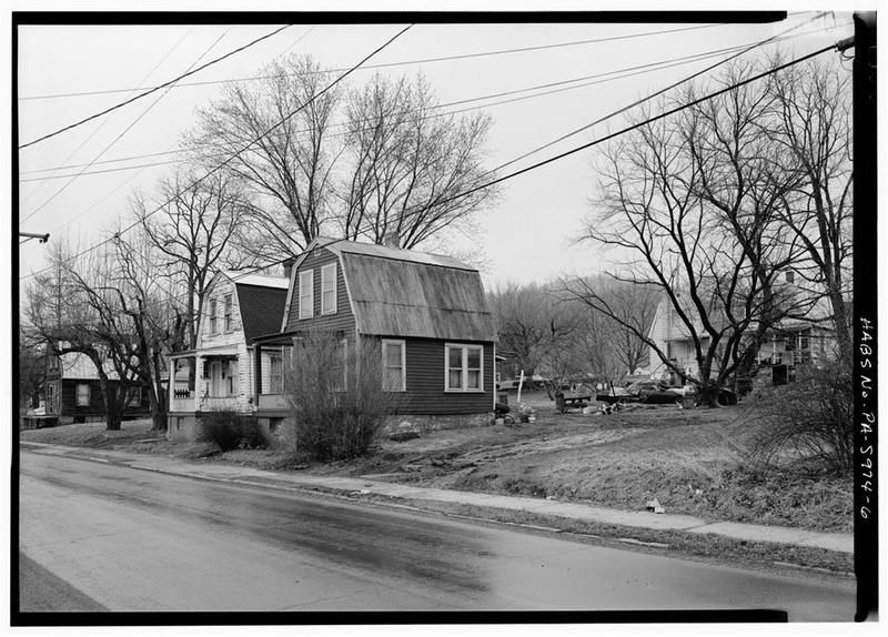
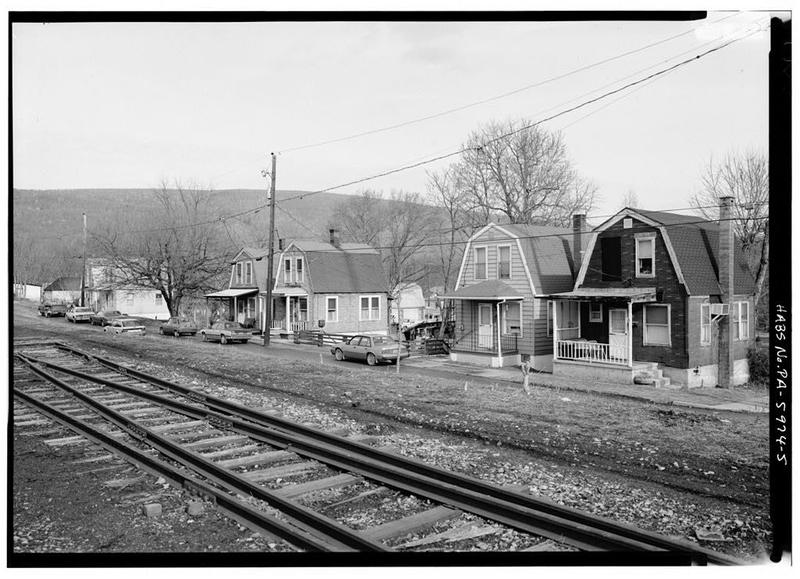
The federal survey describes them exactly as they still stand: two rows of one and a half story, gambrel roofed houses along east Water Street and Pennsylvania Avenue, built by the General Refractories Company for its workers.

In the early 1950s the company sold them. Across the whole region the brick companies followed the same policy when they got out of the housing business, which was to give the family already living in the house the first chance to buy it. By 1966 the last of those deeds had been recorded and the company town was over.

Sources

  1. HABS PA-5974 p.6
  2. HABS PA-5974 pp.6-7
  3. HABS PA-5973 p.35
  4. LOC caption pa2822.photos.038890p

Open this story on its own page →

Close View of Vermont Farmhouse-Style Home with Original Porch Roof and Siding, No. 43 Poplar Street. - Town of Kistler, Kistler, Mifflin County, PA
Close View of Vermont Farmhouse-Style Home with Original Porch Roof and Siding, No. 43 Poplar Street. - Town of Kistler, Kistler, Mifflin County, PALibrary of Congress, Historic American Buildings Survey / Historic American Engineering Record. No known copyright restrictions. pa2824.photos.038913p

Not numbers. Names. They are written on John Nolen's own plan for the town, and the federal survey copied them down: Double Valley Farm House, Double Mountain House, Double Capri Villa, Georgian Cottage, Vermont Farm House, and Norman Cottage.

The architects picked those old fashioned forms on purpose. They believed the character of a building could shape the character of the people living inside it, and the families coming to Kistler were going to be a mix of native born Americans, immigrants and African Americans who had never been asked to live the way the company had in mind.

The survey is specific about where those families came from. Kistler's foreign born residents, like Mount Union's, included east European immigrants, and the African American families had been recruited from the country around Saluda, South Carolina. On how they were then distributed through this carefully drawn village, the surveyors chose their words with care, and so will we: although no strict segregation was reported in Kistler, most of the African American families lived on Pine Street.

This one is No. 43 Poplar Street, a Vermont Farm House. Twenty seven of them were built and all but one were still standing when the surveyors counted. The caption notes this one still had its original porch roof and its original siding.

Checked against the record. ADDED, from the survey's own text and footnotes: the African American families in Kistler were recruited from the area around Saluda, South Carolina. That is not a general statement about migration. It names the place they were brought from, and it is the kind of detail a family in this town might still be able to match to a grandparent. THE HEDGE IS THE SOURCE'S OWN AND IT IS REPRODUCED EXACTLY. The survey says “al…

Open this story on its own page →

View Southwest of Mailbox Base Made of Refractory Bricks from the Three Mt. Union Brickyards. Located at the Corner of Market and South Jefferson
View Southwest of Mailbox Base Made of Refractory Bricks from the Three Mt. Union Brickyards. Located at the Corner of Market and South JeffersonLibrary of Congress, Historic American Buildings Survey / Historic American Engineering Record. No known copyright restrictions. pa2848.photos.038944p

When the last of it was over, the town went and got the bricks.

A committee collected brick and some of the most elaborate shapes from all three Mount Union plants and built a platform for a mailbox on the public sidewalk beside the post office, at Market and South Jefferson. The plaque set into it reads Bricktown Ganister and lists the plants by name. Look closely at the picture and you can pick out the shapes that were never ordinary bricks at all.

The Mount Union Times ran it under a headline that got it right: Mailbox Holder A Tribute To Bricktowners' Heritage.

Sources

  1. HABS PA-5974 p.8
  2. HABS PA-5973 p.39
  3. Mt. Union Times, 14 September 1990, cited therein
  4. LOC caption pa2848.photos.038944p

Open this story on its own page →

Photograph not reproduced here. The image that goes with this story is held by huntingdoncountyhistory.com and its credit does not permit republication, so it is cited rather than copied. See the original.

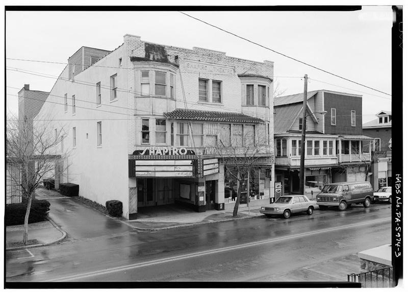
Saturday night, 1941: the Shapiro Theatre. For decades this marquee was Mount Union's night out.

The Shapiros were not newcomers when they built it. George Shapiro already had his own entry among the town's businessmen in Charles H. Welch's history of Mount Union, published in 1909. The family were still at it a generation later: Shapiro and Sherr opened a branch of their Mount Union store at Mapleton in 1924, and Joe Shapiro sat on the committee that ran the county's sesquicentennial in 1937.

The town they sold to was a boom town. A little more than a mile below Mount Union the Aetna Explosives Company had its powder works, and in November 1916 a single order was reported as meaning work for 1,500 men. That spring the town's William Penn Highway boosters had argued for a bridge over the Juniata for a plain reason: with one, the men could walk to the powder plant from their own homes.

Checked against the record. TWO DATES CUT, both unsourced, and the same year in both. The original said "The Shapiro family opened their first movie house in 1915, the same year the powder plant opened." Two searches of the Pennsylvania newspaper archive and a search of the nine books in the local corpus produced no source for either. Neither is contradicted. Both are simply not shown, and a year that carries the whole sentence has to be sourc…

Open this story on its own page →

Mount Union Refractories beehive ovens
Mount Union Refractories beehive ovensLibrary of Congress / HABS-HAER (Nancy Shedd) c04

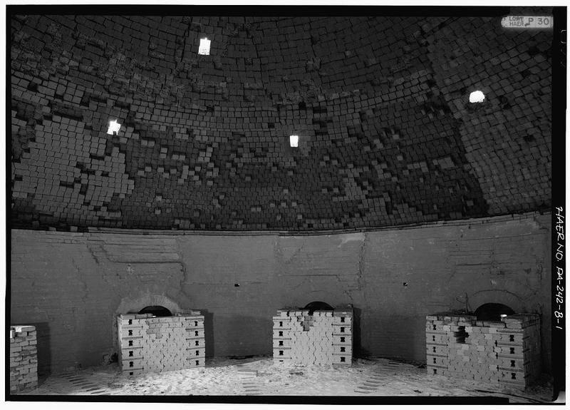
The beehive kilns of the Mount Union Refractories Company. The company was organized in 1911 and finished its silica brick plant in 1912, the third refractory concern to open in Mount Union in less than fifteen years.

Being last to arrive cost it. The two older companies had already taken the closest ganister, so Mount Union Refractories had to work quarries farther out, at Three Springs, and the East Broad Top Railroad hauled the rock in and the Broad Top coal that fired the kilns.

Then the war came. By 1919 the plant had gone from eight kilns to twenty-nine and was working 885 men. The housing shortage that followed is why the company hired the noted designer John Nolen to lay out the town of Kistler across the river.

Between the three plants, Mount Union claimed to be the silica brick capital of the world.

It is worth knowing how it ended. The company built a fireclay plant in Clearfield County in 1922 and became U.S. Refractories, merged into North American Refractories in 1930, and stopped making brick here for good in 1990. The site was put on the National Register, and then a salvage company took the buildings down and sold them for scrap. A state surveyor walked the ground on 3 April 1996 and found three buildings left. That June the Bureau for Historic Preservation wrote that the property had lost the very qualities that got it listed, and began the process of striking it off the Register. The two beehive kilns are gone.

Checked against the record. CITATION CORRECTED. An earlier pass on this page cited the nomination at npgallery.nps.gov/GetAsset/90000398_text. That address answers HTTP 200 with a 1,623 byte PNG placeholder for ANY reference number, including a deliberately invented one, so a reader following it would have got a broken image and no document. There is no digitized text asset at NPGallery for this reference, and the reason turns out to matter: th…

Read the full story, with 3 passages quoted from the county histories →

“Mount Union — Looking Toward the West”, from Charles Welch's 1909 history of the town.
“Mount Union — Looking Toward the West”, from Charles Welch's 1909 history of the town.Welch, History of Mount Union, 1909 stg10

Who named Mount Union, and when? The town's own histories can't quite agree.

Welch's 1909 book says Col. William Pollock gave the name, in consequence of the union of mountains at this point. A footnote adds that good authority also claims John Dougherty named it.

The founding date is no tidier. Lytle's 1876 county history says Mount Union was laid out in 1850 by Gen. George W. Speer and John Dougherty. The 1937 sesquicentennial book says William Pollock laid it out in 1840 for John Sharrer. Our September 1 post already gave you 1840 and 1849 from two other records. Now you have 1850 as well.

On one point the old books stand together: the name means exactly what it says. Lytle names the mountains in the union: Jack's and Stone mountains on the west, Chestnut ridge and Jack's mountain on the east.

And one number worth a smile: the county's 1937 history records that the first postmaster earned $6.59 for a full year's service.

If your family holds deeds, letters or records from when Mount Union was laid out, we would love to see them.

Checked and confirmed. Published without a source list. Every claim in it has now been read against the books it names and all of them hold, in the wording the original gives them: Welch 1909 for Pollock and for the "good authority" footnote naming John Dougherty, Lytle 1876 for the 1850 laying-out and for the four mountains, and the 1937 sesquicentennial book for both the 1840 date and the postmaster's $6.59. One thing the check added: th…

Open this story on its own page →

1908, a year into the boom, and Mount Union had a baseball team. These young men, many the sons of immigrant families who came for the brick work, claimed their place in American culture through the game. Baseball diamonds are where factory towns proved they belonged.

Sources

  1. Image posted to the Historic Mount Union page on 13 September 2015. Community archive, not a published record: the image and its caption come from the page, and the facts in the text still need a source of their own., Historic Mount Union page archive
  2. Photograph credit: Historic Mount Union Facebook page
  3. Image from the Historic Mount Union page archive, posted 13 September 2015. Community archive, not a published record.

Open this story on its own page →

November 22, 1906, Roy Jones sends a postcard to Miss Maud, telling her about hunting rabbits in Mount Union. Fifteen rabbits, a shared meal, and a moment of life preserved in a one-cent stamp and fountain-pen handwriting. These personal postcards are the voice of the era.

Sources

  1. Image posted to the Historic Mount Union page on 17 September 2019. Community archive, not a published record: the image and its caption come from the page, and the facts in the text still need a source of their own., Historic Mount Union page archive
  2. Photograph credit: Historic Mount Union Facebook page
  3. Image from the Historic Mount Union page archive, posted 17 September 2019. Community archive, not a published record.

Open this story on its own page →

Coulter School on December 29, 1897, Miss Minnie Jones and her pupils gathered for a photograph. This is Mount Union before the brickyards changed everything, when a one-room schoolhouse educated the valley's children. Education and ambition went hand in hand even then.

Sources

  1. Image posted to the Historic Mount Union page on 17 September 2019. Community archive, not a published record: the image and its caption come from the page, and the facts in the text still need a source of their own., Historic Mount Union page archive
  2. Photograph credit: Historic Mount Union Facebook page
  3. Image from the Historic Mount Union page archive, posted 17 September 2019. Community archive, not a published record.

Open this story on its own page →

The East Broad Top locomotive working Mount Union in 1907, a narrow-gauge workhorse hauling coal from the Broad Top mines to the PRR main line. The EBT was the connecting link between the mines to the west and the wider rail network that fed America's steel mills.

Sources

  1. Image posted to the Historic Mount Union page on 13 September 2015. Community archive, not a published record: the image and its caption come from the page, and the facts in the text still need a source of their own., Historic Mount Union page archive
  2. Photograph credit: Historic Mount Union Facebook page
  3. Image from the Historic Mount Union page archive, posted 13 September 2015. Community archive, not a published record.

Open this story on its own page →

East Broad Top Railroad & Coal Company, Roundhouse, State Route 994, West of U.S. Route 522, Rockhill Furnace
East Broad Top Railroad & Coal Company, Roundhouse, State Route 994, West of U.S. Route 522, Rockhill FurnaceLibrary of Congress, Historic American Buildings Survey / Historic American Engineering Record. No known copyright restrictions. pa3371

The East Broad Top Railroad's shops stand on Meadow Street in Rockhill Furnace, a middle point on a three-foot-gauge line that ran from Mount Union to Alvan. The nomination calls the railroad one of the oldest narrow gauge lines in America, and a 1991 National Park Service inventory of the county's industrial sites records that it was designated a National Historic Landmark in 1964.

The nomination says the East Broad Top Railroad and Coal Company was established in 1871, after the Civil War interfered with an earlier plan to reach the Broad Top coal. Africa's 1883 county history says the company had been organized under an act approved April 16, 1856, that construction began on September 16, 1872, and that the road opened to Robertsdale, its southern terminus, on November 4, 1874. The 1991 inventory says the owners of Rockhill Furnace built the line to reach iron ore and coal in the region, and that it reached its greatest length in 1916 with the extension to Alvan. The road carried timber, sand, rock, general freight and passengers, but coal was its great money-maker: trains hauled it to Mount Union, where it was transferred to the Pennsylvania Railroad. In 1881, Africa records, the road carried 143,449 tons of bituminous coal.

After World War II other fuels began to supplant coal. Passenger service ended in 1953, and on April 16, 1956, the company ran its last train. The purchaser of the entire line preserved five miles of track and six steam locomotives, Mikado types built for the East Broad Top by the Baldwin works of Philadelphia, and began running part of the line as a tourist attraction in 1960. The 1991 inventory names the buyer as the Kovalchick Salvage Company of Indiana, Pennsylvania, and says the town of Orbisonia asked for the reopening to commemorate its bicentennial.

The bulk of the Rockhill yard dates from 1874, including the red brick roundhouse with berths for eight engines and the Armstrong turntable. When the form was written in 1974 the blacksmith shop, foundry and machine and car shops still housed their original machinery, and the foundry was filled with patterns used in making the rolling stock. About 1,400 feet of grade north of Shirleysburg washed out in 1972. Across Meadow Street, the Orbisonia passenger station had its waiting room converted into a gift shop and its freight room into a snack bar.

Decline in the use of coal after World War II forced the East Broad Top to cease operations in 1956. All of its track and rolling stock seemed doomed, but the purchaser of the line generously preserved five miles of the track and six of the steam engines.National Register of Historic Places nomination, East Broad Top Railroad (reference 66000666), 66000666, p. 3 · character 7,078 of the scanned text
Checked against the record. Checked against the National Register nomination text before publication; 3 claims the nomination did not support were removed or corrected.

Open this story on its own page →
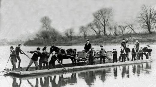
The St. Patrick's Day Flood of March 1936 put water where the town stood. Streets became rivers, buildings became obstacles, and the disaster was so severe that Congress acted, the Flood Control Act of 1936 was a direct response to this flood and others.

Sources

  1. Image posted to the Historic Mount Union page on 26 February 2019. Community archive, not a published record: the image and its caption come from the page, and the facts in the text still need a source of their own., Historic Mount Union page archive
  2. Photograph credit: Historic Mount Union Facebook page
  3. Image from the Historic Mount Union page archive, posted 26 February 2019. Community archive, not a published record.

Open this story on its own page →

This is Clinton V. Hackman. Charles H. Welch's history of Mount Union, published in 1909, prints this portrait and captions it “Superintendent Harbison-Walker Brick Plant”.

He did not stay there. The federal survey of Mount Union puts it in one sentence: the third company, Mt. Union Refractories, was organised by two former managers for Harbison-Walker, R. P. M. Davis and Clinton V. Hackman. It was built in 1911 and 1912 on the edge of town along the Juniata and started with eight kilns. During the First World War it built twenty one more.

By November 1916 the Harrisburg Telegraph was naming C. V. Hackman as superintendent of that company, and Davis as its president and general manager. Two men who had worked for Harbison-Walker, running their own plant across town from it.

The company did not keep the name. In 1922 it opened a second plant in Clearfield County and became the U. S. Refractories Company. In 1930 it was merged into North American Refractories, which is the name most people in town still use for that end of the works.

Mount Union Refractories is the company that hired John Nolen to lay out Kistler, the planned town across the river in Mifflin County, for the workers it could not house.

Checked against the record. THIS PAGE CARRIED A CORRECTION THAT WAS ITSELF WRONG, AND IT IS NOW REVERSED. The honest version of what happened matters more than a tidy note, so here it is. The page originally said Hackman “was one of two former Harbison-Walker managers who organized Mount Union Refractories in 1911.” An earlier check cut that sentence for want of a source, cut it from a second page as well, and recorded that nothing supported i…

Read the full story, with 3 passages quoted from the county histories →

July 4th, 1906, Mount Union's still-small town comes out for a parade. The brick boom hasn't fully arrived yet, but the traditions are there: bands, bunting, marching down the main street. This is America asserting itself through ritual.

Sources

  1. Image posted to the Historic Mount Union page on 13 September 2015. Community archive, not a published record: the image and its caption come from the page, and the facts in the text still need a source of their own., Historic Mount Union page archive
  2. Photograph credit: Historic Mount Union Facebook page
  3. Image from the Historic Mount Union page archive, posted 13 September 2015. Community archive, not a published record.

Open this story on its own page →

General View of Church Looking South. Building Constructed by African-American Residents in 1921. - Mt. Hope Baptist Church, Chestnut & Division Streets
General View of Church Looking South. Building Constructed by African-American Residents in 1921. - Mt. Hope Baptist Church, Chestnut & Division StreetsLibrary of Congress, Historic American Buildings Survey / Historic American Engineering Record. No known copyright restrictions. pa2847.photos.038941p

As the wartime labor market kept expanding, and a third brick plant and a government munitions plant went up, Mount Union drew a number of African American workers from the South. The federal survey puts it plainly: it gave the town a mix of nationalities and races that was new to central Pennsylvania at the time.

The survey records this building at Chestnut and Division streets as constructed by African American residents in 1921. The history of that community was serious enough to carry a master's thesis of its own at Penn State in 1987, written by R. Cummins McNitt.

Sources

  1. LOC caption pa2847.photos.038941p (HABS PA-5988)
  2. Shedd 1991, Historical Overview, p.20
  3. HABS PA-5973 p.45 (McNitt thesis in the source list)

Open this story on its own page →

General View of Church Looking South. Building Constructed by East European Immigrants Om 1915-16. - Saints Peter & Paul Orthodox Church
General View of Church Looking South. Building Constructed by East European Immigrants Om 1915-16. - Saints Peter & Paul Orthodox ChurchLibrary of Congress, Historic American Buildings Survey / Historic American Engineering Record. No known copyright restrictions. pa2846.photos.038940p

The demand for steel in the First World War pushed silica brick production to a level the county could not staff. Employment at Huntingdon County refractories hit an all time high of 1,800 in 1919, and more than 1,600 of those jobs were in Mount Union alone. Local people could not fill them, so the companies hired eastern and southern European workers, and the town filled up with families who had been somewhere else a year before. By 1910 the Ganister Hill section already held Italian, Austro-Hungarian, Serbian, Croatian, Russian and Macedonian households.

They built this. The federal survey records the church at North Jefferson and Sherman streets as constructed by East European immigrants in 1915 and 1916.

Sources

  1. LOC caption pa2846.photos.038940p (HABS PA-5987)
  2. Shedd 1991, Historical Overview, p.20
  3. HABS PA-5974 p.6

Open this story on its own page →

The wheels buckled and intertwined, metal folded like paper under the force of the collision. This is the physical evidence of the impact that killed about twenty people in seconds.

Sources

  1. Image posted to the Historic Mount Union page on 17 September 2019. Community archive, not a published record: the image and its caption come from the page, and the facts in the text still need a source of their own., Historic Mount Union page archive
  2. Photograph credit: Historic Mount Union Facebook page
  3. Image from the Historic Mount Union page archive, posted 17 September 2019. Community archive, not a published record.

Open this story on its own page →

February 27, 1917, the day everything stopped. The sleeper car of the Mercantile Express lies twisted, and a lone figure stands watching. Inside were twenty people who wouldn't go home that night. Photographers captured the disaster raw, selling postcards of the wreck across the state.

Sources

  1. Image posted to the Historic Mount Union page on 17 September 2019. Community archive, not a published record: the image and its caption come from the page, and the facts in the text still need a source of their own., Historic Mount Union page archive
  2. Photograph credit: Historic Mount Union Facebook page
  3. Image from the Historic Mount Union page archive, posted 17 September 2019. Community archive, not a published record.

Open this story on its own page →

The Captain Jack Motel in the early 1950s, a new type of lodging for a new era. The brick boom was waning, but Mount Union was adjusting: highways, automobiles, travelers passing through instead of staying for business. The motel represented a different kind of future.

Sources

  1. Image posted to the Historic Mount Union page on 30 January 2015. Community archive, not a published record: the image and its caption come from the page, and the facts in the text still need a source of their own., Historic Mount Union page archive
  2. Photograph credit: Historic Mount Union Facebook page
  3. Image from the Historic Mount Union page archive, posted 30 January 2015. Community archive, not a published record.

Open this story on its own page →

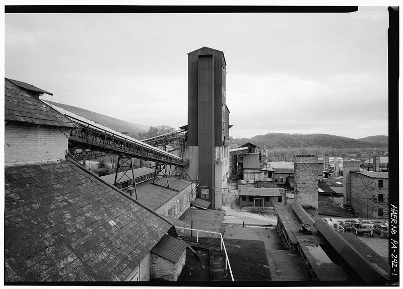
View east from western edge of complex. Collapsed overhead conveyor in foreground carried ganister down to the brickyard from crushing and grinding
View east from western edge of complex. Collapsed overhead conveyor in foreground carried ganister down to the brickyard from crushing and grindingLibrary of Congress, Historic American Buildings Survey / Historic American Engineering Record. No known copyright restrictions. pa2723.photos.356905p

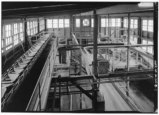
For most of the plant's life the ganister came from the far side of the Juniata and had to be hauled across the river and across the main line. In the late 1940s Harbison-Walker moved the mining to the mountainside directly above the plant and set the crushing and washing at intervals down the slope, with an overhead conveyor to bring the rock the rest of the way in.

That decision took about a hundred company houses with it. The Ganister Hill neighborhood stood in the way, and the conveyor belt ran between two of the houses. Residents were allowed to buy their own homes for salvage, for around two hundred dollars, and a good deal of that lumber went back up as new houses in the flats along the river. To shelter the families who were displaced, the Huntingdon County housing authority built its first federally supported project on the east edge of town.

Sources

  1. HAER PA-242 p.2
  2. HABS PA-5974 p.7
  3. LOC caption pa2723.photos.356905p

Open this story on its own page →

View of Nos. 96 and 96 Cedar Street Looking North, Examples of Norman Cottages. - Town of Kistler
View of Nos. 96 and 96 Cedar Street Looking North, Examples of Norman Cottages. - Town of KistlerLibrary of Congress, Historic American Buildings Survey / Historic American Engineering Record. No known copyright restrictions. pa2824.photos.038914p

A Norman Cottage sits gable end to the street, one and a half stories, with one roof slope run out long to cover a side porch and a three window bay pushed out of the front. Twenty three were built at Kistler and twenty one were still there when the federal survey counted them.

Kenneth and Edna Cox kept theirs exactly as it was built. No additions, no alterations to the outside. The survey noticed something quiet and human in that. For most of the century it was a mark of getting ahead to modernize a company house. By 1991 the neighbors were asking the Coxes not to touch theirs.

Sources

  1. Shedd 1991, company town of Kistler (Norman Cottage description, 23 built, 21 survive)
  2. HABS PA-5973 pp.39-40 (Kenneth and Edna Cox, interview 10 June 1991)
  3. LOC caption pa2824.photos.038914p

Open this story on its own page →

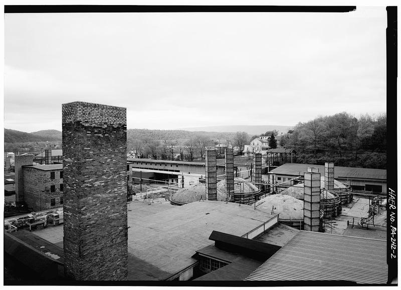
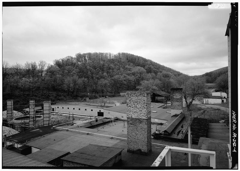
General view looking north. - Harbison-Walker Refractories Company, West end of Shirley Street, Mount Union, Huntingdon County, PA
General view looking north. - Harbison-Walker Refractories Company, West end of Shirley Street, Mount Union, Huntingdon County, PALibrary of Congress, Historic American Buildings Survey / Historic American Engineering Record. No known copyright restrictions. pa2723.photos.356904p

In 1899 the W. H. Haws Company of Johnstown began building a plant at the west end of Shirley Street. The federal engineering survey that documented it records what that plant was: the first works in the United States built exclusively to manufacture silica brick. Nowhere else in the country had anyone put up a factory for that one purpose and nothing else. Harbison and Walker of Pittsburgh, one of the largest refractory makers in the world, bought it within a few years and built a second works beside it. By 1910 the two together employed more than 600 men and could turn out 150,000 bricks a day.

This is what the yard looked like when federal surveyors photographed it after the closing. The kilns were gone. The stacks were still up.

Sources

  1. HAER PA-242 pp.1-2
  2. HABS PA-5974 pp.3-4
  3. LOC caption pa2723.photos.356904p

Read the full story, with 3 passages quoted from the county histories →

View of Kistler Company Store and School Building Looking North. Demolished in 1990. - Town of Kistler
View of Kistler Company Store and School Building Looking North. Demolished in 1990. - Town of KistlerLibrary of Congress, Historic American Buildings Survey / Historic American Engineering Record. No known copyright restrictions. pa2824.photos.038904p

Kistler was about as complete a company town as this region produced. The company built and kept up virtually every building in it, along with the roads, the water and the electric.

This was the store and school building, and there is a reason the school was in it. By 1924 Wayne Township was running the Kistler school out of three rented rooms on the second floor, above the company store, and the school board proposed to put up a building of its own. The company president, R. P. M. Davis, objected. The board's choice was a “portable, ready-made building,” and he did not think it “adequate or appropriate” for a town designed by famous architects and planted with thousands of dollars of trees and shrubs. Kistler as a model town, he wrote, was famous, and letters came from all over the United States and from Europe asking about its plans and its history. To put “a squatty, ready-made, ugly school building right in the center of Kistler would be a great misfortune.”

So he stopped it. He had Kistler incorporated as a borough, which took its school administration out of the township's hands, and the classes stayed upstairs in the company's building. The borough of Kistler exists because a brick company did not want a cheap schoolhouse spoiling the view.

Children were taught there until 1936, when a brick school went up at the end of Cedar Street with help from the Works Progress Administration. It is still the Kistler elementary school.

The federal photographer got to the store in time, because the caption on this negative carries four words that end the story: demolished in 1990. A ranch house stands on the site.

Checked against the record. ADDED, and it is the best documented thing on the page: the borough of Kistler was incorporated to keep a school out. The survey sets out the sequence and quotes the company president directly. By 1924 Wayne Township was renting three rooms above the company store for the school. The board wanted a portable, ready-made building of its own. R. P. M. Davis, then president, objected that it was neither adequate nor appr…

Open this story on its own page →

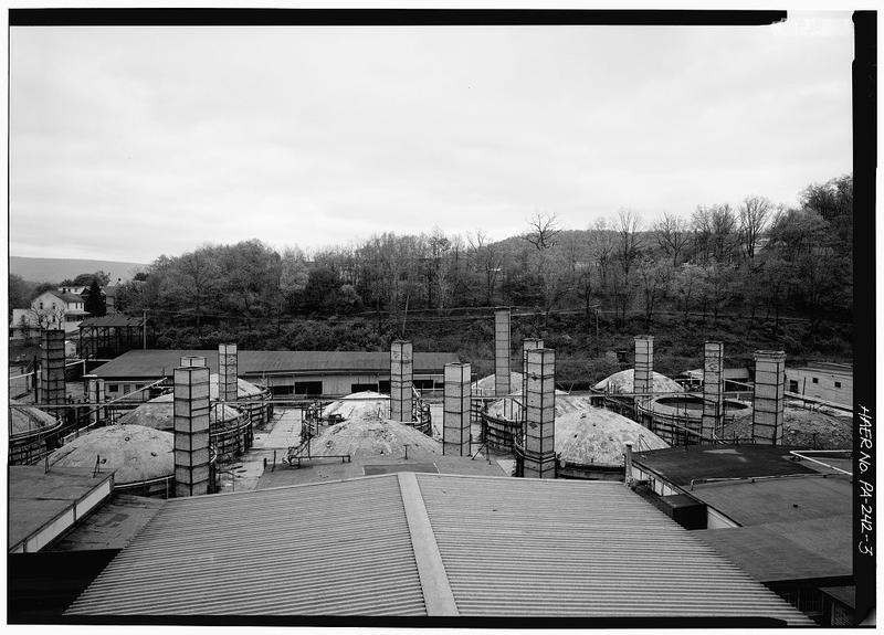
General view looking west from eastern edge of complex. Kilns have been demolished but kiln stacks still stand.
General view looking west from eastern edge of complex. Kilns have been demolished but kiln stacks still stand.Library of Congress, Historic American Buildings Survey / Historic American Engineering Record. No known copyright restrictions. pa2723.photos.356902p

At the end of November 1985 a Harbison-Walker spokesman told the United Steelworkers that the Mount Union plant was closing, because the silica brick market had all but collapsed. Somewhere between twenty five and forty seven people were still on the payroll. In 1925 there had been 563.

Then came a strange postscript that says everything about what was made here. Mount Union and one General Refractories plant in Claysburg were the only two operations in the entire country that made silica shapes and nothing else, the odd sizes that coke ovens are built out of. When Mount Union shut, customers with coke ovens still running discovered there was nowhere left to buy replacements. So the retired plant manager and three former employees went in, gathered up the molds, and shipped them to a plant in Utah so the brick could still be made. What was left over was sold for scrap in April of 1989.

North American's yard closed in March of 1990. That was the end of it.

Sources

  1. HABS PA-5974 p.7 (Nov 1985 notice, 25 to 47 employed vs 563 in 1925)
  2. HAER PA-242 pp.2-3 (silica shapes, molds shipped to Utah, scrapped April 1989)
  3. LOC caption pa2723.photos.356902p

Open this story on its own page →

Photograph not reproduced here. The image that goes with this story is held by huntingdoncountyhistory.com and its credit does not permit republication, so it is cited rather than copied. See the original.

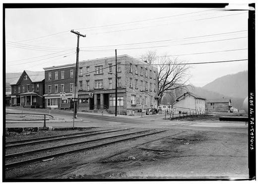
The PRR depot was Mount Union's front door, and by the time it was serving that purpose the main line had already stopped coming past it.

The National Register nomination for the town's historic district explains the arrangement. A high line viaduct, thrown over the bed of the old Pennsylvania canal in 1906 and 1907, let the Pennsylvania Railroad's main line bypass the town with its express trains. The original right of way, the one the station stood beside, became a yard siding where passengers and cargo were moved between the standard gauge and the narrow gauge East Broad Top coming up from the south. The upgraded main line runs just beyond the northern edge of the district.

It is often said the rails are why the brick companies came. The record puts the rock first. What drew them, say the National Register nominations, was the ganister on the mountaintops, combined with rail connections to Broad Top coal and to the steel centres that bought the brick. Rock and rails together, and the rock named first.

Charles H. Welch, writing in Mount Union in 1909, tells it the same way: before the Harbison-Walker plant went up, Scott Dibert and W. H. Haws of Johnstown came to look the town over as a site for a brick plant, and what they found was ganister on Jacks Mountain.

Checked against the record. A FREQUENCY CLAIM STAYS OUT, AND NOW THERE IS A REASON RATHER THAN A SHRUG. An earlier version of this page said dozens of trains a day passed here. That was removed for want of a source, which is a weak reason on its own. The district nomination has now been read for it: across 186,000 characters it mentions railroads fifty two times and stations twenty times and gives no figure for train frequency anywhere. It does…

Read the full story, with 3 passages quoted from the county histories →

View of Brick Plant from Kistler Looking West - Town of Kistler, Kistler, Mifflin County, PA
View of Brick Plant from Kistler Looking West - Town of Kistler, Kistler, Mifflin County, PALibrary of Congress, Historic American Buildings Survey / Historic American Engineering Record. No known copyright restrictions. pa2824.photos.038901p

The third brickyard in town was started by two men who used to run the first one. R. P. M. Davis and Clinton V. Hackman, both former managers for Harbison-Walker, organized the Mount Union Refractories Company and built its plant in 1911 and 1912 on the edge of town along the Juniata. It opened with eight kilns. During the First World War they built twenty one more.

In 1922 the company put up a second plant in Clearfield County and renamed itself U.S. Refractories. In 1930 it merged into North American Refractories. The yard ran until March of 1990, and all but two of its beehive kilns came down after that.

This is the plant seen from Kistler, the town it built.

Sources

  1. HABS PA-5974 p.4
  2. HABS PA-5974 p.7
  3. LOC caption pa2824.photos.038901p

Open this story on its own page →

General View of Post Office Looking South - U.S. Post Office, Market & South Jefferson Street, Mount Union
General View of Post Office Looking South - U.S. Post Office, Market & South Jefferson Street, Mount UnionLibrary of Congress, Historic American Buildings Survey / Historic American Engineering Record. No known copyright restrictions. pa2848.photos.038942p

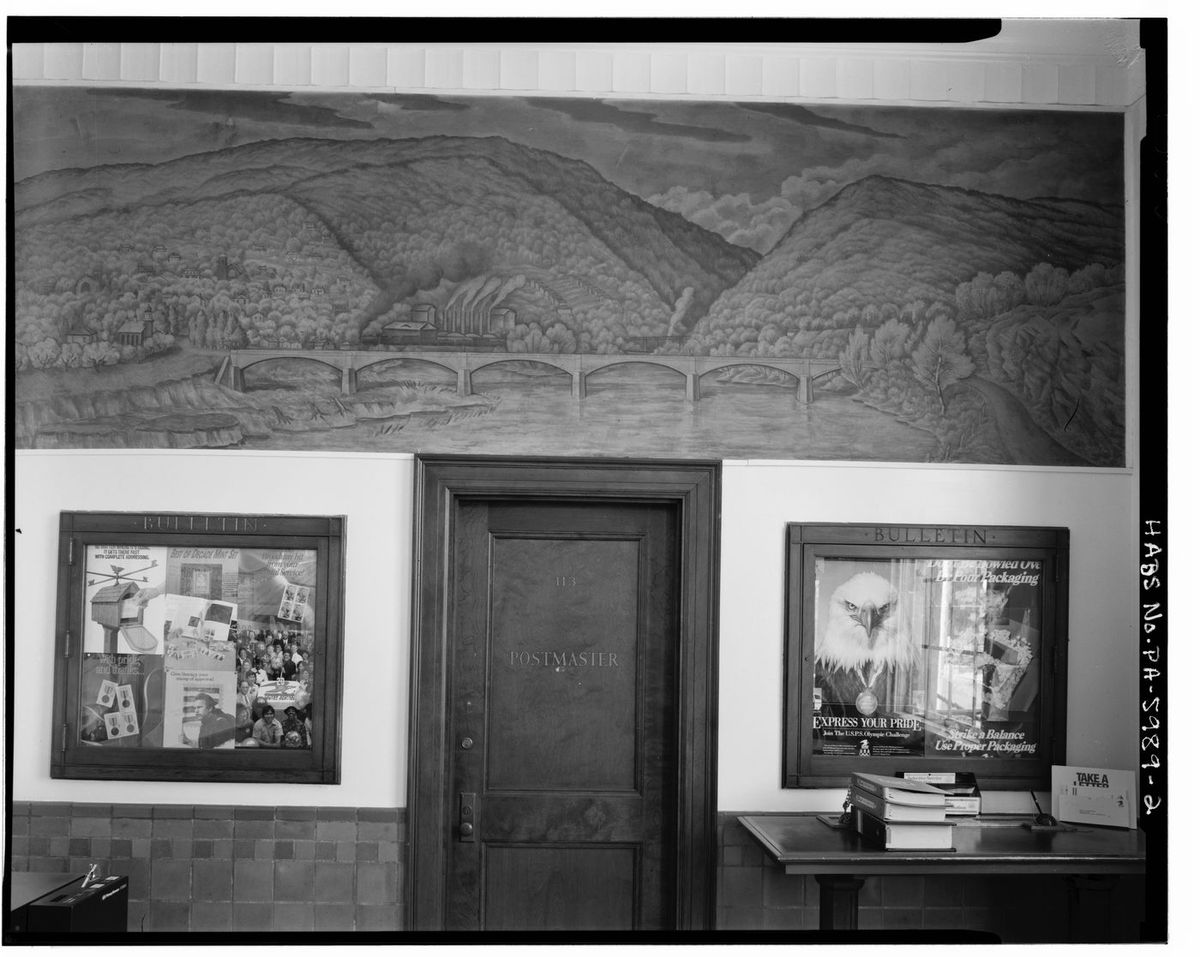
The date is cut into the front of the building: 1936.

The year after, the Treasury Department's Section sent Paul Rohland to paint a mural inside it. He called it The Union of the Mountains, and the title is the whole argument: he turned down the town's industry as a subject, writing that he “was not particularly interested in industrial turmoil as a decorative idea”, and painted instead the two mountains the town is named for. The industry is still in there, though, and it is what a local eye goes to first — Harbison-Walker's smokestacks, and beside them a clearing on the mountainside that is a tract of company housing. Along the left stand three churches: a red Catholic one, a tan Methodist one, and a Greek Orthodox one with an onion dome, which is the immigrant town painted without comment.

Fifteen years later the company tore every one of those houses down. The painting is still on the wall.

Open this story on its own page →

The crew of the Silica Brick Works, this is the human side of industrial statistics. Each face represents a decade or more of work at the kilns, in the molding rooms, at the presses. Some are immigrants, some American-born, all essential to the boom.

Sources

  1. Image posted to the Historic Mount Union page on 13 September 2015. Community archive, not a published record: the image and its caption come from the page, and the facts in the text still need a source of their own., Historic Mount Union page archive
  2. Photograph credit: Historic Mount Union Facebook page
  3. Image from the Historic Mount Union page archive, posted 13 September 2015. Community archive, not a published record.

Open this story on its own page →

View of House Looking South. - General Refractories Company, Superintendent'S House, 118 Market Street
View of House Looking South. - General Refractories Company, Superintendent'S House, 118 Market StreetLibrary of Congress, Historic American Buildings Survey / Historic American Engineering Record. No known copyright restrictions. pa2850.photos.038946p

This is 118 Market Street, the General Refractories superintendent's house. It is still there.

The same company owned forty one houses in Mount Union, scattered in four different places. Two rows of gambrel roofed houses along east Water Street and Pennsylvania Avenue. A row of seven, two stories, right up against the plant on Wausau Place. Six frame houses on Shirley Street. And twelve one story shanties across Hill Valley Run on the far side of the plant, in a section the town called Shantytown. Not far off was Mount Union Refractories' own row of shanties, which somebody with a sense of humor had nicknamed Little Kistler.

When the divesting came, the houses that looked like houses were sold to the families in them. The shanties were judged unfit to pass into private hands and were pulled down. One end of the company's housing survived to be photographed. The other end did not.

Sources

  1. LOC caption pa2850.photos.038946p (HABS PA-6003)
  2. HABS PA-5974 p.6 (41 houses in four areas, Shantytown)
  3. HABS PA-5973 p.29 (Little Kistler)

Open this story on its own page →

Perspective view of south face, looking NNW from east bank of Juniata River. - Pennsylvania Railroad, Mount Union Bridge, Spanning Juniata River
Perspective view of south face, looking NNW from east bank of Juniata River. - Pennsylvania Railroad, Mount Union Bridge, Spanning Juniata RiverLibrary of Congress, Historic American Buildings Survey / Historic American Engineering Record. No known copyright restrictions. pa3738.photos.362041p

In 1906 the Pennsylvania Railroad replaced its bridge over the Juniata east of Mount Union. The new one runs 668 feet on six stone arches of a hundred feet each, built of the massive cut stone the railroad used everywhere. It took eight months and twenty days and was finished that December. The four span truss bridge it replaced was handed over to automobiles.

It was part of a much larger straightening and rebuilding program between Ryde, in Mifflin County, and Mount Union. In 1907 the Semi-Weekly News of Huntingdon ran the numbers on all of it under a headline that has aged very well: PRR Spends $3,250,000 to Save 22 Seconds.

Sources

  1. Shedd 1991, PRR: Bridge between Mount Union and Kistler
  2. Semi-Weekly News (Huntingdon), 9 May 1907, cited therein
  3. LOC caption pa3738.photos.362041p

Read the full story, with 1 passage quoted from the county histories →

Photograph not reproduced here. The image that goes with this story is held by huntingdoncountyhistory.com and its credit does not permit republication, so it is cited rather than copied. See the original.

Welcome to Historic Mount Union!

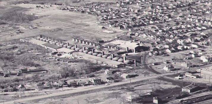
We start from the air: Bricktown USA before 1960. At its peak the town ran three refractory plants at once: Harbison-Walker, General Refractories and North American Refractories. Harbison-Walker advertised its Mount Union operation in 1917 as the largest silica brick plant in the world, and the town became known as the silica brick capital of the world. The county's industrial survey puts the town itself more carefully: one of North America's largest producers of refractory brick. The brick era began in 1899 and ran a long way past the middle of the century. Harbison-Walker closed in 1985 and North American Refractories carried on until 1990.

Checked against the record. The post as published said Mount Union was "the largest producer of refractory silica brick in the world". No source says that. The superlative belongs to a single plant and comes from the company's own advertising: Shedd's 1991 county industrial survey records that Harbison-Walker called its Mount Union operation the largest silica brick plant in the world in a 1917 advertisement, and Welch's 1909 town history says …

Sources

  1. Nancy Shedd, Huntingdon County Historic Engineering and Industrial Sites Inventory (1991): the 1917 Harbison-Walker advertisement, the "silica brick capital of the world" name, Mount Union as one of North America's largest producers of refractory brick, and the closing dates (Harbison-Walker 1985, North American Refractories 1990). Cited to confirm; still in copyright, so not quoted at length here.
  2. Charles Howard Welch, History of Mount Union, Shirleysburg and Shirley Township (1909), p. 342: "Mount Union enjoys the distinction of having the largest silica brick plant in the world - that of the Harbison-Walker Refractories Co."
  3. Democratic Watchman (Bellefonte), 15 August 1930, p. 1, reporting that the North American Refractories plant at Mount Union was formerly the United States Refractories Corporation and had been sold to North American a few weeks earlier, and that more men were being called back to work. Cited to confirm the 1930 succession; not quoted, because the scan interleaves two columns.

Open this story on its own page →

Mount Union's nickname was not something the town only called itself. In the winter of 1927 the Democratic Watchman of Bellefonte, eighty miles away in Centre county, reported two Mountain League basketball games against Mount Union High and both times called the visitors the Bricktowners, without explaining it to anybody. The passages below are printed exactly as the pages read, including the spelling of the day and the errors the scanner made. Nothing has been rewritten, summarised or added to.

28 January 1927. "From the opening whistle the red and white tossers took the lead and held supremacy throughout the forty minutes of play. At no time were the Bricktowners dangerous. When the first session terminated, the score stood 28-6." — 11 March 1927. "Bellefonte High passers successfully invaded Mount Union, last Friday evening, and returned home with a 49-28 triumph neatly tucked away. The Bricktowners proved easy for coach Riden's aggregation and at no time proved dangerous."Democratic Watchman (Bellefonte), 28 January and 11 March 1927, both p. 8 · character 0 of the scanned text

Open this story on its own page →

View of Facade Looking Southwest. - Harbison-Walker Refractories Company, Manager'S House, 213 Shirley Street
View of Facade Looking Southwest. - Harbison-Walker Refractories Company, Manager'S House, 213 Shirley StreetLibrary of Congress, Historic American Buildings Survey / Historic American Engineering Record. No known copyright restrictions. pa2849.photos.038945p

This was the Harbison-Walker manager's house, at 213 Shirley Street.

The federal study of these towns explains what you are looking at without needing to say a word about this particular house. In a company town the rank was built into the street. A large and deliberately distinctive house for the man in charge, set at a distance and often up on a rise, and much smaller identical houses with no ornament on them at all for everybody else. You could read a man's place in the works off the porch he came home to.

Sources

  1. LOC caption pa2849.photos.038945p (HABS PA-6004)
  2. HABS PA-5973 p.25

Open this story on its own page →

Photograph not reproduced here. The image that goes with this story is held by huntingdoncountyhistory.com and its credit does not permit republication, so it is cited rather than copied. See the original.

A Mount Union street in 1907, dirt road, board sidewalks, and a town in the middle of an explosion. The brickyards were hiring every hand they could find, and the population tripled from 1,086 in 1900 to 3,338 by 1910, on figures Jordan's 1913 history of the valley reports directly.

Open this story on its own page →

Photograph not reproduced here. The image that goes with this story is held by huntingdoncountyhistory.com and its credit does not permit republication, so it is cited rather than copied. See the original.

Beyond the brick plants and the railroads, there's the Aughwick, the creek that makes this valley livable. The Rod and Gun Club connected people to the river and the woods, a counterpoint to factory life.

Sources

  1. catalog h03 facts
  2. Photograph credit: huntingdoncountyhistory.com

Open this story on its own page →

Bird's-eye panorama of Mount Union
Bird's-eye panorama of Mount UnionLibrary of Congress Panoramic Maps (T. M. Fowler, 1906) l01

Mount Union in 1906, as Thaddeus Mortimer Fowler drew it.

Fowler, who lived from 1842 to 1922, made bird's-eye views of towns all over the country. This one was published by Fowler and Kelly of Morrisville, Pennsylvania, and the Library of Congress holds it: a sheet 34 by 59 centimetres, listed as number 811 in its catalogue of panoramic maps.

He did not draw it from the air. There were no aeroplanes to draw it from. The Library's own note calls it a perspective map, not drawn to scale — a view assembled on the ground by a man walking the streets and working out how the town would look if you could hover above it.

He caught it at the right moment. Charles H. Welch, writing three years later, records that Mount Union had 1,086 people in 1900 and upward of 3,200 including suburbs by 1909.

Every street, mill and church is here. Zoom in and find your house.

Checked against the record. SOURCED at the Library of Congress record for the map itself. CONFIRMED: “Mount Union, Huntingdon Co., Pa. 1906”, published at Morrisville, Pennsylvania by Fowler & Kelly, c1906; drawn by T. M. Fowler, Thaddeus Mortimer Fowler, 1842-1922; a sheet 34 by 59 centimetres; number 811 in the Library's catalogue of panoramic maps of cities in the United States and Canada. The page had his initials right and can now give hi…

Open this story on its own page →

Company town survey, view 2
Company town survey, view 2Library of Congress HABS PA-2822 l13

The federal survey team walked Mount Union as a company town, where the housing was owned by the factory, the streets were laid out by the factory and the day ran on the factory whistle.

How many company houses were there? The documented figures are worth more than a round number. General Refractories alone owned forty-one houses in Mount Union, scattered across four places: two rows of gambrel-roofed houses on east Water Street and Pennsylvania Avenue, a row of seven up against the plant on Wausau Place, six frame houses on Shirley Street, and twelve one-storey shanties across Hill Valley Run in the section the town called Shantytown.

Across the river, and across the county line into Mifflin, Kistler was built on a different principle entirely. The Sanborn Map Company counted 111 residences there in 1919, laid out to a plan by John Nolen: eighty single family houses, twenty one double houses, and ten buildings holding four families each.

Checked against the record. THE SAME NUMBER, CORRECTED ON THE SAME DAY ON EVERY PAGE THAT CARRIES IT. This page said ninety four company dwellings at Kistler, finished in 1917. So did the page about the design of the village. Neither figure could be traced to a document, and the survey gives the Sanborn Map Company's count of 1919: 111 residences, eighty single family, twenty one double, and ten four family buildings that were not on Nolen's pl…

Open this story on its own page →

Photograph not reproduced here. The image that goes with this story is held by huntingdoncountyhistory.com and its credit does not permit republication, so it is cited rather than copied. See the original.

One corner, many lives. The Crum building stands on the corner of Jefferson Street and Railroad Avenue, and before it there was a hotel called the Broad Top House.

James G. Doyle built it. He had come to town in 1857, and he died in the building on 28 April 1859, before it was entirely finished. Charles H. Welch names the keepers who followed him: Elijah Aultz, Bryson Shaver, Scott Wollett, the Hackadorns and Mrs. Withers.

It stood along the railroad opposite the station, and Welch says that made it “a center for much trade in its day.”

When it came down the material did not go to waste. Welch records that it was re-erected on the North Side, and was being used by Mr. Crum when he wrote.

Inside the Crum building that replaced it worked the barber James Nevell, in a room opposite the Beers Hotel. He set up for himself on 1 November 1896.

Checked against the record. SOURCED at last. Every detail this page carried — James Nevell, November 1896, the Beers Hotel, the Broad Top House — came from Welch's history and none of it was cited. The page now names the book and the pages. CORRECTED: the page called the Broad Top House an early hotel “in canal days”. It was not. Welch places it “along the railroad opposite the station” and dates its building to the late 1850s, by which time t…

Open this story on its own page →

Overview elevation, looking NNE along Juniata River. - Pennsylvania Railroad, Mount Union Bridge, Spanning Juniata River
Overview elevation, looking NNE along Juniata River. - Pennsylvania Railroad, Mount Union Bridge, Spanning Juniata RiverLibrary of Congress, Historic American Buildings Survey / Historic American Engineering Record. No known copyright restrictions. pa3738.photos.362040p

Charles Dickens came through this valley in 1842, on a canal boat, and he wrote it down.

He had ridden a coach from Baltimore to York and on to Harrisburg, and there he boarded a boat on the Pennsylvania Main Line Canal for Pittsburgh. The canal ran west up the Juniata valley, past where Mount Union stands, on its own channel cut alongside the river rather than on the water itself. Charles H. Welch, writing the town's history in 1909, put it plainly: Dickens "came this way in the forties on board a canal boat, before the shrill whistle of the locomotive was heard in the country."

What Dickens remembered was not the scenery first. It was the mornings:

"There was much in this mode of travelling which I heartily enjoyed at the time, and look back upon with great pleasure. Even the running up, bare-necked, at five o'clock in the morning, from the tainted cabin to the dirty deck; scooping up the icy water, plunging one's head into it, and drawing it out, all fresh and glowing with the cold; was a good thing. The fast, brisk walk upon the towing-path, between that time and breakfast, when every vein and artery seemed to tingle with health."

He wrote that about the boat, and the boat came up this valley. A packet did the run at four miles an hour, and a man could step off and walk the towpath faster than it moved, which is exactly what Dickens did.

Checked against the record. CORRECTED on geography, on direction, and on who is making the claim. A CANAL IS NOT A FERRY, BUT IT DID END ONE, AND THIS NOTE OVERSTATED THE CORRECTION. The original page said the canal “had replaced the earlier ferries, offering faster passage than the river crossings that came before”, and ended “travelers depended on the canal boats to cross.” The second half is still wrong: a canal boat does not carry you acro…

Read the full story, with 3 passages quoted from the county histories →

Photograph not reproduced here. The image that goes with this story is held by huntingdoncountyhistory.com and its credit does not permit republication, so it is cited rather than copied. See the original.

Downtown Mount Union in its prime, grocery stores, furniture dealers, clothiers, theaters, and banks all competing for boom-town money. Every storefront meant jobs beyond the brick plants.

Sources

  1. catalog h09 facts
  2. Photograph credit: huntingdoncountyhistory.com

Open this story on its own page →

Photograph not reproduced here. The image that goes with this story is held by Flickr Commons / Wikimedia and its credit does not permit republication, so it is cited rather than copied. See the original.

This Baldwin locomotive, built in 1911, worked the East Broad Top for nearly 50 years. When the EBT quit carrying freight and passengers in 1956, people thought that was the end. But the engines endured, and today the East Broad Top is running again, not hauling coal, but carrying tourists and history.

Sources

  1. catalog l03 facts
  2. Photograph credit: Wikimedia Commons

Open this story on its own page →

Photograph not reproduced here. The image that goes with this story is held by huntingdoncountyhistory.com and its credit does not permit republication, so it is cited rather than copied. See the original.

Look at the planing mill after the flood of March 1936 and you can see exactly how high the water came. The mark is on the building.

Mount Union had two planing mills when Charles H. Welch wrote in 1909. One ran on steam. The other was A. S. Welch's, run off electric power alongside his lumber business.

About the flood itself, the site's own page on the gage records is worth reading beside this one. The Geological Survey measured four Huntingdon County creeks that week, and on two of them the flood of June 1889 was higher than 1936.

Checked against the record. A CORRECTION THAT DID NOT PROPAGATE, which is worse than not making it. An earlier pass refuted the claim that the 1936 flood was the most destructive ever recorded in the Juniata Valley, using the Geological Survey's gage records: on Aughwick Creek at Orbisonia the June 1889 discharge was about 18,400 second feet against 16,400 in 1936, and on Standing Stone Creek the highest stage in the whole record is 9.38 feet o…

Open this story on its own page →

The plant that started Mount Union's refractory brick industry stood at the west end of West Shirley Street, on a flat expanse at the foot of Jacks Mountain. The W.H. Haws Company, refractory makers from Johnstown, began building it in 1898 and 1899 and sold the whole property to Harbison and Walker of Pittsburgh. The nomination says this was the first works in the United States built exclusively to make refractory brick.

Charles Howard Welch's 1909 history of Mount Union tells how it began. Scott Dibert came to town with W.H. Haws of Johnstown to look it over as a site for a brick plant, and they found large quantities of ganister rock on Jacks Mountain. Ganister is the stone silica brick is made from, and the nomination says the deposits around Mount Union are what drew the brick companies. Two more refractory companies followed, and their combined production led to what the nomination calls the town's claim to be the refractory brick capital of the world.

Within five years of the first works a second was built beside it, and the two were designed to run independently. By 1910, the nomination says, the dual plant could produce 150,000 bricks a day. Two railroads served it, the East Broad Top bringing in coal and the Pennsylvania carrying the brick out. The ganister came at first from exposed rock on the north side of Jack's Narrows, hauled across the Juniata River and the PRR main line on a dinky tramway; later the quarrying moved to the mountainside directly above the plant.

The plant made refractory products from 1899 through 1985, which the nomination says made it the longest producing refractory complex in the county. The kilns still standing in 1989, 44 feet across and bound with metal bands, had burned coal at first and were converted to gas and to oil in the 1950s and 1970s, changes the nomination reads in the colored piping on their outside walls. The nomination reached the National Park Service in February 1990 under Criterion A for industry, with the crushers, silos and conveyors added after 1950 counted as noncontributing. The nomination says most of the machinery had been removed by then, but inside both works the tracks that carried raw material and unfinished brick through the process were still in place.

Both the Pennsylvania and East Broad Top railroads served the plant. The EBT provided coal to fire the kilns and the steam boilers which powered the crushing pans, and the PRR offered direct shipping to the customers who purchased the brick.National Register of Historic Places nomination, Harbison-Walker Refractories Company (reference 90000392), section 8, p. 14 · character 21,142 of the scanned text
Checked against the record. Checked against the National Register nomination text before publication; 5 claims the nomination did not support were removed or corrected.

Open this story on its own page →
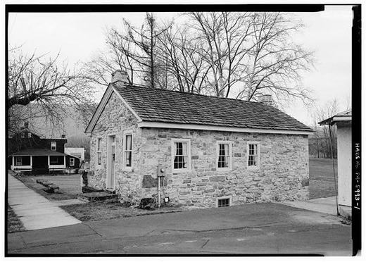
In 1909, when Charles H. Welch published his History of Mount Union, the town was already nostalgic. He printed Jack's Spring twice: as it used to be, and as it is today. The spring is celebrated for its cool, silvery water. Welch's side-by-side plates show a landscape transformed within a lifetime. The wild spring of the earlier days gave way to carefully walled stone, a visible mark of progress and care.

Checked and confirmed. It is not in Welch. It is word for word in Africa's 1883 county history, which the first check did not consult. The two plates are in Welch's list of illustrations. Checked 1 September 2026.

Read the full story, with 3 passages quoted from the county histories →

Overall View of Kistler and Juniata River from State Highway Bridge Looking South. - Town of Kistler, Kistler, Mifflin County, PA
Overall View of Kistler and Juniata River from State Highway Bridge Looking South. - Town of Kistler, Kistler, Mifflin County, PALibrary of Congress, Historic American Buildings Survey / Historic American Engineering Record. No known copyright restrictions. pa2824.photos.038900p

Most company towns were laid out by engineers with almost no thought given to how they would feel to live in. Kistler was different, and it is worth being exact about who wanted it different and why.

In 1916 the Mount Union Refractories Company hired John Nolen of Cambridge, Massachusetts, one of the best known town planners in the country, to design a whole village across the river from the plant. The New York firm of Mann and MacNeille drew the buildings. The Sanborn Map Company counted 111 residences in Kistler in 1919: ten built to hold four families each, twenty one double houses and eighty single family houses, in six designs with names instead of numbers.

Nolen wrote the village up himself ten years later in a book called New Towns for Old, and he was plain about the purpose. His philosophy, he said, rested on the belief “that housing is something more than an incident in the life of the worker,” and that good planning could “cultivate a spirit of citizenship and social life among the inhabitants.” Then he explained why that mattered here in particular:

“The population being so largely foreign in its make-up, there is distinct necessity for a lead to be given in the direction of Americanism. This is done in a much better way than by exhortation, by the provision of something tangible, in the form of good living conditions, which more nearly express the ideals of this country.”

The houses had indoor plumbing and bathrooms, and a floor plan with a living room and a separate dining room, which was a middle class arrangement rather than a company house one. The federal surveyors who measured them added the detail that settles the tone of the whole thing: the houses were often so small that the room marked dining room would not take a dining table.

Checked against the record. A NUMBER REPLACED, AND THE SITE'S OWN PAGES ARE WHAT CAUGHT IT. The page said the town was finished in 1917 with ninety four dwellings, seventeen of them two family houses and seventy seven single family houses. That count could not be traced to any document. The survey gives the Sanborn Map Company's count of 1919: 111 residences, ten of them four family buildings, twenty one double houses and eighty single family h…

Open this story on its own page →

Before the brick works came the tannery. In 1883, when Mount Union's chief industry was A. D. Faust and Sons, they could process 13,000 hides a year with a crew of 25 men. The tannery had been built in 1859 by Mr. Bare and ran for decades before silica brick would transform the town.

The 1909 photograph shows the Juniata Oak Extract Works, part of that leather era. Workers and buildings stand in it that you might recognize if your family was here then. Among the people who made their way to this valley was Franz Heidel, a German cabinetmaker born beside an old castle in Freidenberg, Baden. In 1865, at 22 years old, he survived an 80-day Atlantic crossing starting from Antwerp. A serious storm almost destroyed the vessel mid-voyage, but Heidel made it through to a new life in America.

Mount Union's boom decade came fast and fierce. The tannery gave way to three brick plants and an explosives factory. The population more than tripled between 1900 and 1910.

Checked and confirmed. Published without a source list. The tannery figures are Africa's 1883 county history word for word, and every detail of Franz Heidel's crossing is in Welch's 1909 history, including the storm. Two claims are carried by other sourced stories on this site rather than by these two books: the population more than tripling between 1900 and 1910, which "The J. E. Everett grocery" sources, and the explosives factory, which…

Open this story on its own page →

One of the oldest, most faded views we have of Market Street, from around the turn of the last century. Time and the camera have washed most of it soft, but you can still make out the old street lamps and the shape of a small town on the edge of its brick boom.

Sources

  1. Caption from the Historic Mount Union page archive: “Market Street around the turn of the last century”. Community archive, not a published record.
  2. Photograph credit: Historic Mount Union archive

Read the full story, with 3 passages quoted from the county histories →

The Mount Union Historic District covers about 32 square blocks centered on Jefferson and Market Streets, more than two thirds of the borough, and takes in 645 resources, 572 of them contributing buildings, as the nomination counted them in 1994. The nomination reads the town in three eras: the Canal Era from 1831 to 1850, the Railroad Era from 1850 to 1900 and the Refractories Era from 1900 to 1944.

The period of significance begins in 1841 with the John Sharrar House on Water Street, which the nomination calls the district's oldest resource, though it also describes the John Shaver House, an 1818 stone house, as older. Charles Howard Welch's history of the town, printed in 1909 and 1910, says the stone house was built by John Sharrar in 1841 and that the first survey, made that year by Col. William Pollock for Sharrar, might be said to have been the nucleus of the town. The town plan came in 1849, when John Dougherty and George W. Speer laid out about eight square blocks of their own land around Pennsylvania Avenue and Washington Street, with the avenue reserved for the railroad due the next year. Welch says Dougherty, with Speer, was instrumental in laying out the town, getting a charter and naming the streets.

The nomination says the East Broad Top Railroad's 1873 connection made Mount Union a transfer point between narrow and standard gauge for coal, pig iron, ore and passengers, and the population doubled between 1870 and 1900. Then came the brick plants: the W. H. Haws Fire Brick Company in 1899, bought out after a year by Harbison-Walker of Pittsburgh; Mount Union Silica Brick in 1901; and Mount Union Refractories in 1911 and 1912. The brick companies, the nomination says, probably became the town's largest single developers of housing once they needed to house workers in the 1910s; Harbison-Walker's 100 houses on Ganister Hill were demolished in the early 1950s.

Growth after the early 1920s was limited, and the nomination credits that slowdown with leaving the pre-1920 town largely intact. The district was listed under Criteria A and C for community development, industry, transportation, commerce and architecture. The 1936 post office at Jefferson and Market has yellow brick walls the nomination likens to the mottled yellow of refractory brick, and a lobby mural of the Harbison-Walker plant painted that year by Paul Rohland.

To provide some context for the refractories' local impact, Mount Union's population in 1906 stood at 1,086. By 1910, when only two refractories operated, the population had more than tripled to 3,338. By 1920, following the tremendous growth caused by the opening of Mount Union Refractories in 1911-12 and a government-sponsored munitions plant in 1915, the population had risen to over 6,000.National Register of Historic Places nomination, Mount Union Historic District (reference 94000516), Section 8 page 4 (PDF page 19) · character 55,740 of the scanned text
Checked against the record. Checked against the National Register nomination text before publication; 6 claims the nomination did not support were removed or corrected.

Sources

  1. National Register of Historic Places nomination: Mount Union Historic District, reference 94000516 (1994)
  2. Charles Howard Welch, History of Mount Union, Shirleysburg and Shirley Township (1909), John Sharrar house and John Dougherty sketch, pp. 149-150 (corpus lines 6328-6350, 7160-7172)

Open this story on its own page →

The Mount Union Refractories Company plant stood on a triangular plot at the east end of Pennsylvania Avenue, between a Pennsylvania Railroad spur, the East Broad Top Railroad yards and the Juniata River. The nomination, prepared by Deborah L. Suciu in August 1989 from Nancy Shedd's 1988 Historic American Engineering Record report, put it on the National Register in 1990. Six years later the state asked to take it off.

The company was organized in 1911 and finished its silica brick plant in 1912, the third such concern to open in Mount Union in less than fifteen years, after Harbison-Walker and Mount Union Silica Brick. The nomination says the three plants' total production led to the town's claim that it was the silica brick capital of the world. Arriving last, the company had to quarry its ganister rock farther off, at Three Springs, and the East Broad Top hauled it in along with Broad Top coal for the power plant and kilns.

The First World War built it up. By 1919 the plant had grown from eight kilns to 29 and employed 885 men, and the company hired John Nolen to design the company town of Kistler across the river in Mifflin County. A two-story brick office, 30 by 30 feet with pine floors, went up in 1916. In 1922 the firm built a fireclay plant in Clearfield County and became U.S. Refractories; a 1930 merger made it North American Refractories, NARCO. The nomination puts employment at 400 to 500 by 1930. The East Broad Top closed in 1956. The kilns were razed about 1980, two spared out of sentiment. In 1988 fifty-seven employees made specialty refractories for electric steel furnaces, with Bethlehem Steel the largest customer. Production stopped in 1990.

"At the time of its listing in 1990, it retained strong integrity, and its original configuration of storage sheds, production buildings, and office was intact" (removal report, p3). After the shutdown a salvage company began dismantling the buildings for scrap. When Scott D. Heberling walked the site on April 3, 1996, the office, production building, boiler house, maintenance building, both kilns and most of the sheds were gone. Two pre-1939 storage sheds and a 1981 metal addition remained. The state requested removal on June 21, 1996 under 36 CFR 60.15. The last two sheds were scheduled to come down by that summer.

At the time of its listing in 1990, it retained strong integrity, and its original configuration of storage sheds, production buildings, and office was intact.National Register of Historic Places nomination, Mount Union Refractories Company (reference 90000398), removal report (Heberling, 1996), p3 · character 5,121 of the scanned text
Checked against the record. Checked against the National Register nomination text before publication; 4 claims the nomination did not support were removed or corrected.

Sources

  1. National Register of Historic Places nomination: Mount Union Refractories Company, reference 90000398 (1989)
  2. Huntingdon County, Pennsylvania: An Inventory of Historic Engineering and Industrial Sites (Nancy S. Shedd, National Park Service, 1991), refractory brick industry and Mount Union Refractories entries

Open this story on its own page →

This is what a subway looks like in Mount Union. No underground trains here, the subway was the underpass that carried you safely beneath the Pennsylvania Railroad tracks while the freights rolled overhead. In a town built around the rails, it was the only way across when a long coal drag had the crossing blocked.

Sources

  1. Caption from the Historic Mount Union page archive: “This is what a subway looks like in Mt. Union”. Community archive, not a published record.
  2. Photograph credit: Historic Mount Union archive

Read the full story, with 3 passages quoted from the county histories →

General view from west - East Broad Top Railroad & Coal Company, Coal Dock, Route 522, East side, Mount Union
General view from west - East Broad Top Railroad & Coal Company, Coal Dock, Route 522, East side, Mount UnionLibrary of Congress, Historic American Buildings Survey / Historic American Engineering Record. No known copyright restrictions. pa3549.photos.360861p

The East Broad Top yard at Mount Union went in with the line itself, in 1873, and its whole reason for existing was that two railroads of two different widths met here. Everything coming off the narrow gauge had to get onto standard gauge cars, and everything going the other way had to come off.

They kept finding better ways to do it. Around 1922 an overhead electric gantry crane went up to move McKelvey Brothers lumber from one railroad to the other. In 1933, after the lumbering had stopped, that same rig was put to a smarter use: instead of moving the load, they lifted whole standard gauge cars off their wheels and set them down on narrow gauge trucks. The original apron conveyor was rebuilt in 1925 with a sand flotation cleaning plant, which let the Rockhill Coal and Iron Company ship nine separate grades of coal out of this yard.

Sources

  1. Shedd 1991, East Broad Top Railroad: Mount Union Yard
  2. LOC caption pa3549.photos.360861p

Open this story on its own page →

The brick church in this photograph stood on the southeast corner of Shirley and Division Streets for over forty years. Built in 1866 and 1867 at a cost of four thousand five hundred dollars, it replaced an older frame church put up along the Shirleysburg road in 1849 for five hundred dollars. The congregation worshiped there until 1908, when a new church building was completed.

The story begins with Rev. Britton E. Collins, who started preaching in Mount Union in 1845. By 1849 the community had built a frame church for $500. The congregation was formally organized with fourteen members on May 2, 1865, and by 1909 it had grown to 360. The brick church that replaced the frame building cost $4,500 and served as the center of community life for decades.

What happened to the brick church after 1908? If you have memories of it, or know what became of the building and the lot, we would love to hear.

Checked, confirmed and corrected. Published without a source list, and one claim in it could not be found. Everything else holds, and it holds in Africa's 1883 county history rather than in Welch, which is where the first check looked: the 1845 preaching in a stone school-house, the 1849 frame church, both building costs, the corner it stood on, and the organisation on 2 May 1865 with fourteen members. Welch supplies the 360 members and the new churc…

Read the full story, with 3 passages quoted from the county histories →

Photograph not reproduced here. The image that goes with this story is held by huntingdoncountyhistory.com and its credit does not permit republication, so it is cited rather than copied. See the original.

The Shapiro family built two businesses in Mount Union, a movie house that opened in 1915 and a furniture warehouse that served the town through decades. That's merchant instinct: see what a town needs, build it, grow it.

Sources

  1. catalog h33 facts
  2. Photograph credit: huntingdoncountyhistory.com

Open this story on its own page →

Photograph not reproduced here. The image that goes with this story is held by huntingdoncountyhistory.com and its credit does not permit republication, so it is cited rather than copied. See the original.

Shirley Street in the 1920s, the town the State Museum of Pennsylvania calls the Silica Brick Capital of the World, in full stride. Three refractories ran at once, turning out between eighty and a hundred thousand bricks a day, seven days a week, and Welch's 1909 history had already claimed the largest silica brick plant in the world for the Harbison-Walker works at the west end of town. A main street to match.

Open this story on its own page →
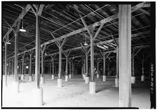
Shirley and Jefferson corner today
Shirley and Jefferson corner todayWikimedia Commons (CC0) l02

Stand at the corner of Shirley and Jefferson today, and you're standing on the same spot where boom-town Mount Union traded in commerce and news and paychecks. The buildings are older, some storefronts are different, but the bones of the place haven't changed.

Sources

  1. catalog l02 facts
  2. Photograph credit: Wikimedia Commons

Read the full story, with 3 passages quoted from the county histories →

Photograph not reproduced here. The image that goes with this story is held by huntingdoncountyhistory.com and its credit does not permit republication, so it is cited rather than copied. See the original.

The St. Patrick's Day Flood, March 1936. It put Mount Union's low streets under water and it is the flood this county still measures other floods against.

But it was not the worst on record here, and we know that because the Geological Survey had gages running that week and published every reading. On Aughwick Creek at Orbisonia the 1936 crest was 16,400 second feet. A June 1889 flood on the same creek reached about 18,400. On Standing Stone Creek the highest stage in the whole record is not 1936 either; it is 9.38 feet on the first of June, 1889.

Two of our four gaged creeks had already seen worse, forty-seven years earlier, and nobody alive remembers being told that.

What 1936 did do was reach far enough to move Washington. That June Congress passed a $320,000,000 omnibus flood-control act, and Pennsylvania was named among the states whose emergency projects, in one congressman's words, could not wait until the following year.

Checked against the record. REFUTED, and refuted by this site's own sourced page before any outside source was opened. The original called 1936 "the most destructive flood ever recorded in the Juniata Valley." The page on the same flood at flood-of-36-devastated-hc already carried the Geological Survey's gage records and says the opposite: on two of the four Huntingdon County gages the June 1889 flood was HIGHER. Aughwick Creek at Orbisonia, 1…

Open this story on its own page →
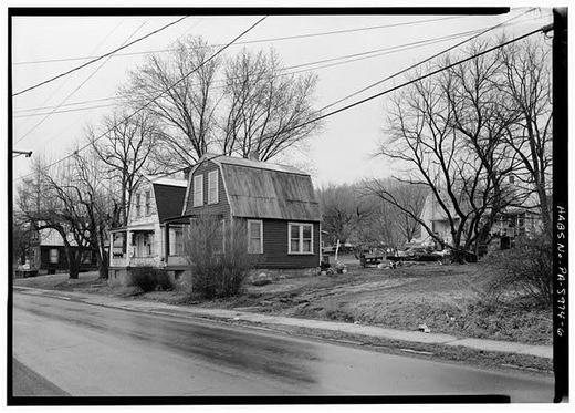
Photograph not reproduced here. The image that goes with this story is held by huntingdoncountyhistory.com and its credit does not permit republication, so it is cited rather than copied. See the original.

Strickler's in the 1950s, full service in every way: pump your gas, fix your car, sell you a cold drink, and maybe a sandwich for the road. By the 1960s, these corner stores were vanishing, replaced by gas stations and convenience chains that didn't know your name.

Sources

  1. catalog h39 facts
  2. Photograph credit: huntingdoncountyhistory.com

Read the full story, with 3 passages quoted from the county histories →

General View of Store - T. A. Giacobello Foreign Supplies Store, Shirley Street, Mount Union, Huntingdon County, PA
General View of Store - T. A. Giacobello Foreign Supplies Store, Shirley Street, Mount Union, Huntingdon County, PALibrary of Congress, Historic American Buildings Survey / Historic American Engineering Record. No known copyright restrictions. pa2852.photos.038948p

The federal survey recorded this storefront on Shirley Street under the name it carried: T. A. Giacobello Foreign Supplies Store. That was what a store called itself when it stocked what the newer families in town could not buy anywhere else.

The surveyors took a second photograph from the same spot looking the other way, up the street toward the old entrance to the Harbison-Walker brickyard. That is how close it was. The store sat at one end of the walk and the gate sat at the other.

Sources

  1. LOC captions pa2852.photos.038948p and 038949p (HABS PA-5992)
  2. HABS PA-5974 p.6

Read the full story, with 2 passages quoted from the county histories →

Photograph not reproduced here. The image that goes with this story is held by Wikimedia Commons and its credit does not permit republication, so it is cited rather than copied. See the original.

Walk under this stone arch and you're stepping through Italian immigrant craftsmanship, stonemasonry built in the early 1900s when the railroad was expanding through the valley. A hundred years later, trains still cross it.

Sources

  1. catalog l18 facts
  2. Photograph credit: Wikimedia Commons

Open this story on its own page →
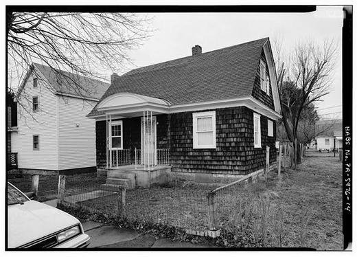
View of Central National Bank Looking East. Located at the Corner of Jefferson and Shirley Streets - Town of Mount Union
View of Central National Bank Looking East. Located at the Corner of Jefferson and Shirley Streets - Town of Mount UnionLibrary of Congress, Historic American Buildings Survey / Historic American Engineering Record. No known copyright restrictions. pa2822.photos.038885p

The county's own history book, published for the sesquicentennial in 1937, lists the banks then operating in Huntingdon County. Two of them were here: the Central National Bank of Mount Union and the First National Bank of Mount Union.

The book makes a point of something that would not have felt small at the time. Every one of the county's banks stayed open and solvent straight through the years from 1929 to 1937, and all of them were on solid ground when it was written.

Sources

  1. Sesqui 1937, Banks and Banking and Business
  2. LOC caption pa2822.photos.038885p

Open this story on its own page →
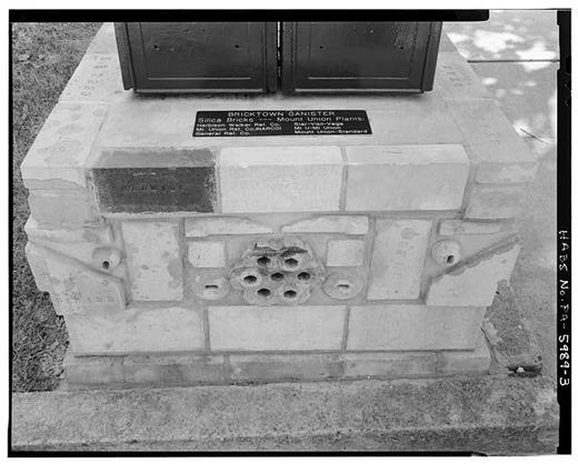
Photograph not reproduced here. The image that goes with this story is held by huntingdoncountyhistory.com and its credit does not permit republication, so it is cited rather than copied. See the original.

Mount Union, in numbers: 764 people in 1880, 810 in 1890, 1,086 by 1900 — and 3,338 by 1910, more than triple the town of a decade before.

The brick industry came first. The wages followed. And with the wages came the makeshift and disreputable services and entertainments that followed the money. The town earned a nickname for it: a second Sodom and Gomorrah, a reputation that marked the decade when Mount Union built itself and lived rough.

Did your grandparents come during the boom? Tell us who they were, what work they did, and what you remember about those years.

Read the full story, with 3 passages quoted from the county histories →

Photograph not reproduced here. The image that goes with this story is held by huntingdoncountyhistory.com and its credit does not permit republication, so it is cited rather than copied. See the original.

The Dinky Bridge, not a passenger line, but a workhorse. This little quarry railroad hauled ganister rock down from Jacks Mountain to the brick plants. If not for that ganister and that bridge, Mount Union would have been just another small valley town.

Sources

  1. catalog h07 facts
  2. Photograph credit: huntingdoncountyhistory.com

Read the full story, with 3 passages quoted from the county histories →

View of locomotive form southeast. - East Broad Top Railroad & Coal Company, Engine House, Route 522, East side, Mount Union
View of locomotive form southeast. - East Broad Top Railroad & Coal Company, Engine House, Route 522, East side, Mount UnionLibrary of Congress, Historic American Buildings Survey / Historic American Engineering Record. No known copyright restrictions. pa3548.photos.360859p

When the federal survey team walked the East Broad Top yard, this is part of what they found. A concrete block engine house going soft at the edges, tracks running out of it lined with abandoned EBT coal hoppers, and inside, still sitting where it had been left, a switch engine that once worked these yards.

The survey also noted what had grown up along the Route 522 side of the same yard by then: a supermarket, a drug store and a bank.

One end of the property was a parking lot. The other end had a locomotive in a shed.

Sources

  1. Shedd 1991, East Broad Top Railroad: Mount Union Yard
  2. LOC caption pa3548.photos.360859p

Read the full story, with 3 passages quoted from the county histories →

Photograph not reproduced here. The image that goes with this story is held by huntingdoncountyhistory.com and its credit does not permit republication, so it is cited rather than copied. See the original.

February 27, 1917 is the date Mount Union remembers. Eight minutes past midnight a fast preference freight came out of the fog and struck the Mercantile Express standing at the station, and in seconds about twenty people were dead.

Among them was Chester A. Minds of Ramey, a Clearfield County coal operator, travelling east with his family to the funeral of his wife's father. The Evening Public Ledger reported that Minds and six members of his family died in that car.

Checked against the record. THE SAME THREE ERRORS AS THE SISTER PAGE, which had been corrected while this one was left alone. A correction that reaches one page and not the other is not a correction, and this site now has a check that greps every refuted claim across every page. WRONG, now fixed: “a coal freight”. Every contemporary account calls it a fast PREFERENCE freight. The coal belongs to a victim rather than to the train — Chester A. M…

Open this story on its own page →
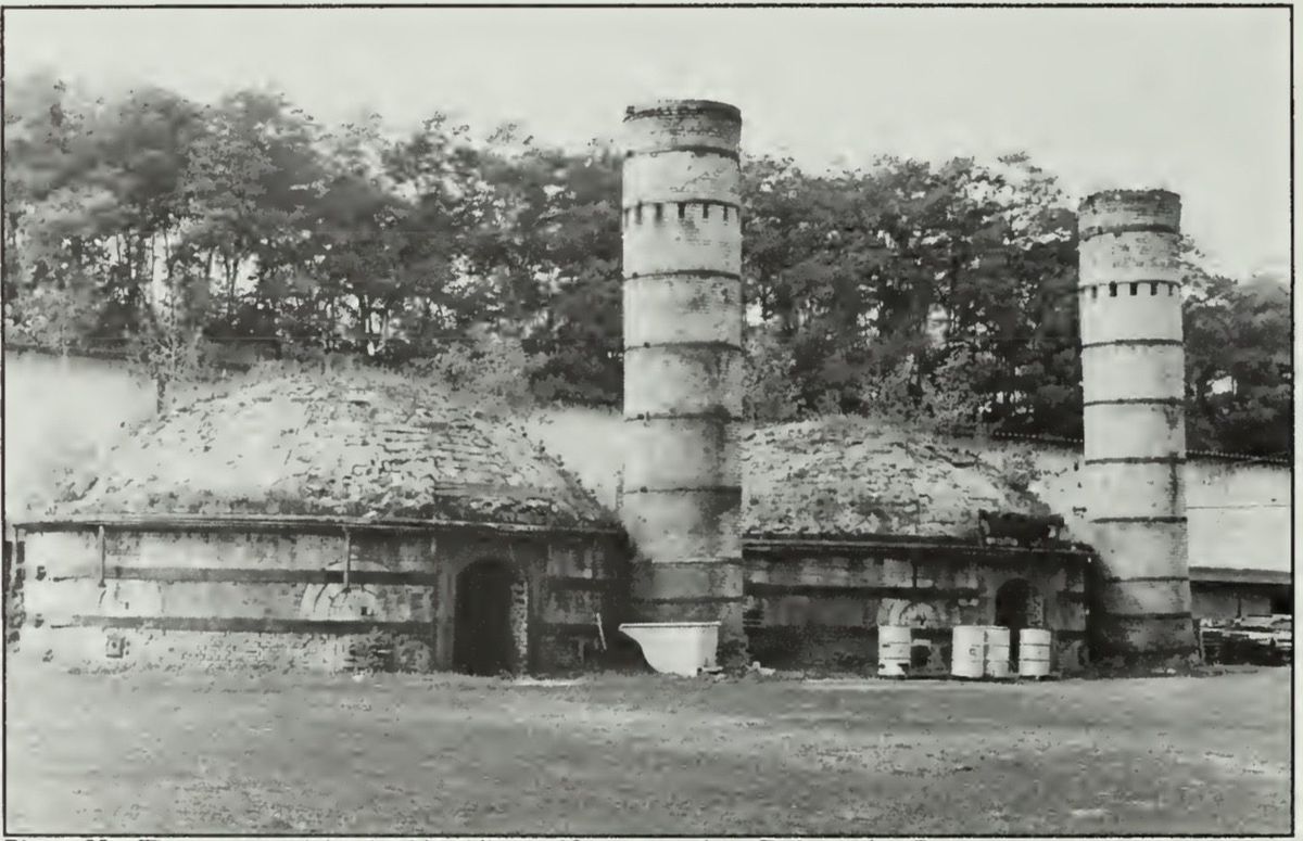
The Mount Union fire department and a crowd of dignitaries on the engine in front of the Municipal Building, 1920. In a tight-packed brick town, the volunteer firemen were a real point of pride, one bad fire could take a whole block.

Sources

  1. Caption from the Historic Mount Union page archive: “Fire dept. and dignitaries on a fire truck in front of the Municipal Building”. Community archive, not a published record.
  2. Photograph credit: Historic Mount Union archive

Read the full story, with 1 passage quoted from the county histories →

Photograph not reproduced here. The image that goes with this story is held by huntingdoncountyhistory.com and its credit does not permit republication, so it is cited rather than copied. See the original.

The St. Patrick's Day Flood of March 17-18, 1936 wasn't a passing inconvenience, it was catastrophic. The Dinky Bridge, which had hauled ganister for decades, was destroyed. Towns across the Juniata Valley were wrecked. The disaster was big enough that Congress passed the Flood Control Act that year.

Sources

  1. catalog h08 facts
  2. Photograph credit: huntingdoncountyhistory.com

Open this story on its own page →
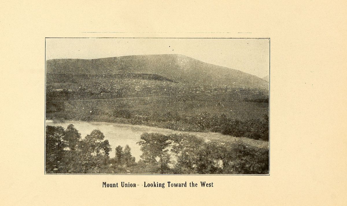
View of Conrail Freight Station on Pennsylvania Avenue Looking Southwest. Located Between Depot and Washington Streets. - Town of Mount Union
View of Conrail Freight Station on Pennsylvania Avenue Looking Southwest. Located Between Depot and Washington Streets. - Town of Mount UnionLibrary of Congress, Historic American Buildings Survey / Historic American Engineering Record. No known copyright restrictions. pa2822.photos.038898p

The Pennsylvania Railroad put up a new freight depot in Mount Union in 1914, on Pennsylvania Avenue between Depot and Washington streets. It did not replace the old freight office so much as grow onto it. Sanborn insurance maps from 1919 still show part of the older building attached to the east side, and the line of that old roof could be read on the east wall long after the building itself came off.

When the federal survey team came through, the depot had sat unused for twenty years or more, Conrail had announced plans to tear it down, and a group of townspeople was trying to acquire it for a community library or a senior citizens center.

Sources

  1. Shedd 1991, Pennsylvania Railroad: Mount Union Freight Depot
  2. LOC caption pa2822.photos.038898p

Open this story on its own page →
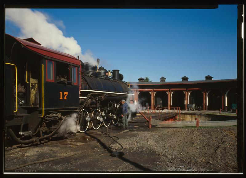
Photograph not reproduced here. The image that goes with this story is held by huntingdoncountyhistory.com and its credit does not permit republication, so it is cited rather than copied. See the original.

The G. W. Radle store, one family's answer to the question, "How do you feed a boom town?" With supply lines, trust, and willingness to extend credit between paydays. Radle and a hundred stores like it kept Mount Union running.

Sources

  1. catalog h15 facts
  2. Photograph credit: huntingdoncountyhistory.com

Read the full story, with 1 passage quoted from the county histories →

The General Refractories Company office in Mount Union. Harbison-Walker gets the headlines, but it wasn't the only brick empire in town, General Refractories ran its own plant and its own company houses on the east end, all of it built on Jacks Mountain ganister.

Sources

  1. Brick Yards README + LOC HAER pa2851 (General Refractories Co. Office)
  2. Photograph credit: Library of Congress (HAER)

Open this story on its own page →
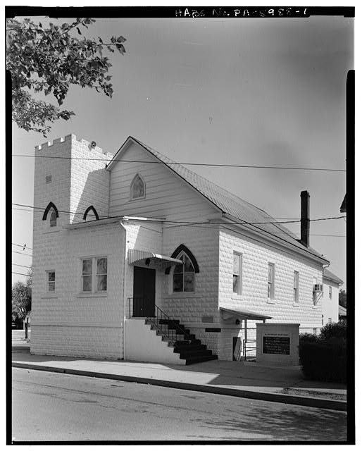
The Harbison-Walker Refractories works, the plant that made Mount Union 'Bricktown USA.' Beehive kilns, brick stacks, and acres of works turning Jacks Mountain ganister into the silica brick that lined America's steel furnaces, with the town it built climbing the hill behind.

Sources

  1. Brick Yards README + LOC HAER pa2723 (Harbison-Walker plant, general view 2)
  2. Photograph credit: Library of Congress (HAER)

Open this story on its own page →
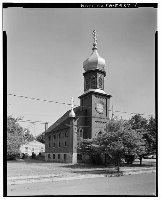
The Kenmar Hotel on Pennsylvania Avenue, photographed for the federal survey in 1991. The railroad track in the foreground is the old main line right of way, by then a transfer siding.
The Kenmar Hotel on Pennsylvania Avenue, photographed for the federal survey in 1991. The railroad track in the foreground is the old main line right of way, by then a transfer siding.Historic American Buildings Survey, National Park Service (Town of Mount Union, HABS No. PA-5974, photograph 11), Library of Congress stg01

The Kenmar Hotel in 1908. A brick town on the main line drew a steady stream of visitors, salesmen, investors, and railroad men, and they all needed a bed and a hot meal. A hotel like the Kenmar was a sign Mount Union had arrived.

Sources

  1. Caption from the Historic Mount Union page archive: “1908 Kenmar Hotel”. Community archive, not a published record.
  2. Photograph credit: Historic Mount Union archive

Open this story on its own page →
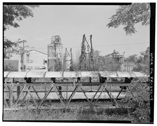
Photograph not reproduced here. The image that goes with this story is held by huntingdoncountyhistory.com and its credit does not permit republication, so it is cited rather than copied. See the original.

The Mount Union Times, printers and publishers, and the reason we know as much about this town as we do.

It was run by A. S. and C. H. Welch, father and son, as editors. In the summer of 1909 the son, Charles Howard Welch, decided to write a history of Mount Union. He did not set out to write a book. The first instalment appeared in the Mount Union Times on 10 September 1909, and he expected a brief sketch.

In his own words at the end of it: “As the hidden treasures of interesting historical narrative have unfolded, the prospect has widened.” The sketch ran to several hundred pages and became the book this site quotes on almost every Mount Union page. It was printed in the Times office.

The Times was not the town's only paper. Welch records a County Bulletin, run by Orthello Z. Shaver, which a young compositor named John S. Kirk joined in February 1900 — and which had “since passed out of existence” by the time Welch wrote. Kirk moved to the Times in October 1900 and was its foreman when the history was being set.

Checked against the record. SOURCED, and the source is unusually direct: this newspaper printed the book the rest of this site is built on, and its editors wrote it. CONFIRMED from the book's own title page: “Printed at The Mount Union Times Office. A. S. & C. H. Welch, Editors. Mount Union, Pa. 1909-1910.” CONFIRMED from Welch's closing pages: “We started this historical sketch of Mount Union last summer. The first installment of it was prin…

Read the full story, with 3 passages quoted from the county histories →

The packing shed at the Harbison-Walker works. This is where it all ended up, finished silica brick, crated and loaded onto the Pennsylvania Railroad for the steel furnaces of Pittsburgh and beyond. Mount Union brick lined the mills that built America.

Sources

  1. Brick Yards README + LOC HAER pa2727 (Packing Shed)
  2. Photograph credit: Library of Congress (HAER)

Read the full story, with 3 passages quoted from the county histories →

View of 95 Cedar Street Looking North - Town of Kistler
View of 95 Cedar Street Looking North - Town of KistlerLibrary of Congress, Historic American Buildings Survey / Historic American Engineering Record. No known copyright restrictions. pa2824.photos.038915p

The company painted the insides of its houses. That much is in the federal record: the Historic American Buildings Survey describes the refractories housing as solid frame structures, nicely painted and slate roofed, with interiors “painted and papered”, porcelain sinks and city water.

It was never only about paint. The survey quotes the thinking behind the houses: “the employees and their families should be comfortably and decently housed; and . . . they should be encouraged to keep their houses as nicely as possible.” Housing was part of what the companies themselves called a programme of social and cultural transformation, aimed at a workforce the local paper in 1916 listed as “Slavish, Roumanians, Bulgarians, Italians, Greeks and Serbians” as well as “native Americans, and southern Negroes.”

The same programme had harder edges. It included “a policy of curtailing alcohol consumption”, and employees who flagrantly ignored admonishments to abstain were fired.

The story told here for years is that the first colours were deep greens, blues, browns and greys, that the residents said so, and that the company changed to beiges and pastels. It is a good story and it may well be true. It is not in either federal survey, and where it comes from is set out in the note below.

Checked against the record. THE SPECIFIC CLAIM IS NOT SOURCED, and the page now says so rather than asserting it. The page said the company painted interiors in bright deep greens, blues, browns and greys, that residents complained, and that the company switched to beiges and pastels. Two federal documents were opened and searched: the Historic American Buildings Survey for the Town of Mount Union (PA-5974) and for the Town of Kistler (PA-5976…

Open this story on its own page →
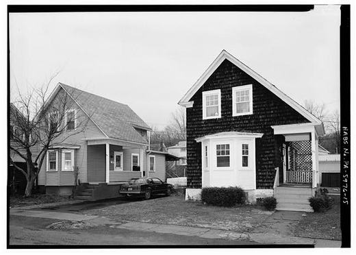
View of Kistler Elementary Looking East-Southeast at End of Cedar Street. Building Constructed by Works Progress Administration
View of Kistler Elementary Looking East-Southeast at End of Cedar Street. Building Constructed by Works Progress AdministrationLibrary of Congress, Historic American Buildings Survey / Historic American Engineering Record. No known copyright restrictions. pa2824.photos.038903p

Kistler Elementary sits at the end of Cedar Street. The federal survey records two things about it that belong together: the brick school in the company town dates to 1936, and the building was put up by the Works Progress Administration.

A company built the houses. The government built the school. The children who filled it were the children of men making brick for steel mills two hundred miles away.

Sources

  1. LOC caption pa2824.photos.038903p (HABS PA-5976)
  2. Shedd 1991, Mount Union Refractories: Company town of Kistler (brick school, 1936)

Open this story on its own page →
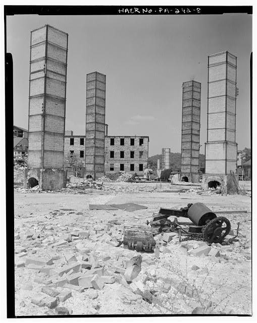
General View of Rotary Dryer and Conveyors, Looking Northwest - Harbison-Walker Refractories Company, Rotary Dryer & Storage Silos
General View of Rotary Dryer and Conveyors, Looking Northwest - Harbison-Walker Refractories Company, Rotary Dryer & Storage SilosLibrary of Congress, Historic American Buildings Survey / Historic American Engineering Record. No known copyright restrictions. pa2728.photos.134466p

A green brick holds so much water that it would blow apart in the kiln, so before anything else it had to be dried. Left in the yard that took days and depended entirely on the weather. The yards fixed that by running flues under the drying floors, and later by circulating steam and waste heat off the kilns. This is the rotary dryer and its conveyors.

Then the burning. Setters stacked the bricks inside the kiln in patterns worked out so the heat could get everywhere evenly, the door was bricked shut, and the firemen brought the temperature up over a period of days to more than two thousand degrees. Then they had to bring it back down just as slowly. A single firing cycle could run twenty days, with loading and unloading on either end of that.

Twenty days, for one kiln of brick, done by men who knew by feel when it was right.

Sources

  1. HABS PA-5973 pp.11-12, 14 (drying, firing cycle, hot floors)
  2. LOC caption pa2728.photos.134466p

Read the full story, with 3 passages quoted from the county histories →

View South, Showing No. 2 Kilns - Harbison-Walker Refractories Company, West End of Shirley Street
View South, Showing No. 2 Kilns - Harbison-Walker Refractories Company, West End of Shirley StreetLibrary of Congress, Historic American Buildings Survey / Historic American Engineering Record. No known copyright restrictions. pa2723.color.572389c

In a 1917 advertisement, Harbison-Walker called itself the largest manufacturer of refractory materials in the world, and called its Mount Union operation the largest silica brick plant in the world.

Those were the company's own words about itself, and the federal survey quotes them as such. What the survey states in its own voice is more than enough: by 1910 the plant employed more than six hundred men and could produce 150,000 bricks a day.

This is a rare color photograph looking south down the No. 2 kilns. That pale cream color in the stacks is not the light. That is what silica brick looks like.

Sources

  1. HAER PA-242 p.2 (1917 advertisement; 600 men; 150,000 bricks per day)
  2. LOC caption pa2723.color.572389c

Read the full story, with 3 passages quoted from the county histories →

Perspective View of South Side and West End of Engine Repair House, Harbison-Walker Quarry
Perspective View of South Side and West End of Engine Repair House, Harbison-Walker QuarryLibrary of Congress, Historic American Buildings Survey / Historic American Engineering Record. No known copyright restrictions. pa2724.photos.134460p

Thousands of people climb the Thousand Steps every year. Far fewer know they were somebody's job.

The federal engineering survey has the answer, and it got it from the man responsible. Frank Pollicino, who worked in the Harbison-Walker quarry in the 1970s, asked John Shaffer, the superintendent of the mine, about the steps cut into the south face of Jacks Mountain. Shaffer said he had his own quarry workers build them, in 1936, to give the men a better way up to their work. The survey adds one more thing worth knowing: it came right after the flood of 1936 destroyed the dinky bridge, and Shaffer may simply have been looking for something to keep his crew working until the damage was repaired and the quarry could run again.

So a flood shut a mountain down, and the men built a staircase up it while they waited.

The stone building in this picture is the engine repair house the company kept up at the quarry.

Sources

  1. HAER PA-242 pp.2-3 (Shaffer interview by Frank A. Pollicino, Oct 1988)
  2. LOC caption pa2724.photos.134460p

Open this story on its own page →
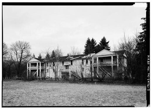
Did you know? The world's largest operating steam locomotive crossed Huntingdon County this summer.

Union Pacific's Big Boy 4014 came through on Wednesday, July 8, on its east coast tour celebrating America250. The Huntingdon Daily News reported that it passed through Mount Union, Mapleton, Mill Creek and Huntingdon, where it stopped for about 10 minutes. From there it went on through Spruce Creek and then on to Tyrone. Hundreds of spectators lined the route.

Checked and confirmed. CONFIRMED 2026-10-03 against the sources listed: every factual sentence was tied to a verbatim passage and a script confirmed each passage is in its source. Where sources disagreed on a number, the number was left out. Information shared with us by readers is given as theirs, not as fact: Lynn Klingel.

Open this story on its own page →
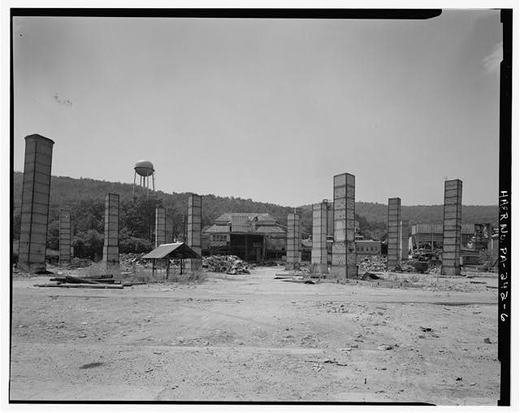
Company town survey, view 3
Company town survey, view 3Library of Congress HABS PA-2822 l14

The HABS surveyors walked every street of Mount Union's company housing, documenting row houses, duplexes, and family homes, all owned by the factory. This is the record of how industrial employers controlled the towns they created.

Checked against the record. Photograph citation corrected from an internal credit line to the Library of Congress record, so a reader can open it. The text on this page is descriptive and still carries no source of its own; that is the next pass, not this one.

Open this story on its own page →
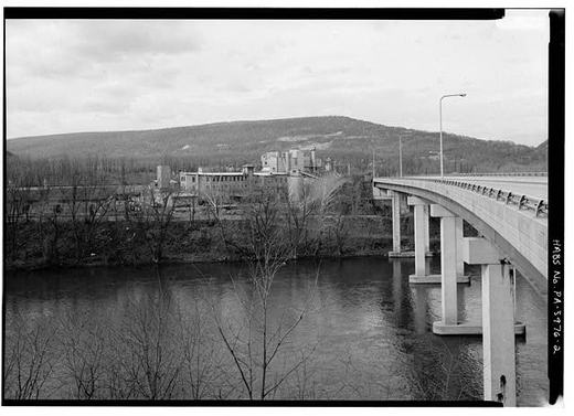
Company town survey, view 1
Company town survey, view 1Library of Congress HABS PA-2822 l12

Company housing from the HABS survey, the brick companies didn't just employ workers, they housed them. Entire neighborhoods were built and owned by the plant. Families lived in company houses, shopped at company stores, and depended on the company whistle.

Checked against the record. Photograph citation corrected from an internal credit line to the Library of Congress item record, so a reader can open it. The prose makes only general statements about company towns, which the federal survey documentation supports and other pages of this site cite in detail. It carries no number or date of its own to check.

Read the full story, with 3 passages quoted from the county histories →

The Pennsylvania Railroad's first creosote tie-treating plant stood northeast of Mount Union along the Juniata River, opened just before 1909 when this photo was taken. The plant was the PRR's first industry of this kind: treating wooden railroad ties with creosote to preserve them. About seven thousand gallons of creosote were used daily, imported from Europe and stored in Philadelphia before being shipped here. The plant kept about five hundred thousand ties on hand at any given time, treating around two thousand daily. Carl W. Tiffany supervised the operation with approximately fifty men. Many of the men standing in this photograph may be your great grandfathers or great uncles.

Checked and confirmed. Published without a source list. Every figure in it has now been read against Welch's 1909 history and all of them hold exactly: the seven thousand gallons a day imported from Europe by way of Philadelphia, the two thousand ties treated daily, the five hundred thousand on hand, Carl W. Tiffany as superintendent and about fifty men. Welch, writing in 1909, calls the plant only a few months old and the process "somewha…

Read the full story, with 3 passages quoted from the county histories →

In 1889, William DeFrehn and his sons arrived in Mount Union from Williamsport in Maryland to start a chair factory. A flood had damaged their establishment back home. They bought the old tannery that R. J. Faust had dismantled and converted it to their factory. Seven sons worked in the business: Robert, William Jr., Edward, Charles, Frank, Augustus, and George.

Thousands of fine quality chairs of various styles were sent from this place to various parts of the country, the 1909 history records. The factory occupied the western edge of town along the old line of the Pennsylvania Railroad. In February 1892, fire destroyed the building, but they rebuilt. The DeFrehn brothers left for Johnstown in 1898, though others operated the plant afterward.

Did your family sit in one of those chairs? Did they work at the factory? We would like to hear what you remember.

Checked, confirmed and corrected. Published without a source list. Every claim has now been read against Welch's 1909 history and holds, including the seven sons by name and the fire, which Welch dates precisely to 20 February 1892. Welch also names the flood: the June 1889 flood at Williamsport, Maryland, which is why they came. One correction: the original placed the factory on "the Pennsylvania Railroad siding" and Welch says "along the old line o…

Open this story on its own page →
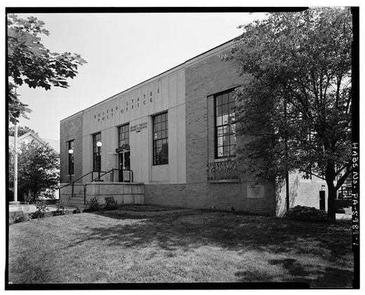
Company town survey, view 6
Company town survey, view 6Library of Congress HABS PA-2822 l17

Street-level perspectives reveal how company towns felt to people who lived in them, the scale of housing, the proximity to neighbors, the relationship between home and street.

Checked against the record. Photograph citation corrected from an internal credit line to the Library of Congress record, so a reader can open it. The text on this page is descriptive and still carries no source of its own; that is the next pass, not this one.

Open this story on its own page →
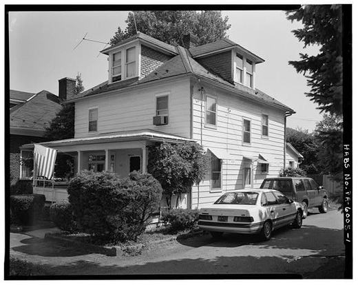
Company town survey, view 5
Company town survey, view 5Library of Congress HABS PA-2822 l16

The HABS survey wasn't just housing, it captured downtown streets, commercial blocks, and the public spaces of Mount Union during the brick era.

Checked against the record. Photograph citation corrected from an internal credit line to the Library of Congress record, so a reader can open it. The text on this page is descriptive and still carries no source of its own; that is the next pass, not this one.

Open this story on its own page →
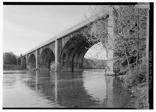
Stoianoff Brothers advertisement, Naroden Glas
Stoianoff Brothers advertisement, Naroden GlasWikimedia Commons (Naroden Glas, 1922, public domain) c05

A 1922 advertisement for the Stoianoff Brothers of Mount Union, printed in Naroden Glas, the Bulgarian-Macedonian newspaper in America.

Ganister Hill is where many of those families lived. The federal survey counts it: in 1911 Harbison-Walker owned 104 houses, all two-storey frame buildings, twenty-seven of them duplexes, and all but three grouped on the sloping hillside around the south and west sides of the plant to form the neighbourhood called Ganister Hill.

Who lived there is on the record too, in the words of the town's own paper. In January 1916 the Twice-A-Week Republican praised the company for an “uplift program” and listed its employees as “Slavish, Roumanians, Bulgarians, Italians, Greeks and Serbians” as well as “native Americans, and southern Negroes.”

The Red Cross ran an Americanization Program alongside it, teaching sewing, fancy work and cooking. The survey's own judgement is worth quoting: the arrival of so many people whose ways of speaking and living were foreign to longer-settled residents “must have been disturbing, and the response to try to make the newcomers less challenging and more controllable by ‘uplifting’ them into a safe, more respectable social category was common throughout the country.”

Checked against the record. SOURCED from the Historic American Buildings Survey report on the Town of Mount Union, HABS No. PA-5974. The page previously had no source. CONFIRMED and made exact: the page said “the hundred company houses on Ganister Hill”. The survey says Harbison-Walker owned 104 houses in 1911, all two-storey frame, twenty-seven of them duplexes, all but three grouped on the hillside south and west of the plant to form Ganiste…

Open this story on its own page →
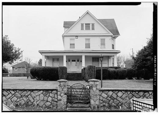
Georgi Vasilev, Naroden Glas
Georgi Vasilev, Naroden GlasWikimedia Commons (Naroden Glas, public domain) c06

Georgi Vasilev, pictured in Naroden Glas, one face among the thousands of Balkan immigrants who came to Mount Union for the brickyards. These families didn't just work the kilns; they built churches, schools, neighborhoods, and a lasting home.

Checked against the record. Photograph citation corrected from an internal credit line to the Wikimedia Commons record, so a reader can open it. The text on this page is descriptive and still carries no source of its own; that is the next pass, not this one.

Open this story on its own page →
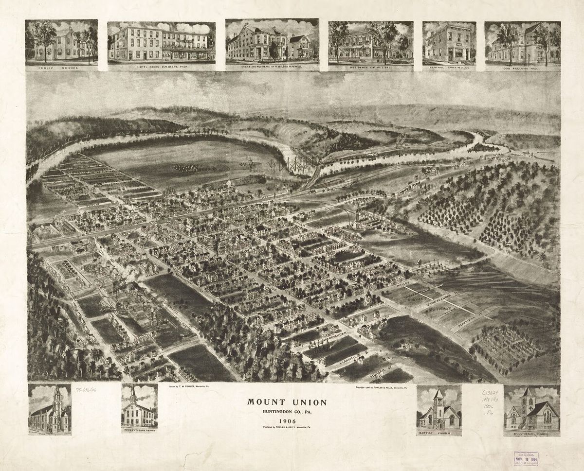
Harbison-Walker plant, HAER view 1
Harbison-Walker plant, HAER view 1Library of Congress HAER PA-242 l04

The plant that built Bricktown. The W. H. Haws Company of Johnstown began the Mount Union works in 1899 and sold the whole property to Harbison-Walker of Pittsburgh in 1900, and the plant expanded in 1905, drawn here by a main rail line and a mountain of ganister rock right at the back door. Its silica brick lined the steel furnaces of Pittsburgh. The complex joined the National Register of Historic Places in 1990.

Checked against the record. The post as published said Harbison-Walker built the Mount Union works in 1899. It did not. The W. H. Haws Company of Johnstown began the plant that year and sold the property to Harbison-Walker in 1900. Two independent sources agree: the federal engineering survey cited in "The first of its kind in the country" on this site, and Nancy Shedd's 1991 county industrial sites inventory. Corrected 1 September 2026.

Sources

  1. Nancy Shedd, Huntingdon County Historic Engineering and Industrial Sites Inventory (1991), on the founding of the Mount Union works. Cited to confirm the date and the builder; still in copyright, so not quoted at length here.

Open this story on its own page →
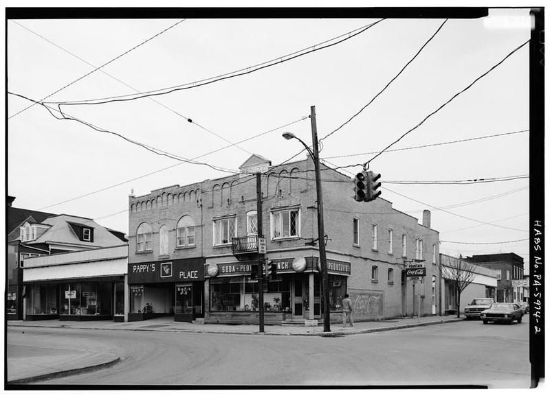
We have shared photographs of the Harbison-Walker plant abandoned, silent under the federal survey cameras. This is the plant alive. It is 1909. Smoke rises from the round beehive kilns visible in the yard. Workers stand among the structures that made the town prosper. We cannot say who is in the picture. We can say who arrived the year the works began: Charles Wenzel, born at Northeim in Hanover, a bricklayer by trade who had spent twenty years in Johnstown and made his name there with the W. H. Haws Fire Brick Company in the manufacture of silica brick. Haws is the firm that started this plant in 1899, the year Wenzel came. By the time this plate was printed he was chief of the Mount Union fire department and the borough's street commissioner. The kilns themselves are nearly gone now, reduced to bare stacks. But in this plate from the town's 1909 history, the furnaces are running at full steam.

Checked against the record. The post said one of the workers in this photograph "may have been Charles Wenzel, the German brickmaker". Two things were wrong with that. Nothing places Wenzel at this plant - Welch has him in Johnstown until 1899 and, by 1909, chief of the fire department and street commissioner - and his trade was brick laying, not brickmaking. What Welch does record is better: Wenzel had worked in Johnstown for the W. H. Haws Fi…

Read the full story, with 3 passages quoted from the county histories →

Harbison-Walker plant, HAER view 2
Harbison-Walker plant, HAER view 2Library of Congress HAER PA-242 l05

The Harbison-Walker complex sprawled across Mount Union, kilns, molding rooms, storage, rail yards, all connected. One photo can't capture it. The HAER documentation required dozens of images from different angles.

Checked against the record. Photograph citation corrected from an internal credit line to the Library of Congress record, so a reader can open it. The text on this page is descriptive and still carries no source of its own; that is the next pass, not this one.

Open this story on its own page →
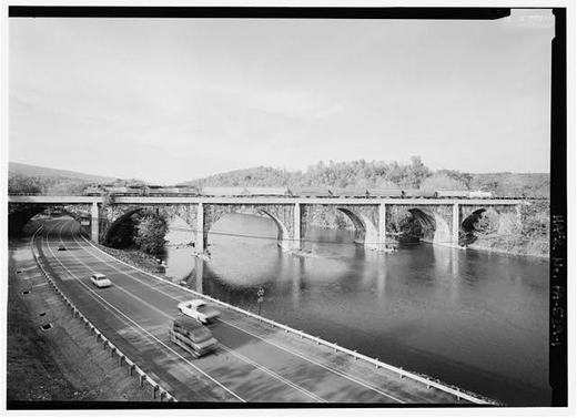
Harbison-Walker plant, HAER view 3
Harbison-Walker plant, HAER view 3Library of Congress HAER PA-242 l06

The HAER photographers understood that documenting Harbison-Walker meant capturing the whole ecosystem, not just the main plant, but all the supporting structures that made it run.

Checked against the record. Photograph citation corrected from an internal credit line to the Library of Congress record, so a reader can open it. The text on this page is descriptive and still carries no source of its own; that is the next pass, not this one.

Open this story on its own page →
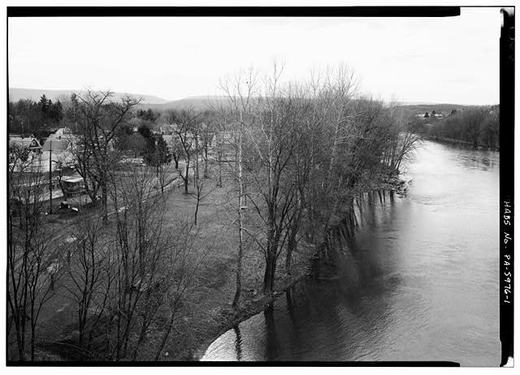
Harbison-Walker plant, HAER view 4
Harbison-Walker plant, HAER view 4Library of Congress HAER PA-242 l07

The HAER survey is an archive of industrial architecture before it all fell apart. These photographs preserve what was built, how it worked, and why it mattered to American industry.

Checked against the record. Photograph citation corrected from an internal credit line to the Library of Congress record, so a reader can open it. The text on this page is descriptive and still carries no source of its own; that is the next pass, not this one.

Open this story on its own page →
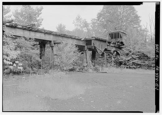
Photograph not reproduced here. The image that goes with this story is held by huntingdoncountyhistory.com and its credit does not permit republication, so it is cited rather than copied. See the original.

Fire protection in Mount Union before 1903, when getting to the blaze depended on hooves and volunteer grit.

The date is exact. Charles H. Welch, writing six years afterwards, records that the Mount Union Fire Department was organized on 28 July 1903, and that by 1909 it had about fifty members who had “enlisted their services voluntarily for the extinguishing of public fires.”

He names the whole slate. Samuel S. Mosser was president, R. O. Johnson vice president, Stewart A. Kyper secretary, Arthur Johnson assistant secretary, Frank B. Davis financial secretary, G. B. M. Kepler treasurer, Charles Wenzel chief and Frank Moore assistant chief.

Welch also says what they were working with: “A suitable equipment for the extinguishing of fires is much in need by the local fire department, but with what apparatus they have they have done” well. Fifty volunteers, not enough kit, and a town that had trebled in nine years.

Salute to every firefighter who has served this town since.

Checked against the record. SOURCED, from a page image of the book rather than its OCR, which had the chapter only as an index entry. CONFIRMED, Welch page 334: “The Mount Union Fire Department was organized July 28, 1903. At the present time there are about 50 members, who have enlisted their services voluntarily for the extinguishing of public fires.” The page had said fire protection “before 1903” with nothing behind it. The year was right …

Read the full story, with 1 passage quoted from the county histories →

Harbison-Walker kiln interior
Harbison-Walker kiln interiorLibrary of Congress HAER PA-242 l09

This is what you faced if you took a kiln job at Harbison-Walker, extreme heat, constant monitoring, days of firing to get the brick right. The work was critical, dangerous, and hot beyond what modern workers would accept.

Checked against the record. Photograph citation corrected from an internal credit line to the Library of Congress record, so a reader can open it. The text on this page is descriptive and still carries no source of its own; that is the next pass, not this one.

Open this story on its own page →
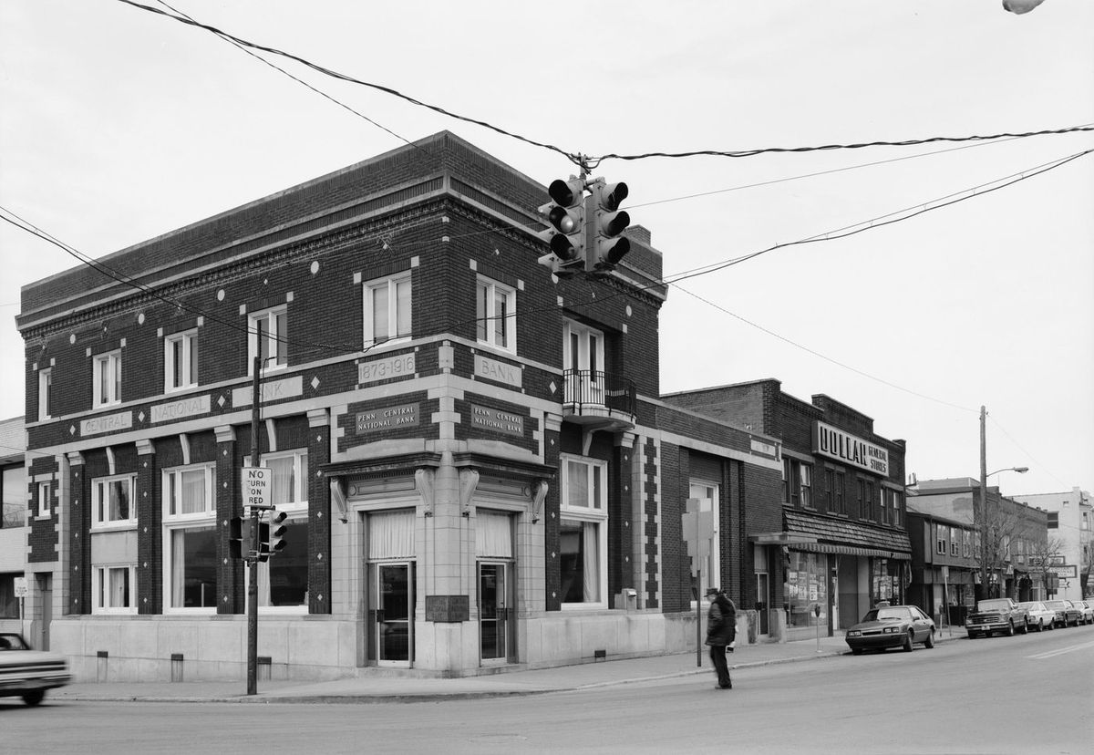
View Showing Corner of Jefferson Street and Pennsylvania Avenue Looking West, Showing Conrail Freight Station at Far Right, Hotel in Center and Stores - Town of Mount Union
View Showing Corner of Jefferson Street and Pennsylvania Avenue Looking West, Showing Conrail Freight Station at Far Right, Hotel in Center and Stores - Town of Mount UnionLibrary of Congress, Historic American Buildings Survey / Historic American Engineering Record. No known copyright restrictions. pa2822.photos.038897p

Mount Union in 1909 was more worldly than people imagine. Alley Kasan came to America in 1901 and by 1903 opened a grocery on West Shirley Street. Ye Hing Song, described in the town's own history book as a laundryman, kept his shop in the Welch building at the corner of Pennsylvania Avenue and Jefferson Street. Both men appear in Charles Welch's 1909 History of Mount Union, Shirleysburg and Shirley Township as businessmen of the community, their livelihoods sketched with the same respect given to carpenters and merchants born here. A grocer born a day's journey from Beirut. A laundryman from China. Neighbors at the corner.

Checked, confirmed and corrected. Published without a source list. Both men are in Welch's 1909 history at pp. 512-513, with the dates, the trades and both addresses as the original gives them. Checked 1 September 2026. The post said Alley Kasan came from "a village near Beirut". Welch's 1909 history, the book the original is drawn from, says he was born in the vicinity of Beirut and places his birthplace "about a day's journey from Beirut in the reg…

Open this story on its own page →
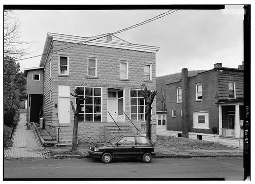
Post office mural
Post office muralLibrary of Congress / HABS (Paul Rohland, 1936) c03

Walk into the Mount Union post office and look up: in 1937, Treasury Department artist Paul Rohland painted The Union of the Mountains there, as part of the New Deal's public art programme. The same decade the flood hit, Uncle Sam gave Mount Union a piece of national art history.

Open this story on its own page →
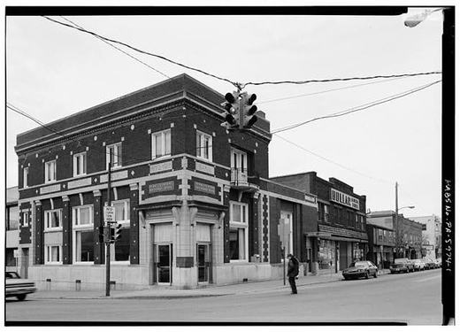
Peduzzi's entrance tile
Peduzzi's entrance tileWikimedia Commons (Smallbones, CC0) c01

Step into Peduzzi's and look down. The name is set in tile at the doorway.

T. C. Peduzzi did not come here for the brick. Welch's 1909 account has him born in Lombardy in 1867, a stone mason who worked five years through the Swiss cantons and four in France, reaching America in 1890 and going west to Montana and Washington. The first brick plant in this town was not built until 1899.

He ended up the town's confectioner, and the tile is still in the floor.

Checked against the record. A GENERALISATION THE RECORD CONTRADICTS FOR THE NAMED FAMILY. The page said “Italian families like the Peduzzis and Melonis came for the brick work”. For the Peduzzis that is not what happened. Welch has T. C. Peduzzi reaching America in 1890 and going to Montana and Washington. The W. H. Haws plant, the first brick works in Mount Union, was not built until 1899, nine years later, and he was a stone mason by trade ra…

Open this story on its own page →
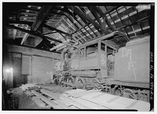
Peduzzi's Soda and Lunch
Peduzzi's Soda and LunchWikimedia Commons (Smallbones, CC0) c02

Peduzzi's Soda and Lunch, the counter at the heart of downtown. Look down at the doorway and the name is still set in tile.

The man behind it had come a long way to stand there. Charles H. Welch wrote him up in 1909 as “the Mount Union Confectioner”. T. C. Peduzzi was born in Lombardy, in northern Italy, on 16 March 1867. He spent fourteen years in Italy, then five travelling the Swiss cantons of the Alps, working as a stone mason. At nineteen he went to France and stayed four years. In 1890 he came to America, and went west — Montana and Washington — before he ever saw this town. Welch says he had travelled through thirty-one states.

A stone mason from Lombardy by way of the Alps, France and the American West, keeping a soda counter in Mount Union.

Checked against the record. SOURCED. The page had no source at all and described the counter without ever saying who kept it. CONFIRMED from Welch, page 406, written while Peduzzi was in business: born in Lombardy in northern Italy on 16 March 1867; fourteen years in Italy; five years through the cantons of Switzerland, a stone mason by trade; France at nineteen for four years; to America in 1890, settling in the West in the region of Montana …

Open this story on its own page →
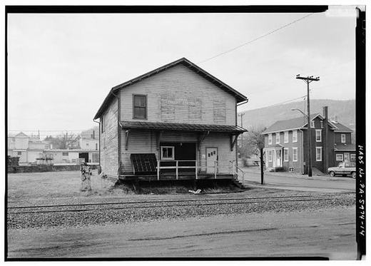
For weeks we have been sharing photographs from Charles H. Welch's 1909 history of Mount Union. Now we want to tell you about the photographer who took most of them: R. F. Ernst.

Ernst was born in Goslar, Germany, on New Year's Day 1877. He came to America at eighteen and settled in Houtzdale, Pennsylvania, where he worked in photography with a cousin. After a few years, he returned to Germany and spent three years there. He came back to the United States, settled in Clearfield, and married Jennie Reed in 1902. The couple had a son, Frederick.

In November 1904, Ernst moved his family to Mount Union. Here he was kept busy supplying the town's demand for his photographic work. By the time Welch's history book was published in 1909, Ernst had already made his mark on the town through his images. The book itself credits him: the pictures "have mostly been taken by R. F. Ernst, the Mount Union photographer."

This street view of the Maxwell Hardware corner is one of his photographs. For a century these images have shaped how we understand the town. Every photograph has a photographer. This one gets his name back.

Checked and confirmed. Published without a source list. Every claim in it has now been read against Welch's 1909 history, the book the photographs come from, and all of it holds: Goslar, New Year's Day 1877, Houtzdale, the three years back in Germany, Jennie Reed and Clearfield in 1902, the son Frederick, November 1904, and the credit line quoted at the end. Checked 1 September 2026.

Open this story on its own page →
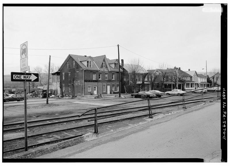
Photograph not reproduced here. The image that goes with this story is held by huntingdoncountyhistory.com and its credit does not permit republication, so it is cited rather than copied. See the original.

Shirley Street in the 1960s, parking meters, neon, and a main street still carrying three refractories plants. That's 30 days of Mount Union history, one photo at a time. Thank you for following along!

The archive doesn't end here: if you have old photos of Mount Union in a shoebox or an album, share them with the page, with your permission we'll post them with their story so they're never lost.

Sources

  1. Nancy Shedd, Huntingdon County Historic Engineering and Industrial Sites Inventory (1991), on the closing dates: Harbison-Walker 1985, North American Refractories 1990 — which is why the 1960s was not the last full decade of the brick era. Cited to confirm; still in copyright, so not quoted at length here.

Open this story on its own page →
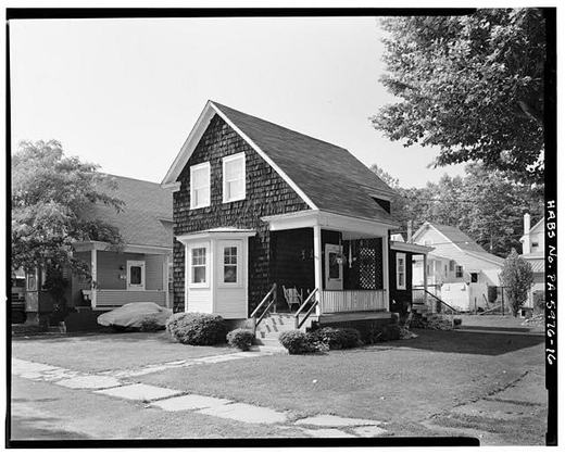
Selea Cutshall lost both legs to a serious railroad accident. But he built a life anyway. Born in Springfield Township on February 6, 1870, he came to Mount Union in October 1905 and opened a small store in the eastern section of town. He worked as a confectioner and cobbler. By 1909, when the town's history was written, Cutshall was described as getting around remarkably well and ambitious toward making an honest living. The railroad that built this town took plenty from its people. Yet Selea Cutshall took what remained and built something of his own.

Checked and confirmed. Published without a source list. Every claim is in Welch's 1909 history at p. 500, in the wording the original gives them. Welch adds what the original leaves out: Cutshall married Miss Ranck of Hustontown and had three children. Checked 1 September 2026.

Read the full story, with 3 passages quoted from the county histories →

Photograph not reproduced here. The image that goes with this story is held by huntingdoncountyhistory.com and its credit does not permit republication, so it is cited rather than copied. See the original.

1910: the J. D. Flood Company delivering furniture the old way, by horse and wagon.

The Floods were county men. Charles H. Welch records that the brothers were born near Nossville, in the lower end of Huntingdon county, and spent their early days there. J. D. Flood, the senior member of the firm, was in Virginia and in Tyrone before going into the furniture business at Lewistown.

They brought it home. The Messrs. Flood came to Mount Union in the spring of 1906 — four years before this photograph — and J. D. Flood married Marie Boggs of Lewistown.

Checked against the record. SOURCED. The page had no source and said nothing about who the Floods were. CONFIRMED from Welch, page 431: the Messrs. Flood were born near Nossville in the lower end of Huntingdon county and spent their early days there; J. D. Flood, the senior member of the firm, spent time in Virginia and in Tyrone and was later in the furniture business in Lewistown; the Floods came to Mount Union in the spring of 1906; J. D. F…

Read the full story, with 3 passages quoted from the county histories →

Harbison-Walker silos
Harbison-Walker silosLibrary of Congress HAER PA-242 l11

Industrial storage at the Harbison-Walker complex. These silos held finished brick waiting for the railroad cars that would carry them to the furnaces of Pittsburgh and beyond. Mount Union's silica brick was a commodity traded by the ton.

Checked against the record. Photograph citation corrected from an internal credit line to the Library of Congress record, so a reader can open it. The text on this page is descriptive and still carries no source of its own; that is the next pass, not this one.

Open this story on its own page →
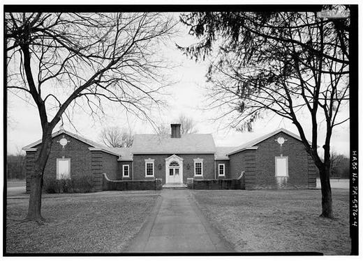
Photograph not reproduced here. The image that goes with this story is held by huntingdoncountyhistory.com and its credit does not permit republication, so it is cited rather than copied. See the original.

The Pennsylvania Railroad's tie-treating plant, on the company's ground northeast of town along the Juniata.

Charles H. Welch was writing in 1909, when it was brand new. He calls it “Mount Union's latest industry”, put up by the railroad during the previous year and opened only months before he wrote.

The numbers he gives are the ones worth keeping. Seven thousand gallons of creosote used every day, imported from Europe, stored in tanks at Philadelphia and shipped up here. Two thousand feet of siding in and around the works. Two thousand ties treated a day, and half a million ties lying on hand. About fifty men employed, under Superintendent Carl W. Tiffany.

And Welch adds something he is careful about: so far as he could learn, treating ties with creosote was “somewhat of an experiment”, and this was the first plant of its kind the Pennsylvania Railroad had built.

Checked against the record. SOURCED. The page previously cited an internal catalogue reference and a photograph credit, neither of which a reader can open, and it described the operation only in general terms. CONFIRMED and greatly expanded from Welch, page 226, written while the plant was new: erected by the Pennsylvania Railroad Co. on their grounds northeast of town along the Juniata River; seven thousand gallons of creosote used daily, imp…

Read the full story, with 3 passages quoted from the county histories →

Photograph not reproduced here. The image that goes with this story is held by huntingdoncountyhistory.com and its credit does not permit republication, so it is cited rather than copied. See the original.

The Crum building on the corner of Jefferson Street and Railroad Avenue.

It replaced the Broad Top House, one of Mount Union's early hotels, built by James G. Doyle in the late 1850s and standing along the railroad opposite the station.

By 1909 the Crum building held a barber's room — James Nevell's, opposite the Beers Hotel — and the real estate and insurance office of McKelvy and Fields.

Checked against the record. SOURCED. The page previously cited an internal catalogue reference and a photograph credit, neither of which a reader can open, and described the building only in general terms about the brick boom. CONFIRMED from Welch: the Crum building stands on the corner of Jefferson Street and Railroad Avenue, on the site of the former Broad Top House; James Nevell's barber room was in it, opposite the Beers Hotel; and McKelvy…

Read the full story, with 3 passages quoted from the county histories →

The factory where the women worked, and the reason they were the ones working there.

Mount Union Manufacturing opened on Pine Street in 1920 to make men's suits and coats, in a building that then took up a lot of only 120 feet by 40. By 1922 it employed sixty-two women. That same year the L. Greif Company of Baltimore bought the firm and put up an addition 130 feet by 120, running east to the corner of Division Street. By 1928 there were 174 on the books, 314 by 1938, and after the company doubled the size of the plant in the 1940s, with part of the work turned over to army uniforms, 591 by 1948.

The federal survey of the county's industrial sites is blunt about why the workforce was female, and it is the opposite of the way this is usually told. Three refractory plants and the East Broad Top yards were taking the town's men. That, the survey says, gave the sewing factory a large pool of women to draw from.

Then something quiet happened. In the 1950s General Refractories closed and the other two plants began shedding men, and men started coming to the textile factory. By 1959 the sewing factory employed 725 workers, about a hundred more than the two remaining refractories put together. The factory that nobody named the town after had outgrown the one that did.

In 1971 Greif became a division of Genesco, which built a modern plant in a new industrial park east of town and kept 225 workers in the old building making small parts for coats that were assembled in the new one. It did not last. Genesco closed both plants in 1974.

The building did not go empty. From 1978 it housed Dallco Industries of York, making women's garments, and when the surveyors came through it was expanding into a long vacant shoe factory on Division Street. Two storeys, 450 feet by 120, concrete block, with three saw-tooth roof monitors, and they judged it well maintained.

Checked against the record. EVERY NUMBER ON THIS PAGE NOW HAS A SOURCE, AND IT IS ONE DOCUMENT. The page carried six employment figures and a chain of ownership with nothing behind any of it. All of it is in Nancy S. Shedd's inventory of the county's historic engineering and industrial sites, prepared for the National Park Service in 1991, on pages 161 and 162: sixty-two women in 1922, the Greif purchase that same year, 314 in 1938, 591 by 1948…

Open this story on its own page →
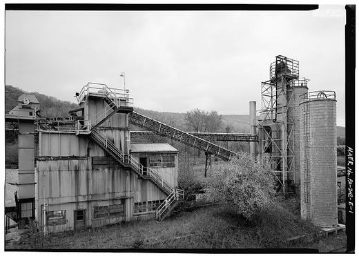
Photograph not reproduced here. The image that goes with this story is held by huntingdoncountyhistory.com and its credit does not permit republication, so it is cited rather than copied. See the original.

The J. E. Everett grocery in 1910, in the middle of the decade that changed this town.

Charles H. Welch, writing here in 1909, put numbers on it. When the water plant went in, in 1900, Mount Union had a population of 1,086. By the time he wrote, it had “upward of 3200” counting the suburbs.

He listed what had arrived in those nine years: two large fire brick plants, a large steam tannery, extract works, creosoting works and two railroads, employing between them more than a thousand men. In 1900, he says, work had only just begun on the Ganister Works.

A grocery in a town that trebles in nine years is not a quiet business.

Checked against the record. SOURCED. This page previously cited an internal catalogue reference and a photograph credit, neither of which a reader can open, and it carried a population claim with nothing behind it: that Mount Union went “from about a thousand to over three thousand” between 1900 and 1910. CONFIRMED, and better than the estimate. Welch's history, page 390: “When the plant was installed, in 1900, Mount Union had a population of …

Open this story on its own page →
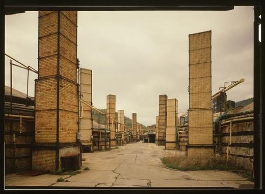
Harbison-Walker molding room
Harbison-Walker molding roomLibrary of Congress HAER PA-242 l10

The molding room at Harbison-Walker, a craft operation hidden inside an industrial giant. Hand-pressed ganister, careful shaping, then off to the kilns. The work was skilled and back-breaking, day shift and night shift, always the same pace.

Checked against the record. Photograph citation corrected from an internal credit line to the Library of Congress record, so a reader can open it. The text on this page is descriptive and still carries no source of its own; that is the next pass, not this one.

Open this story on its own page →
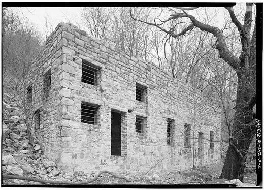
On August 20, 1905, the electric lights came on for the first time. Scott Dibert, president of the Mount Union Silica Brick Company, had brought electric light to the town through the Mount Union Light and Power Company. The two large dynamos sat in the engine room of the brick works itself, furnishing both day and night current to the streets.

It was a night long to be remembered. The electric lights glowed for the first time on Mount Union's streets. One man, one brick plant, two industries: the same works that burned to make fire brick across America also powered the lamps where families walked at night.

Did your family live here when those lights came on, or do you have stories passed down about the night Mount Union lit up?

Checked and confirmed. Published without a source list. Every claim has now been read against Welch's 1909 history and all of it holds, including the date, the two dynamos in the engine room of the brick works, the day and night current, and the phrase about a night long to be remembered, which is the book's own. Checked 1 September 2026.

Open this story on its own page →

View of Double Mountain-Style Houses Looking Southeast on Birch Street. - Town of Kistler
View of Double Mountain-Style Houses Looking Southeast on Birch Street. - Town of KistlerLibrary of Congress, Historic American Buildings Survey / Historic American Engineering Record. No known copyright restrictions. pa2824.photos.038911p

Seven Double Mountain Houses were built in 1917 for workers in Kistler, the company town of Mount Union Refractories across the Juniata River from Mount Union. Only three of the seven were still standing when the federal surveyors counted in 1991. Each duplex stands one and one-half stories tall, distinguished by a rectangular plan, gable roof with pent eaves, a wide shed roof dormer on the front, and double front entrance porches. The Double Mountain House was one of six house types designed for the industrial village by the New York architectural firm Mann and MacNeill under landscape architect John Nolen's town plan. Among all the house types built for Kistler, this one faced the steepest loss.

Checked and confirmed. Published without a source list. Every claim has now been read against the 1991 county industrial survey and holds, including the architectural description and the count of seven built and three surviving. The superlative needed the most work, because saying a thing suffered the worst losses means counting all its rivals: the survey gives all six house types, and the Double Mountain House lost four of seven where the…

Sources

  1. Nancy Shedd, Huntingdon County Historic Engineering and Industrial Sites Inventory (1991), the Kistler entry: ninety-four company-built dwellings in six house types named on John Nolen's plan, designed by Mann and MacNeill of New York; the Double Mountain House described as a one-and-one-half-story duplex, seven built and three surviving. The survey's counts for all six types are what make the "steepest loss" claim checkable: 6/6, 7/3, 8/8, 30/30, 27/26 and 23/21. Cited to confirm; still in copyright, so not quoted at length here.

Open this story on its own page →

Photograph not reproduced here. The image that goes with this story is held by huntingdoncountyhistory.com and its credit does not permit republication, so it is cited rather than copied. See the original.

The Pennsylvania Railroad tie yard in the 1950s. Mount Union was not only brick: millions of wooden crossties passed through the railroad's treating plant here on their way to the main line.

The works were new in 1909, and Charles H. Welch described them while the creosote smell was still fresh: seven thousand gallons a day, imported from Europe, two thousand ties treated every day, half a million lying in the yard, about fifty men under Superintendent Carl W. Tiffany. Forty years later the yard in this photograph was still doing it.

Checked against the record. SOURCED for the plant, not for the photograph's decade. The page had no source at all. Welch's 1909 account of the tie-treating plant, page 226, establishes what the works were and at what scale, and that is now on the page with his figures. WHAT IS STILL NOT SOURCED: that this particular photograph is from the 1950s. No source opened here dates the image. The claim that ties were still being treated here four decad…

Read the full story, with 3 passages quoted from the county histories →

After teaching school for five years in Franklin and Huntingdon counties, Thomas H. Adams was ready to enter business. His savings were modest but sufficient: by April 1861, he had opened a mercantile partnership with Peter M. Bare in Mount Union. A storekeeper first, Adams proved a judicious businessman. He returned to Mount Union in July 1867 to settle permanently. By 1873, he founded something larger: "The Central Banking Co., was organized on March 13, 1873, with T. H. Adams as President and Edmund S. Doty as Cashier."

Adams was born near Orbisonia on February 16, 1836, the son of Irish immigrants. His father John had been born in Ireland and came to America in 1825, eventually settling in Germany Valley. Thomas H.'s journey was the classic one: farm boy, scholar, teacher, tradesman, then founder. By the time the 1909 history was published, the Central Banking Company had weathered the panics of 1873 and 1893 and the slump of 1907. This building was the bank's second home, erected in 1902 and occupied in March 1903.

Checked and confirmed. Published without a source list. Every claim in it has now been read against Welch's 1909 history and all of it holds, including the sentence the original quotes about the bank's founding, which appears word for word. Welch adds what the original leaves out: Adams's father John was at one time superintendent of the old Rockhill mines and furnaces, and worked on the canal, helping complete four of its locks. Checked 1…

Read the full story, with 3 passages quoted from the county histories →

View Showing Peduzzi'S Lunch Counter and Pappy'S Place Looking South at the Corner of Jefferson and Shirley Streets - Town of Mount Union
View Showing Peduzzi'S Lunch Counter and Pappy'S Place Looking South at the Corner of Jefferson and Shirley Streets - Town of Mount UnionLibrary of Congress, Historic American Buildings Survey / Historic American Engineering Record. No known copyright restrictions. pa2822.photos.038886p

In 1989 and 1991 federal historians came to Mount Union to record the people who remembered the brickyards.

You can see them working in the footnotes. The Historic American Buildings Survey's report on this town cites, in among the newspaper clippings and the company records, a line like this: “Ivan Phillips, interview by author, Mt. Union, Pa., June 11, 1991.” Someone sat down with him and wrote down what he said, and it went into the federal record.

Alongside him the same notes cite Nancy Shedd, the county historian whose 1988 engineering report the whole survey was built on.

That is what a government survey looks like from the inside: not a form, but a historian in a front room in Mount Union with a notebook, on a Tuesday in June 1991.

Checked against the record. PARTLY CONFIRMED, and the page now claims only the part that is. CONFIRMED at the Historic American Buildings Survey report on the Town of Mount Union, HABS No. PA-5974: a footnote reads “Ivan Phillips, interview by author, Mt. Union, Pa., June 11, 1991.” That establishes both the interviewing and the 1991 date, in the survey's own citation. NOT FOUND HERE: the other eight names the page listed — Fred S. Beatty, Jo…

Open this story on its own page →

Georgi Vasilev, Naroden Glas
Georgi Vasilev, Naroden GlasWikimedia Commons (Naroden Glas, public domain) c06

Georgi Vasilev, from the village of Krushoradi in the Lerin district, lived in Mount Union, Pa. This portrait appeared in Naroden Glas, the Bulgarian language newspaper of America. The newspaper published portraits and advertisements featuring Bulgarian and Macedonian Americans.

Sources

No source list was recorded with this item when it was written. It is shown here as written and has not been re-verified. Treat it as unverified until it has been.

Open this story on its own page →

Photograph not reproduced here. The image that goes with this story is held by huntingdoncountyhistory.com and its credit does not permit republication, so it is cited rather than copied. See the original.

An East Broad Top train working Mount Union in 1950. This town was the northern end of the narrow gauge, a big dual-gauge yard and a coal cleaning plant where Broad Top coal met the Pennsylvania Railroad main line and fired the brick kilns. The EBT quit common-carrier runs in 1956, but she's running excursions again today.

Sources

No source list was recorded with this item when it was written. It is shown here as written and has not been re-verified. Treat it as unverified until it has been.

Open this story on its own page →

Photograph not reproduced here. The image that goes with this story is held by huntingdoncountyhistory.com and its credit does not permit republication, so it is cited rather than copied. See the original.

The G. W. Radle store in Mount Union sold farm supplies. Farm Equipment and Farm Supplies, the signs read in the window glass. A Mail Pouch thermometer hung on the wall, and the photo captures the sidewalk too: kids and a dog, the texture of a small-town business day.

Sources

No source list was recorded with this item when it was written. It is shown here as written and has not been re-verified. Treat it as unverified until it has been.

Read the full story, with 3 passages quoted from the county histories →

Photograph not reproduced here. The image that goes with this story is held by huntingdoncountyhistory.com and its credit does not permit republication, so it is cited rather than copied. See the original.

Happy Fourth of July from Historic Mount Union! An American Legion parade rolls through town in the 1940s. This town sent its sons to both World Wars, and its kilns and powder plant served on the home front in each.

Proud of every Mount Union veteran, then and now.

Sources

No source list was recorded with this item when it was written. It is shown here as written and has not been re-verified. Treat it as unverified until it has been.

Open this story on its own page →

Photograph not reproduced here. The image that goes with this story is held by huntingdoncountyhistory.com and its credit does not permit republication, so it is cited rather than copied. See the original.

Meloni's Bar, one of the Italian-American family businesses that took root when immigrant workers came to Mount Union for the brickyards and the railroad, and stayed to build the town.

Sources

No source list was recorded with this item when it was written. It is shown here as written and has not been re-verified. Treat it as unverified until it has been.

Open this story on its own page →

Photograph not reproduced here. The image that goes with this story is held by huntingdoncountyhistory.com and its credit does not permit republication, so it is cited rather than copied. See the original.

The storefront of J. E. Everett in Mount Union, photographed around 1910. Two people stand in the central doorway, framed between two windows. On the left, the word Groceries. On the right, the word Confectionery. A Mail Pouch crate or sign sits at ground level.

One storefront with two separate names. The couple in the photograph occupy the space between them, the merchants of this arrangement, though we do not know their names. One doorway, one storefront, two different departments under the Everett name.

Who were the two people in this doorway? If you are descended from J. E. Everett, or if this corner belonged to your Mount Union memory, tell us their story. Someone will recognize this storefront and know.

Sources

No source list was recorded with this item when it was written. It is shown here as written and has not been re-verified. Treat it as unverified until it has been.

Open this story on its own page →

Photograph not reproduced here. The image that goes with this story is held by huntingdoncountyhistory.com and its credit does not permit republication, so it is cited rather than copied. See the original.

Parade day in the 1920s, when a boom town's sidewalks filled shoulder to shoulder for a band and a banner. Some things about a small town never change.

Sources

No source list was recorded with this item when it was written. It is shown here as written and has not been re-verified. Treat it as unverified until it has been.

Open this story on its own page →
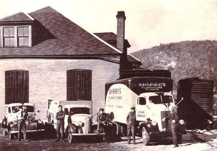
Photograph not reproduced here. The image that goes with this story is held by huntingdoncountyhistory.com and its credit does not permit republication, so it is cited rather than copied. See the original.

Pennsylvania Avenue in 1945. The east end of town grew up around General Refractories, which built clusters of company housing for its workers on the streets east of Greene. Between the three brick plants, whole neighborhoods of Mount Union were company-built.

Sources

No source list was recorded with this item when it was written. It is shown here as written and has not been re-verified. Treat it as unverified until it has been.

Open this story on its own page →

Photograph not reproduced here. The image that goes with this story is held by huntingdoncountyhistory.com and its credit does not permit republication, so it is cited rather than copied. See the original.

Shirley Street in the 1930s. Even through the Depression, the brick plants kept Mount Union's main street busier than most towns its size.

Sources

No source list was recorded with this item when it was written. It is shown here as written and has not been re-verified. Treat it as unverified until it has been.

Open this story on its own page →

Photograph not reproduced here. The image that goes with this story is held by huntingdoncountyhistory.com and its credit does not permit republication, so it is cited rather than copied. See the original.

Hard to picture in June, but this is what winter looked like in Mount Union. When the Juniata froze hard, the river became the town's gathering place.

Did you ever skate the river? Tell us where.

Sources

No source list was recorded with this item when it was written. It is shown here as written and has not been re-verified. Treat it as unverified until it has been.

Open this story on its own page →
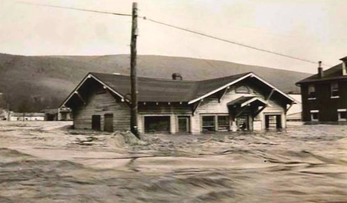
Photograph not reproduced here. The image that goes with this story is held by huntingdoncountyhistory.com and its credit does not permit republication, so it is cited rather than copied. See the original.

Strickler's in the 1950s was where two needs met on the same corner: ice cream and a full tank of gas. The Ice Cream sign is painted large above the store. The pumps stand out front, numbered and ready. A truck waits at the curb. Everything in the photograph speaks of a simple afternoon transaction in a working town.

Sources

No source list was recorded with this item when it was written. It is shown here as written and has not been re-verified. Treat it as unverified until it has been.

Read the full story, with 2 passages quoted from the county histories →

Photograph not reproduced here. The image that goes with this story is held by huntingdoncountyhistory.com and its credit does not permit republication, so it is cited rather than copied. See the original.

The Acme grocery on Shirley Street, back when clerks fetched your order from behind the counter and most families ran a tab between brickyard paydays.

Sources

No source list was recorded with this item when it was written. It is shown here as written and has not been re-verified. Treat it as unverified until it has been.

Open this story on its own page →
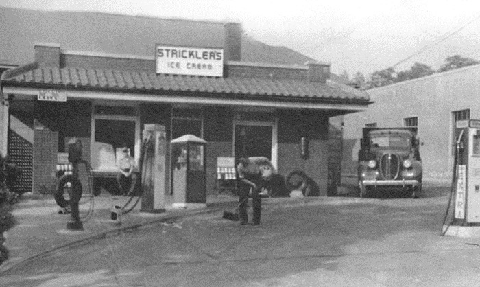
Photograph not reproduced here. The image that goes with this story is held by huntingdoncountyhistory.com and its credit does not permit republication, so it is cited rather than copied. See the original.

The crew posed out front of the drug store. In a brickyard town, the soda counter was where the day's news got traded after the shift whistle.

Sources

No source list was recorded with this item when it was written. It is shown here as written and has not been re-verified. Treat it as unverified until it has been.

Open this story on its own page →

Photograph not reproduced here. The image that goes with this story is held by huntingdoncountyhistory.com and its credit does not permit republication, so it is cited rather than copied. See the original.

The old Mount Union High School. Generations of Trojans passed through these doors before consolidation.

Sources

No source list was recorded with this item when it was written. It is shown here as written and has not been re-verified. Treat it as unverified until it has been.

Read the full story, with 3 passages quoted from the county histories →

Photograph not reproduced here. The image that goes with this story is held by huntingdoncountyhistory.com and its credit does not permit republication, so it is cited rather than copied. See the original.

1945: with the men overseas, the women of Mount Union kept the brick moving. Silica brick from this plant lined the furnaces of the steel mills that armed America in World War II.

If you recognize a face in this photo, tell us her name, let's get them remembered.

Sources

No source list was recorded with this item when it was written. It is shown here as written and has not been re-verified. Treat it as unverified until it has been.

Open this story on its own page →
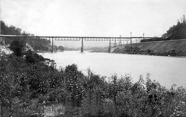
Interior View of Molding Room, No. 2 Works, Showing Bucket Line Feeding Molding Machines - Harbison-Walker Refractories Company, Molding Room
Interior View of Molding Room, No. 2 Works, Showing Bucket Line Feeding Molding Machines - Harbison-Walker Refractories Company, Molding RoomLibrary of Congress, Historic American Buildings Survey / Historic American Engineering Record. No known copyright restrictions. pa2726.photos.134464p

The machines that built the secret.

In 1942, when Robert Wagner came to work at Harbison-Walker's Mount Union plant, hand molding accounted for 90 percent of production. The company had patented special impact presses made right here that transformed the work. These machines produced denser brick that could better withstand the extreme temperatures inside coke ovens. By the late 1970s, about 95 percent of the coke oven brick shapes leaving Mount Union were made by machine.

The presses were a competitive advantage worth protecting. When the plant closed in 1985, former customers needed replacement brick for coke ovens still in use. The plant's retired manager, with three of his former workers, shipped the molds to a plant in Utah where replacements could be made. The remaining presses were destroyed, and the company regarded the press design as a valuable industrial secret.

The photo shows the molding room bucket line feeding materials into the machines that built an industry.

If your grandfather or great grandfather worked at the brick plant, there's a chance he ran one of those presses or watched them transform the work.

Sources

No source list was recorded with this item when it was written. It is shown here as written and has not been re-verified. Treat it as unverified until it has been.

Open this story on its own page →

Where it sits

Alexandria borough: 12 storiesBirmingham borough: 2 storiesBroad Top City borough: 2 storiesCassville borough: 2 storiesCoalmont borough: 2 storiesDudley borough: 2 storiesHuntingdon borough: 36 storiesMapleton borough: 6 storiesMarklesburg borough: 4 storiesMill Creek borough: 4 storiesMount Union borough: 137 storiesOrbisonia borough: 8 storiesPetersburg borough: 3 storiesRockhill borough: 5 storiesSaltillo borough: 5 storiesShade Gap borough: 3 storiesShirleysburg borough: 4 storiesThree Springs borough: 4 storiesBarree township: 6 storiesBrady township: 4 storiesCarbon township: 3 storiesCass township: 2 storiesClay township: 4 storiesCromwell township: 7 storiesDublin township: 5 storiesFranklin township: 10 storiesHenderson township: 6 storiesHopewell township: 5 storiesJackson township: 9 storiesJuniata township: 8 storiesLincoln township: 5 storiesLogan township: 5 storiesMiller township: 4 storiesMorris township: 2 storiesOneida township: 6 storiesPenn township: 4 storiesPorter township: 10 storiesShirley township: 10 storiesSmithfield township: 5 storiesSpringfield township: 5 storiesSpruce Creek township: 7 storiesTell township: 3 storiesTodd township: 5 storiesUnion township: 5 storiesWalker township: 9 storiesWarriors Mark township: 5 storiesWest township: 2 storiesWood township: 13 storiesHuntingdonMount UnionOrbisoniaThree SpringsPetersburgMapletonAlexandriaRockhillBroad Top CitySaltillo
10 or more4 to 91 to 3borough outline