Mount Union borough
Mount Union's Subway
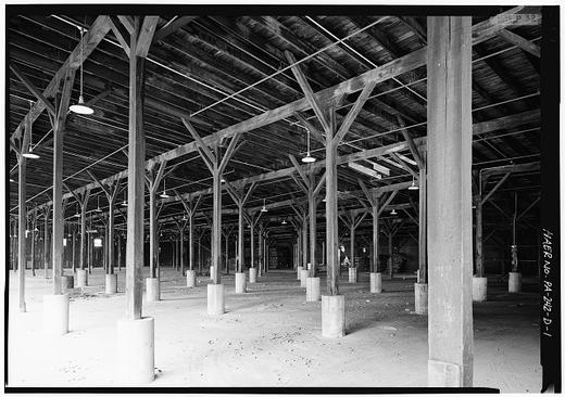
This is what a subway looks like in Mount Union. No underground trains here, the subway was the underpass that carried you safely beneath the Pennsylvania Railroad tracks while the freights rolled overhead. In a town built around the rails, it was the only way across when a long coal drag had the crossing blocked.
From the record
Passages about this subject, quoted from county histories now in the public domain. Each one names the book and the position in the text so it can be checked. Spelling is as printed.
The East Broad Top railroad connects with the Pennsylvania railroad at Mount Union and runs south through Shirleysburg, giving the township and outlying region ample transportation facilities. Smithiield is one of the newer townships of the county, having been organized in March, 1886, from Porter, Walker, and Juniata. It lies directly across the Juniata river from Huntingdon borough, the village of Smithfield forming practically a suburb of the county seat. The Huntingdon & Broad Top railroad runs southwest through the township. Springfield township, located in the southern part of the county, was organized in December, 1790, from the townships of Dublin and Shirley. Its original area has been much reduced by the erection of Cromwell in 1836 and Clay in 1845. It is bounded on the north by Cromwell ; on the east by Dublin ; on the south by Fulton county, and on the west by the township of Clay. John Bailey, a Revolutionary soldier, settled on the banks of the Aughwick creek soon after that war. He was soon joined by William Jones, John Robertson and William Ward. Then came a tide of immigration from Maryland, the Browns, Maddens, Ramseys, Lanes, Cutshalls, Wibles, and several other families locating in what is now Springfield township.John W. Jordan, ed., History of the Juniata Valley and Its People (New York: Lewis Historical Publishing, 1913) · character 200,911 of the scanned text
Gorsuch and Union Church, near the center of the township, and Ardenheim, a small station on the Pennsylvania railroad, two miles east of Huntingdon, are the only villages of consequence. Hopewell township was erected in July, 1773, when the Bedford county court ordered that "that part of Barre township including all the waters that empty into the Raystown Branch of Juniata below the mouth of Yellow Creek and up said creek to Tussey's Mountain is hereby erected into a township by the name of Hopewell township." It was therefore one of the six original townships when the county was erected in 1787. Union township was taken from it in 1791 ; Penn in 1846, and Lincoln in 1866. These curtailments have left it one of the smallest townships in the county. It is located in the southwest corner and is bounded on the north by Lincoln township; southeast by Tod and Carbon, from which it is separated by Terrace mountain ; southwest by Bedford county, and northwest by the county of Blair. The Huntingdon & Broad Top railroad traverses it from northeast to southwest and the Raystown branch of the Juniata follows the same general direction.John W. Jordan, ed., History of the Juniata Valley and Its People (New York: Lewis Historical Publishing, 1913) · character 187,991 of the scanned text
This road was probably always unnecessary, and was certainly so after the making of the Pennsylvania railroad. That a need for it is now growing up, and that it will probably take the place of the dismantled canal, is one of the revolutions of progress. The Pennsylvania Railroad Company was incorporated April 13th, 1816. Among the commissioners appointed by the act " to do and perform the several acts and things," therein mentioned, were John G. Miles, John Kerr, A. P. "Wilson, Edwin F. Shoenberger, Benjamin Leas, John McCahen, John Long, Brice Blair, Thomas E. Orbison and John Porter, of Huntingdon county. The first surveys through the county were made in the summer of 1817. By the 3rd of August, the engineers had progressed several miles west of Huntingdon in the direction of Petersburg. At that time they passed through the former borough on Washington street, but later in the same season they made a re-survey on Allegheny street, where the location of the road was determined upon. Proposals for the grading and masonry between Lewistown and Huntingdon were advertised for in April, 1818, and received until the 17th of May. Contracts were entered into within the next twenty days, and the work was at once commenced. At the close of tbe year the grading was almost completed.Milton Scott Lytle, History of Huntingdon County (Lancaster: William H. Roy, 1876) · character 284,579 of the scanned text
Sources
- Caption from the Historic Mount Union page archive: “This is what a subway looks like in Mt. Union”. Community archive, not a published record.
- Photograph credit: Historic Mount Union archive
Checked 2026-07-22 · Historic Mount Union collection
← All stories from Mount Union borough
Have something to add to this story, or a photograph of it? Send it here →
Photographs from Mount Union borough
More from Mount Union borough
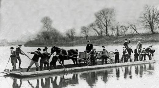
Did you know? The crossing at Drake's Ferry, just above Mount Union, went from a ferry to a series of bridges. Samuel…
Mount Union borough, The darkest day: February 27, 1917February 27, 1917, eight minutes past midnight. The eastbound Mercantile Express, Pennsylvania Railroad train No. 6 out…
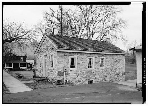
Mount Union borough, A Question We Cannot Settle, and Maybe You CanThis stone house stands on West Water Street near Division. The federal survey records it as the John Sharrar House and…