Mount Union borough
Dickens on the Canal
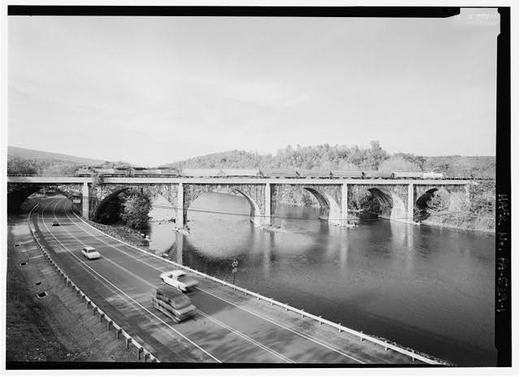
Charles Dickens came through this valley in 1842, on a canal boat, and he wrote it down.
He had ridden a coach from Baltimore to York and on to Harrisburg, and there he boarded a boat on the Pennsylvania Main Line Canal for Pittsburgh. The canal ran west up the Juniata valley, past where Mount Union stands, on its own channel cut alongside the river rather than on the water itself. Charles H. Welch, writing the town's history in 1909, put it plainly: Dickens "came this way in the forties on board a canal boat, before the shrill whistle of the locomotive was heard in the country."
What Dickens remembered was not the scenery first. It was the mornings:
"There was much in this mode of travelling which I heartily enjoyed at the time, and look back upon with great pleasure. Even the running up, bare-necked, at five o'clock in the morning, from the tainted cabin to the dirty deck; scooping up the icy water, plunging one's head into it, and drawing it out, all fresh and glowing with the cold; was a good thing. The fast, brisk walk upon the towing-path, between that time and breakfast, when every vein and artery seemed to tingle with health."
He wrote that about the boat, and the boat came up this valley. A packet did the run at four miles an hour, and a man could step off and walk the towpath faster than it moved, which is exactly what Dickens did.
From the record
Passages about this subject, quoted from county histories now in the public domain. Each one names the book and the position in the text so it can be checked. Spelling is as printed.
Watts, Robert Ferguson, Benjamin Walker, and Joseph Nagle. The names of Stophel Munce, George Etzmiller, Francis Ellis, Samuel Neaves and John Miller appear in the early records as landowners, and some of them may have lived in the township. The Pennsylvania canal ran through this township and the Pennsylvania railroad now follows the Juniata river on the opposite side. The township was named for David Watts, who presided over the court at the time the township was erected in 1849. The first school house was built on what was known as the "Church Lands." It was without a floor and it is said to have settled so much that the teacher could not stand erect in it, when it was rebuilt. In 1912 there were three public schools , McAllister's, Centre, and Livingston's. The schools of New Buffalo, the only borough in the township, are not included in the above. Wheatfield township was erected on January 5, 1826, in response to a petition filed with the court in May, 1824. Several unsuccessful attempts had been made prior to that time to divide Rye township, from which the territory of Wheatfield was taken. At the time it was created it contained 298 taxpayers, but it has since been reduced in size by the formation of Miller, Centre, Penn, and Carroll. Since these townships have been cut off Wheatfield is bounded on the north by Miller, east by the Juniata river, south by Penn, and west by Carroll. It is ten miles long and three miles wide, having an area of thirty square miles.John W. Jordan, ed., History of the Juniata Valley and Its People (New York: Lewis Historical Publishing, 1913) · character 546,114 of the scanned text
Branch of Juniata River, nearly opposite the said John Canan's mills, where the great road from Huntingdon to the western part of the country and to Pittsburg crosses the said branch/ ' This crossing was near Hatfield's Juniata Iron works, in Porter township. Charles Smith was authorized by act of February 7, 1803, to erect a wing dam in the Juniata. He then owned the Huntingdon mills. Shaver's Creek, from its mouth up to the line of James and John Crawford's land, was declared a public highway by act of February 19, 1800; Tuscarora Creek, from its mouth up to the forks near Morrow's mill, by act of April 4, 1805; and the little Juniata, from Ldgan's Narrows to Bell's Mills, then Allegheny township by act of March 26, 1808. The Aughwick Creek became a highway April 1, 1822, and several other acts relative to smaller streams were passed in subsequent years. The importance of the streams as public highways attracted the attention of the Legislature to such an extent as to secure the passage, April 13, 1791, of an act authorizing the improvement of the larger rivers and creeks of the State. It included the Juniata from its mouth to Water Street, and thence to Frankstown, and £2320 were appropriated. The same act made liberal appropriations for the laying out of new and improvement of old roads.Historic Huntingdon, 1767-1909 · character 74,113 of the scanned text
As no report was made by these viewers at April sessions, 1774, on petition, another board of viewers, consisting of James Galbraith, Samuel Thompson, Gaven Cluggage, Giles Stevens, Charles Boyle, and Samuel Daniel, was appointed to lay out a bridle road. The report of these viewers was presented to the court at July sessions, 1774, and the road ordered to be opened thirty-three feet wide. The line began at Silver's Ford, on the Juniata River, about a mile above the mouth of Aughwick Creek, crossed the creek north of Fort Shirley, passed Robert Cluggage's mill, and intersected the wagon-road at Charles Magill's at the Burnt Cabins. Distance according to the return, twenty-one miles and fifty-four perches. At the October sessions, Bartholomew Davis petitioned for a road from his mill "to James Galbraith's and from thence to Patrick Kanan, on the great road leading from Silver's Ford to the Burnt Cabins." James Gailbraith, John Donough, John Ramsey, Robert Ramsey, James Cluggage and Samuel Thompson were appointed viewers.Historic Huntingdon, 1767-1909 · character 68,997 of the scanned text
Sources
- American Notes for General Circulation, Chapter X: Some further Account of the Canal Boat, its Domestic Economy, and its Passengers. Journey to Pittsburg across the Alleghany Mountains, Charles Dickens, via Project Gutenberg (1842)
- History of Mount Union, Shirleysburg and Shirley Township, page 210, recording that Dickens came this way in the forties on a canal boat, Charles Howard Welch, Mount Union, Pa. (1909)
Checked 2026-09-10 · Historic Mount Union collection
← All stories from Mount Union borough
Have something to add to this story, or a photograph of it? Send it here →
Photographs from Mount Union borough
More from Mount Union borough
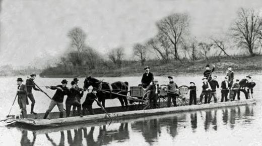
Did you know? The crossing at Drake's Ferry, just above Mount Union, went from a ferry to a series of bridges. Samuel…
Mount Union borough, The darkest day: February 27, 1917February 27, 1917, eight minutes past midnight. The eastbound Mercantile Express, Pennsylvania Railroad train No. 6 out…
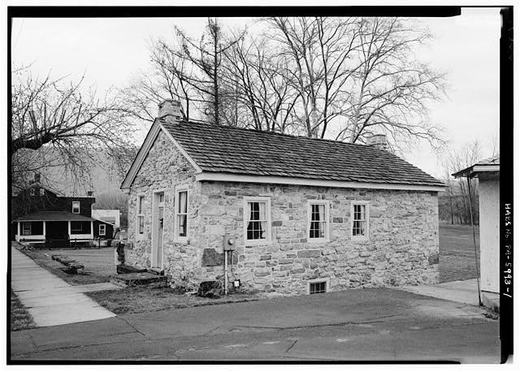
Mount Union borough, A Question We Cannot Settle, and Maybe You CanThis stone house stands on West Water Street near Division. The federal survey records it as the John Sharrar House and…