Huntingdon County Information Page

Borough · Huntingdon County

Alexandria

12 stories on file, each with its sources. 0.1 square miles of land in the ridge and valley country of central Pennsylvania.

384
Population
2020 Census, P.L. 94-171
0.11 sq mi
Land area
2020 Census gazetteer
705 ft
Elevation
Community reference point, checked against USGS
Borough
Type
GEOID 4206100756

Nearby

Straight-line miles between map centers, 2020 Census boundary file

The founding record

The first travelers through the county, the pioneers of the eighteenth century, passed the present site of Alexandria, as it was upon the old Indian path, and the land upon which that town stands was taken up upon one of the warrants issued in 1755. Another tract, on the river below Alexandria, was warranted in the same year. In August, 1793, Elizabeth Gemmill had lots laid out upon the former tract, and the town thus founded was given the name we have mentioned. The proprietress acknowledged the plan on the 7th of August, 1798, and had it recorded on the same day. The borough was incorporated April 11th, 1827, and Trimble's addition was recorded July, 1847. Alexandria has Presbyterian, Reformed and Methodist churches, the buildings being of a superior class and comparing favorably with those of almost any other town of the same population. It has also a large brick public school building, erected within recent years, accommodating a number of schools and all the children of the borough. Walker township extends from Piney ridge, which separates it from Juniata township on the southeast, to Tussey's mountain, dividing it from Blair county on the southwest. Its northern boundary is Porter township, and its southwestern Penn. It was named in honor of the Hon. Jonathan Walker, at one time President Judge of the judicial district to which Huntingdon county belonged. Milton Scott Lytle, History of Huntingdon County (Lancaster: William H. Roy, 1876) · character 582,607 of the scanned text
The borough of Alexandria is situated on the north side of the Frankstown branch of the Juniata river and the HoUidaysburg division of the Pennsylvania railroad, eleven miles by rail west of Huntingdon. It is on the line of the old Indian path and the first land warrant was issued for a tract where the borough now stands in 1755. The town was laid out by Elizabeth Gemmill in August, 1793. Lewis Mytinger opened the first store and was the first postmaster. William Moore and John Walker were the first tavern keepers, and Dr. John A. Buchanan was the first physician. Alexandria became the western terminus of a stage line to Harrisburg in 1808, and after the completion of the Pennsylvania canal it became an important shipping point. It was incorporated by act of the legislature on April 11, 1827, and in July, 1847, Trimble's addition was made to the original plat of one hundred lots. The town has a good public school building, a public library, handsome church edifices of different denominations and in 1910 reported a population of 432, an increase of 26 over the census of 1900. Birmingham, situated on the Little Juniata river and the main line of the Pennsylvania railroad, seven miles west of Huntingdon, was laid out in December, 1797, by John Cadwallader, "for a manufacturing town John W. Jordan, ed., History of the Juniata Valley and Its People (New York: Lewis Historical Publishing, 1913) · character 220,758

Quoted from a work published before 1929 and therefore in the public domain in the United States. Spelling and punctuation are as printed, including nineteenth century spellings of place names. Scanned text carries optical character recognition errors; the character offset is given so the passage can be found and checked in the original.

12 stories

Stories from Alexandria

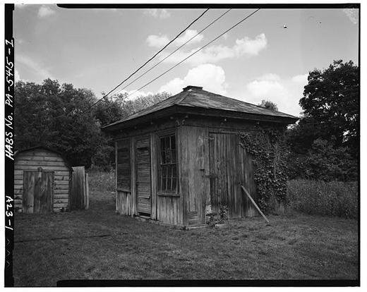
Pennsylvania Railroad Station, Shelton Avenue, Alexandria
Pennsylvania Railroad Station, Shelton Avenue, AlexandriaLibrary of Congress, Historic American Buildings Survey / Historic American Engineering Record. No known copyright restrictions. pa1944

A square frame depot stood on the north side of Shelton Avenue, between Hartslog Street and the old canal basin, when the Historic American Buildings Survey recorded it in August 1988 as HABS PA-5415. The survey describes a low pyramidal roof, a central door flanked by six-over-six wood sash on one side, oversized double wood doors on another, and wide eaves with modest cornice brackets as the whole of its ornament.

The survey dates the building to 1897, when the Pennsylvania Railroad extended a branch off its main line at Petersburg through Alexandria, and calls it the town's first railroad station. A 1991 inventory of the county's historic engineering and industrial sites reads the record differently, dating the little station to about 1900, the year it gives for construction of the Petersburg to Williamsburg branch through town, and adds that it first stood on the south side of the tracks, across Hartslog Street, with a window on its west side for selling tickets. Both agree it was moved about 1903, when a larger station was built.

The timing mattered. The railroad had bought this section of the canal in 1866 but did not close it until 1875, so for the last quarter of the century, the survey says, Alexandria was served by one railroad, and this was its first and short-lived depot. The overview report for the same project says full shipping through Alexandria began in 1900 and that passenger service ended in 1930.

Who replaced it is told three ways. The survey says William Woolverton convinced the railroad company to build a finer station, since demolished, to match the new Memorial Library nearby. The overview report calls Woolverton a director of the Pennsylvania Railroad, says he allegedly convinced the company, and puts the new station in 1904. The 1991 inventory gives the local tradition that both library donors, Woolverton and his cousin William Thompson, felt the town needed a better station and gave heavily toward the brick building that replaced this one.

After 1903 the old building ceased to be a depot and was relocated. The 1991 inventory credits William Baker, owner of the old Shelter Inn across the tracks, with salvaging the frame station and turning it into a garage. In 1988 the survey found it unused; in 1991 the inventory found it deteriorating and used for storage, garage doors on its south side, still standing while the brick station that replaced it had been torn down before 1964 to make way for the Alexandria Fire Hall.

This served as Alexandria's first railroad station from 1897 to 1903. The railroad purchased this section of the canal in 1866, but did not close it until 1875; thus, the transportation industry in Alexandria during the last quarter of the century was served by one railroad, and this was the first, albeit short-lived, local depot.Library of Congress, Historic American Buildings Survey / Historic American Engineering Record, Pennsylvania Railroad Station, written data pages, HABS PA-5415 data pages, p. 2 (Significance) · character 906 of the scanned text
Checked against the record. Checked against the survey's written record before publication; 6 claims it did not support were removed or corrected.

Open this story on its own page →

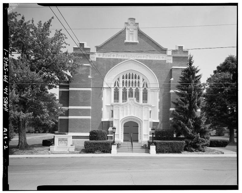
Alexandria Presbyterian Church, Hartslog Street & Shelton Avenue, Alexandria
Alexandria Presbyterian Church, Hartslog Street & Shelton Avenue, AlexandriaLibrary of Congress, Historic American Buildings Survey / Historic American Engineering Record. No known copyright restrictions. pa1942

The Alexandria Presbyterian Church stands on the northeast corner of Hartslog Street and Shelton Avenue, and its doorway carries its own history in an inscription that sets the name First Presbyterian Church between the dates 1850 and 1906. The Historic American Buildings Survey recorded it in 1988 as HABS PA-5413.

The survey dates the building to 1851 and, citing Hartslog Heritage, names William Walker, an Alexandria house carpenter, as its architect. As built it matched the German Reformed Church on Main Street: three bays, a central door, and a hexagonal Greek Revival bell tower over the front gable. Both churches were finished in 1851, and the survey allows that the same architect or the same model may lie behind both. Jordan's 1913 history puts the cost at over $6,000, and Africa's 1883 history says the older White Meeting House was torn down about that time and part of its material went into furnishing the lecture room of the new church.

The congregation was born of a split. Africa records that in 1814 part of the Hart's Log congregation, dissatisfied with the Rev. John Johnston's opinions on the War of 1812, withdrew and ultimately became the basis of the Alexandria Presbyterian Church. In 1819 it joined with Shaver's Creek in calling the Rev. James Thompson, ordained and installed on April 19, 1819; with no meeting house, the people met in a stone shop owned by George Wilson until the frame White Meeting House went up. Thompson served until his death on October 8, 1830. The reunion with Hart's Log was agreed on November 15, 1830 and took effect the following January 1, with 140 names on the rolls; a later count in Africa gives 220 members.

In 1906 the front was rebuilt with financial support from William Thompson, in memory of his father, the pastor. The tower came down and the facade was extended south under a double-height Gothic arch with quatrefoil tracery, crenellated wings and stained glass; the sanctuary's sixteen-over-sixteen sash gave way to pointed arches. The survey found the original block in five-course common bond on a stone foundation, the new front on concrete, and, added later, a small cinder-block shed in the northwest recess.

In 1814 some members withdrew from the Harts Log Church congregation because the pastor, Reverend John Johnston, allegedly expressed some pro-British sentiments; in the wake of the War of 1812 this was not well received, and a large number of the Scotch-Irish congregation formed the Alexandria Presbyterian Church.Library of Congress, Historic American Buildings Survey / Historic American Engineering Record, Alexandria Presbyterian Church, written data pages, HABS PA-5413 data pages, p. 3 (Historical Context) · character 3,920 of the scanned text
Checked against the record. Checked against the survey's written record before publication; 6 claims it did not support were removed or corrected.

Open this story on its own page →

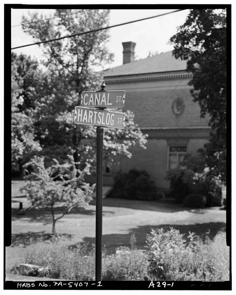
Alexandria, Town of, Alexandria
Alexandria, Town of, AlexandriaLibrary of Congress, Historic American Buildings Survey / Historic American Engineering Record. No known copyright restrictions. pa1936

The Historic American Buildings Survey's overview of Alexandria, HABS PA-5407, is the town-wide report of the 1988 canal-towns project; the individual building records from that summer, from the John Porter House to the lockkeeper's house, list it alongside their own. The project information names Alison K. Hoagland as project leader, Karen Genskow as project historian and Sara Amy Leach as editor of the final report, which became Chapter 3 of Two Historic Pennsylvania Canal Towns: Alexandria and Saltsburg, published by the National Park Service in March 1989.

The report traces the town to the Hartslog tract, in what is now Porter Township, named for the trader John Hart and the fallen white oak log where, the survey says, legend has him salting his horses. In August 1793 Elizabeth Gemmill, a widow, had the town laid out on a grid of 100 lots, 60 by 200 feet except for the shorter ones along the river, with a diamond one block from Main Street. Lytle's 1876 county history records that the proprietress acknowledged the plan on August 7, 1798, and had it recorded the same day; Africa's 1883 history says it was attested for her that day by David Stewart. Lytle gives the borough's incorporation as April 11, 1827. Africa adds that the lots carried a ground rent from September 1, 1793; the survey says Gemmill's heirs went on collecting it until about 1920.

The canal made the town. The survey says the plans for it set off a building boom in Alexandria by 1825, with brick taking over from log and stone. The Juniata Division was legislated in 1827, regular shipping began in the spring of 1833, and locks No. 49 and No. 50 sat just west and east of Hartslog Street. The survey credits the years 1830 to 1850 with the town's most elaborate buildings, and two brick Greek Revival churches, German Reformed and Presbyterian, were finished in 1851.

The Pennsylvania Railroad bought the main line east of Hollidaysburg in 1866 and the canal through Alexandria closed in 1875; a small station followed in 1897 and full shipping in 1900. The survey found a historic core without modern intrusive buildings and recommended it for the National Register of Historic Places as a district. It also priced the original lots in English pounds: seven for a lot on the diamond, three for one on Third Street.

Altogether, this division required eighty-eight locks to overcome a rise of 582 feet. Locks No. 49 and No. 50 were constructed in Alexandria just west and east of Hartslog StreetLibrary of Congress, Historic American Buildings Survey / Historic American Engineering Record, Alexandria, written data pages, HABS PA-5407 data pages, p. 10 (Canal Era) · character 24,771 of the scanned text
Checked against the record. Checked against the survey's written record before publication; 8 claims it did not support were removed or corrected.

Open this story on its own page →

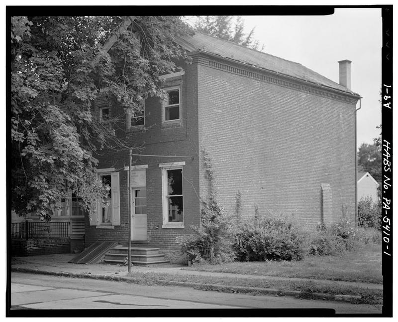
Evander P. Walker Store, Main Street, Alexandria
Evander P. Walker Store, Main Street, AlexandriaLibrary of Congress, Historic American Buildings Survey / Historic American Engineering Record. No known copyright restrictions. pa1939

On the north side of Main Street in Alexandria, five lots north of Hartslog Street, stands a two-story brick store with its gable turned to the street. The Historic American Buildings Survey recorded it in 1988 as the Evander P. Walker Store and called it the only gable-front, three-bay commercial building in Alexandria dating from the middle of the nineteenth century, the lone surviving example of the town's mercantile vernacular. By 1988 it held a video arcade and apartments.

The survey dated it broadly, to somewhere between 1855 and 1875. A period map shows Henry C. Walker owning the lot in 1855. On August 28, 1860, he sold it to Samuel Isenberg for $700 with only a dwelling on it, and on September 12, 1862, Isenberg sold it for $800 to Evander P. Walker, then a merchant in the town. The survey reasoned that Walker put up the store after buying the lot, though it could not fix the year.

The survey called Evander probably Henry's son. The 1897 Commemorative Biographical Encyclopedia of the Juniata Valley settles it, listing Evander P. among the children of Henry C. and Susan (Young) Walker and recording his marriage to Satira Stewart. Africa's 1883 history names E. P. Walker among the merchants of a village that had three stores in 1881, and lists him that year as treasurer of the Odd Fellows lodge and a trustee of the Methodist church. The survey adds that he was burgess of Alexandria in 1875 and 1876 and again in 1880 and 1881.

The survey counts the property as staying in the Walker family for 100 years: deeded to Susan Walker in 1868, back to Evander from her heirs in 1885, to Sue Y. and Mary Walker in 1935, and sold out of the family on December 27, 1962. The windows had all been replaced with modern sash when the survey came, but the brickwork under the eaves survives, mouse-tooth and dentil courses along the side walls with corbeled corners, on a building roughly 20 by 55 feet.

Evander P. Walker, probably Henry's son, acquired the store in 1862 and is identified as a dry-goods merchant in 1862-63 and 1880 censuses. He was a member of the Odd Fellows, for which he served as treasurer in 1881. Walker was a burgess in Alexandria from 1875-76 and 1880-81.Library of Congress, Historic American Buildings Survey / Historic American Engineering Record, Evander P. Walker Store, written data pages, HABS PA-5410 data pages, report page 2 (PDF page 3) · character 4,117 of the scanned text
Checked and confirmed. Every date, name and number was matched to the survey's written record before publication.

Open this story on its own page →

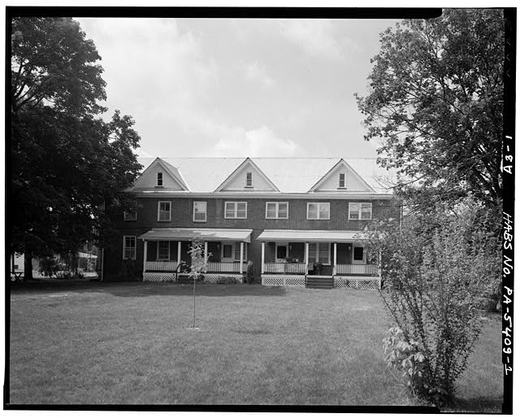
Henry Willibrand Brewery, 700 Block, Main Street, Alexandria
Henry Willibrand Brewery, 700 Block, Main Street, AlexandriaLibrary of Congress, Historic American Buildings Survey / Historic American Engineering Record. No known copyright restrictions. pa1938

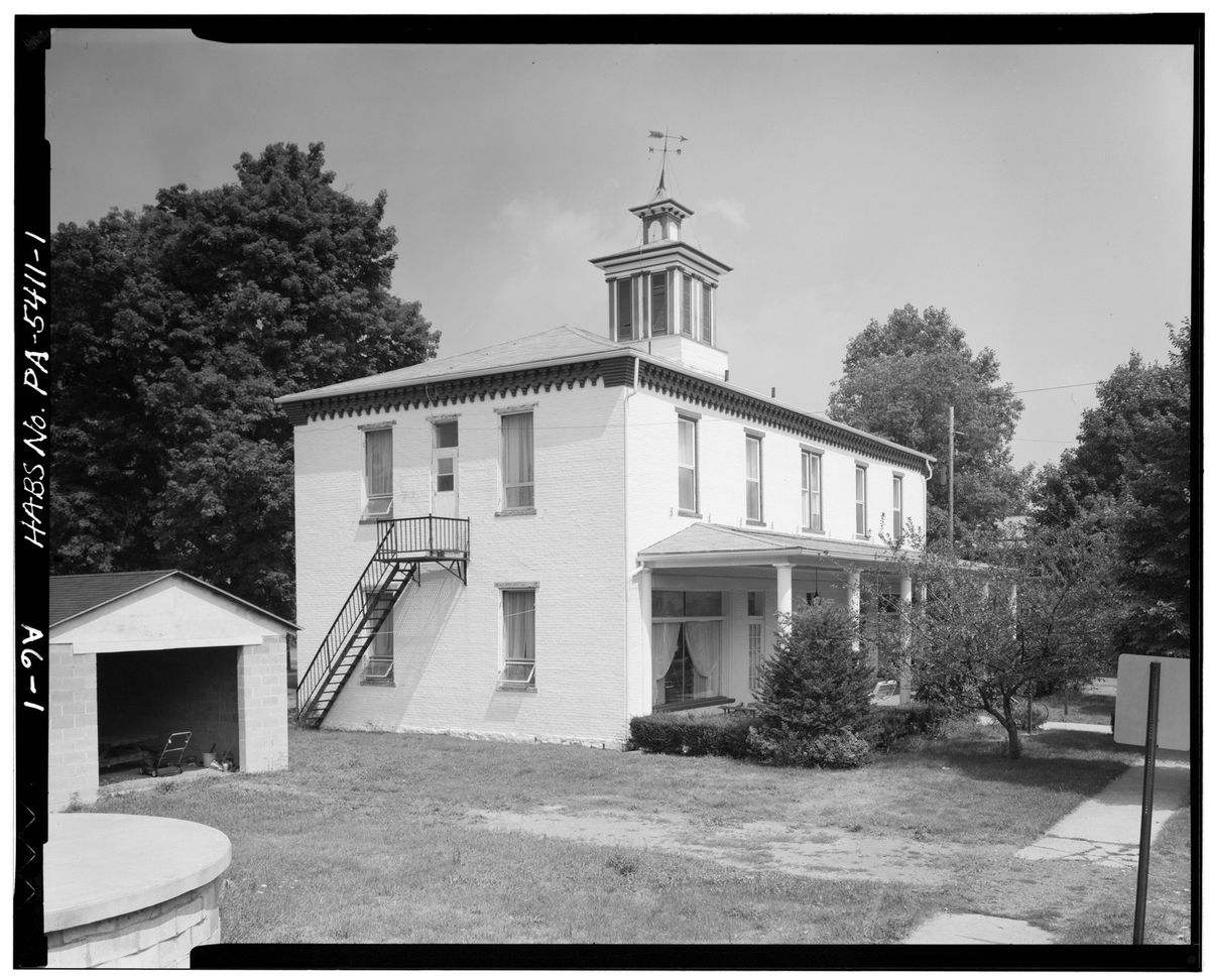
At the west end of Main Street in Alexandria, set 80 feet back from the road on the south side, stands a brick building, two stories raised to two and a half by dormers, that the Historic American Buildings Survey recorded in 1988 as the Henry Willibrand Brewery. By then it had been cut into four apartments and no brewing equipment was left inside. The survey counted it among the few buildings in the borough that still stand as a reminder of its industrial past.

The survey could not settle the year it went up. Willibrand advertised a brewery in Alexandria in 1824, but he did not take title to these two lots until 1829, when he bought them from Dr. James Trimble and his wife. In 1833 he advertised in the Huntingdon Gazette that a new brewery was running, headed by a brewer from Philadelphia. In 1835 he drowned in the canal lock while filling in for a sick lockkeeper.

Henry and John Fockler took the property in 1840. The county's 1991 inventory of industrial sites adds that their deed describes a brick building thought to be the one still standing, and that the 1850 census counted the Fockler brewery's output at 400 barrels of beer and 1,011 barrels of ale and porter. Africa's 1883 county history remembered a large brewery run at Alexandria by Henry Fockler some years before, its building long unused by the time he wrote.

The two records disagree on when brewing stopped. The survey found the business run as the Alexandria Brewery in 1873 and allowed that the site may have brewed until about 1880. The 1991 inventory doubts the business outlived Henry Fockler's sale of 1856, since no later tax or census record of production turned up. A sheriff's deed of 1898 described the property as a former brew house occupied as a residence.

The front wall is red brick laid in Flemish bond. In 1976 the building had three chimneys; the survey found one, on the west gable end.

In 1824 Willibrand advertised his brewery in Alexandria, possibly at a site previous to this one. In an 1833 Huntingdon Gazette advertisement, Willibrand announced that his new brewery was operating in Alexandria, headed by a brewer from Philadelphia.Library of Congress, Historic American Buildings Survey / Historic American Engineering Record, Henry Willibrand Brewery, written data pages, HABS PA-5409 data pages, report page 3 (PDF page 4) · character 5,867 of the scanned text
Checked against the record. Checked against the survey's written record before publication; 5 claims it did not support were removed or corrected.

Open this story on its own page →

Pennsylvania Canal Lockkeeper's House, Hartslog Street & Shelton Avenue, Alexandria
Pennsylvania Canal Lockkeeper's House, Hartslog Street & Shelton Avenue, AlexandriaLibrary of Congress, Historic American Buildings Survey / Historic American Engineering Record. No known copyright restrictions. pa1935

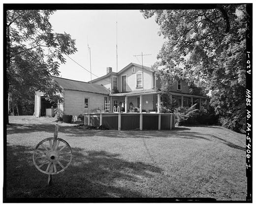
At the southeast corner of Hartslog Street and Shelton Avenue stands a two-story frame house that does not line up with the rest of Alexandria. The Historic American Buildings Survey, recording it in the summer of 1988 as HABS PA-5406, says it is the only building in town set at an angle to the street grid, turned to front the canal path that once ran past its door. The survey calls it the only lockkeeper's house built in Alexandria, and its tender was responsible for two locks, No. 49 and No. 50, one on each side of Hartslog Street.

The survey dates the house to about 1832. The chain of title it traced, which it calls incomplete, begins with a deed of December 30, 1835, from Robert McClelland to the Commonwealth of Pennsylvania, and the report concludes the canal company built the house after taking the land. The overview report for the same project is less sure: it allows that McClelland may have built the house and had it moved, and says only that the commonwealth took the lot from him for a lock house in 1835. A 1991 National Park Service inventory of the county's engineering sites reads the 1835 deed as conveying a lot that already had a house on it.

Census returns name some of the tenders who lived here rent free: W. Mealy, 53, in 1850; Thomas Madow, 17, in 1860; and Perry Robinson, 58, in 1870. The canal through Alexandria closed in 1875, and on December 31 of that year the Pennsylvania Canal Company deeded the property to William P. Robison. In 1890 it passed to William M. Phillips, a grain buyer and commission merchant from York whom the survey describes as a leading merchant in the county by 1868.

By 1988 a front door had been cut into the west side so the house faced Hartslog Street instead of the canal, and it had been wrapped with a one-story porch and enlarged with a two-story shed and a garage. The survey rated its fabric fair. The 1991 inventory names it, substantially altered, among the standing canal remains its survey recorded in the county, alongside the guard lock, its feeder and remnants of the Raystown feeder dam below Huntingdon. Warren and Rebecca Itinger had owned it since April 25, 1950.

The house was undoubtedly erected by the Pennsylvania Canal Company after it obtained deed to the land in 1835, gable-front oriented to accommodate the canal's diagonal alignment through Alexandria. No other building in town violates the rectangular town grid.Library of Congress, Historic American Buildings Survey / Historic American Engineering Record, Pennsylvania Canal Lockkeeper's House, written data pages, HABS PA-5406 data pages, p. 3 (Historical Context) · character 4,285 of the scanned text
Checked against the record. Checked against the survey's written record before publication; 7 claims it did not support were removed or corrected.

Open this story on its own page →

German Reformed Church, Main Street & Church Street, Alexandria
German Reformed Church, Main Street & Church Street, AlexandriaLibrary of Congress, Historic American Buildings Survey / Historic American Engineering Record. No known copyright restrictions. pa1941

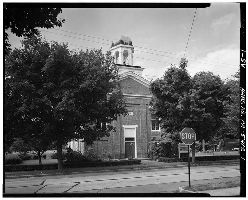
Christ Reformed Church, the German Reformed Church when it was built, fronts the south side of Main Street in Alexandria about 20 feet west of Church Street. The Historic American Buildings Survey recorded it in 1988 as HABS PA-5412 and called it a modest Greek Revival church that has stayed largely unaltered.

Africa's 1883 history gives the founding. Between November 5, 1843 and October 1, 1852 the Rev. Samuel H. Reid was pastor of the Water Street charge, and in his time the charge was divided into three congregations, called locally Keller's, Sinking Valley and Alexandria, each with its own organization under one minister. On April 13, 1846, John G. Stewart conveyed a lot in trust for the Reformed congregation, and on it the church was erected in 1849: a large two-story brick with steeple and bell, room for five hundred worshipers, not consecrated until 1851. Africa lists the Alexandria membership by family, among them Harnish, Huyett, Isenberg, Knode, Neff and Piper, and a few years after the division counts 145 confirmed members and 163 baptized, 308 in all.

The survey adds what stood on the lot before. The Hart's Log Presbyterians had a brick church here, used until they moved to the White Church in Alexandria, and the survey says the first brick building was sold to James Wilson in 1833. Africa tells the rest of that story: the Hart's Log and Alexandria congregations agreed terms of reunion on November 15, 1830, taking effect the first of January following. The dedication stone above the door originally read \"German Reformed Church 1851\"; the survey says the word \"German\" was reportedly chipped away during the First World War, and a modern stained glass transom now reads \"Christ Reformed Church.\" Africa's 1883 history heads its account \"Christ's Reformed Church of Alexandria,\" and the survey reads that as the name in use by 1881.

Inside, the sanctuary fills the second floor with fifteen rows of pews, four of them stepped on risers against the north wall, under a coffered plaster ceiling and four brass chandeliers. The stained glass windows are alike in color and design and differ in the names inscribed on them, and those names, the survey says, belong to the Harnish, Isenberg, Neff and Piper families. In 1881 Africa lists Benjamin Isenberg and John H. Kennedy superintending a Sabbath school of 160.

The dedication stone set into the recessed brick panel above the front door originally read "German Reformed Church 1851," but the word "German" was reportedly chipped away during World War I when anti-German sentiments ran high.Library of Congress, Historic American Buildings Survey / Historic American Engineering Record, German Reformed Church, written data pages, HABS PA-5412 data pages, p. 3 (Alterations and additions) · character 3,382 of the scanned text
Checked against the record. Checked against the survey's written record before publication; 6 claims it did not support were removed or corrected.

Open this story on its own page →

John Porter House, Bridge & Main Streets, Alexandria
John Porter House, Bridge & Main Streets, AlexandriaLibrary of Congress, Historic American Buildings Survey / Historic American Engineering Record. No known copyright restrictions. pa1926

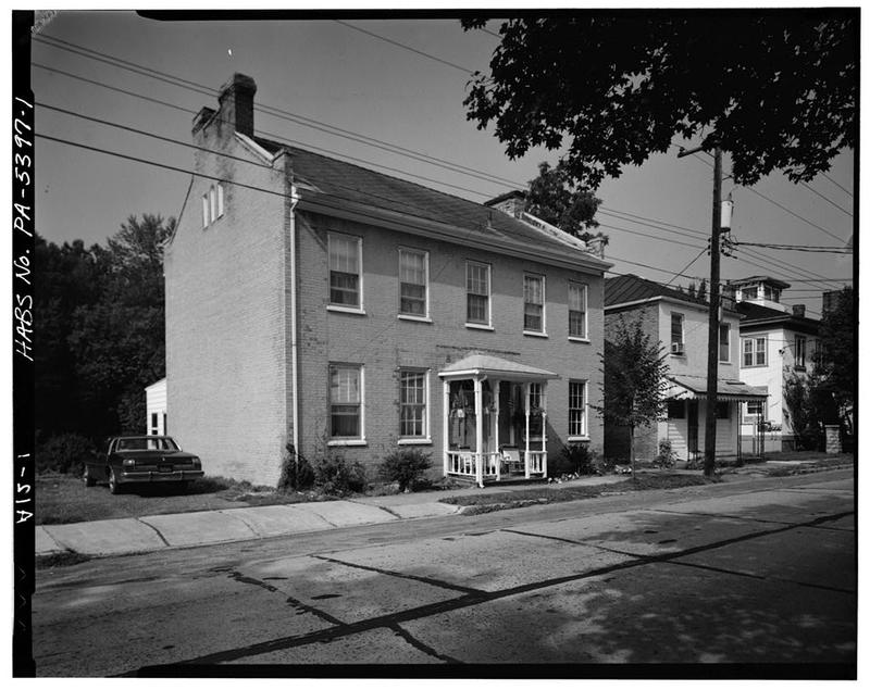
About 90 feet west of the corner of Bridge and Main streets in Alexandria, on the south side of Main with the Juniata River at the back of the lot, stands a two-story brick house that the Historic American Buildings Survey recorded in 1988 as the John Porter House. The survey dated it to about 1822 to 1824 and described a five-bay, L-plan dwelling with a center hall, its Federal styling concentrated at the front door: a six-panel wood door under a decorated fanlight, with three-light sidelights to either side. The deed came on April 30, 1824, from Conrad Bucher to John and Maria Porter. Africa's 1883 history, in its appended list of county marriages, records John Porter marrying a daughter of Conrad Bucher of Alexandria.

The survey called Porter one of the most successful of Alexandria's merchants. Africa records the store of Bucher & Porter, followed by John Porter, and names Bucher & Porter among the owners of the village's four warehouses in the best period of the canal. He served as postmaster, and Africa's roll of the Alexandria school board shows him as secretary from 1857 to 1864. In the Alexandria Presbyterian Church he sat on the first session of elders of the united congregations of Hart's Log and Alexandria, and was clerk of session for fifty-six years. Elected superintendent of the Sabbath school in 1825, he held the post until a few Sabbaths before his death in the spring of 1881.

The survey adds, on the authority of the Huntingdon County Historical Society, that the house was the birthplace of his son Thomas Conrad Porter, a botanist for whom a tree and a flower were named.

His executors conveyed the house to Salome Porter on December 13, 1897, and it was still a single-family home when the survey came. Paired interior chimneys rise through a parapet at each gable end, and between the flues on the east end three narrow attic windows form a modest Palladian group: an arched four-light window flanked by two three-light windows.

The owner of this house throughout the canal era, John Porter, was a locally eminent man. He was director of the Alexandria school in 1848, and secretary of the school board from 1857-64. An elder of the Presbyterian Church in its early years, he was also clerk of the Presbyterian sessions for fifty-six years (Africa, 430).Library of Congress, Historic American Buildings Survey / Historic American Engineering Record, John Porter House, written data pages, HABS PA-5397 data pages, report page 2 (PDF page 3) · character 3,345 of the scanned text
Checked against the record. Checked against the survey's written record before publication; 5 claims it did not support were removed or corrected.

Open this story on its own page →

Did you know? You can still drive a piece of the 1810s turnpike, and it still has the same potholes people complained about two hundred years ago.

The Huntingdon, Cambria and Indiana Turnpike Road Company was incorporated March 20, 1810, after attempts in 1806 and 1807 to get a turnpike from Harrisburg to Pittsburgh had failed. Then nothing happened for years. It took a meeting of citizens in the Huntingdon County Courthouse in January of 1814 to finally raise enough interest, and stock went on sale that April.

By 1821 the road ran complete from Huntingdon to Blairsville, seventy seven miles. It cost more than the subscribers had paid in, so the managers ended up issuing scrip to pay the contractors.

Here is the part worth knowing. A three and a half mile stretch of it still exists, crossing Warrior Ridge between Huntingdon and Alexandria. The state's survey of historic engineering sites calls it "extant and in relatively unaltered condition," mostly unpaved, steep and sharply curved, and "perennially marked by the potholes, ruts, washouts, and dust or mud of which eighteenth-century travelers complained."

East of the ridge it runs past the Pulpit Rocks.

Two centuries on, the road is still bad in exactly the way the people who used it said it was.

Have you driven that stretch over Warrior Ridge? Tell us what it is like now.

Checked against the record. Error: "The road was completed by 1819." It was not. The 1991 county survey of historic engineering and industrial sites says "By 1821 the road was complete from Huntingdon to Blairsville, a distance of seventy-seven miles," and gives the construction date range as 1815 to 1821. Two years early. Correct in the original: the 1810 authorization (the company was incorporated March 20, 1810), the seventy seven miles, and…

Open this story on its own page →

Did you know? Mount Union was not the only town in this county making silica brick. Alexandria had a plant too.

Federal Refractories built a plant west of Alexandria in 1904, at the base of Tussey Mountain. An incline connected it with its quarry on the mountaintop, and the new Petersburg branch of the Pennsylvania Railroad passed within yards of the works, bringing coal for the machinery and kilns and hauling the finished brick to distant markets. A county history printed in 1937 names the large silica brick plants at Mount Union and Alexandria together.

By the end of the 1950s the Alexandria plant had shut down. Maryland Refractories bought it in 1959 to make grog from reclaimed brick, moved to Ohio in the early 1980s, and the plant was razed in 1988.

Checked and confirmed. CONFIRMED 2026-10-03 against the sources listed: every factual sentence was tied to a verbatim passage and a script confirmed each passage is in its source. Where sources disagreed on a number, the number was left out. Information shared with us by readers is given as theirs, not as fact: Myer Souders.

Open this story on its own page →

Northeast/Front Side, Looking Southeast - Alexandria High School, Main Street & Church Street, Alexandria, Huntingdon County, PA
Northeast/Front Side, Looking Southeast - Alexandria High School, Main Street & Church Street, Alexandria, Huntingdon County, PALibrary of Congress, Historic American Buildings Survey / Historic American Engineering Record. No known restrictions on images made by the U.S. Government. pa1940.photos.134378p

Main Street at Church Street, Alexandria borough, recorded by the Historic American Buildings Survey. The caption below is the survey's: the northeast front, looking southeast.

Open this story on its own page →

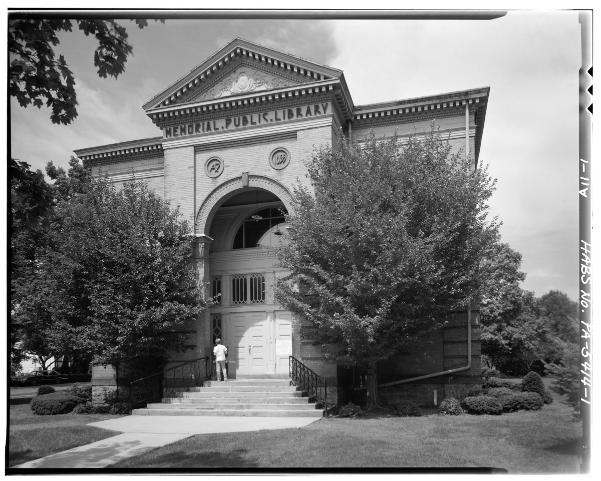
Southwest/front side looking northeast - Alexandria Memorial Public Library, Hartslog & Main Streets, Alexandria, Huntingdon County, PA
Southwest/front side looking northeast - Alexandria Memorial Public Library, Hartslog & Main Streets, Alexandria, Huntingdon County, PALibrary of Congress, Historic American Buildings Survey / Historic American Engineering Record. No known restrictions on images made by the U.S. Government. pa1943.photos.134381p

The federal survey photographed this building at Hartslog and Main Streets in Alexandria borough. The plate below is the survey's own, and the caption is the one the Library of Congress records with it: the southwest front, looking northeast. Alexandria is one of the oldest towns in the county, laid out in 1795.

Open this story on its own page →

Where it sits

Alexandria borough: 12 storiesBirmingham borough: 2 storiesBroad Top City borough: 2 storiesCassville borough: 2 storiesCoalmont borough: 2 storiesDudley borough: 2 storiesHuntingdon borough: 36 storiesMapleton borough: 6 storiesMarklesburg borough: 4 storiesMill Creek borough: 4 storiesMount Union borough: 137 storiesOrbisonia borough: 8 storiesPetersburg borough: 3 storiesRockhill borough: 5 storiesSaltillo borough: 5 storiesShade Gap borough: 3 storiesShirleysburg borough: 4 storiesThree Springs borough: 4 storiesBarree township: 6 storiesBrady township: 4 storiesCarbon township: 3 storiesCass township: 2 storiesClay township: 4 storiesCromwell township: 7 storiesDublin township: 5 storiesFranklin township: 10 storiesHenderson township: 6 storiesHopewell township: 5 storiesJackson township: 9 storiesJuniata township: 8 storiesLincoln township: 5 storiesLogan township: 5 storiesMiller township: 4 storiesMorris township: 2 storiesOneida township: 6 storiesPenn township: 4 storiesPorter township: 10 storiesShirley township: 10 storiesSmithfield township: 5 storiesSpringfield township: 5 storiesSpruce Creek township: 7 storiesTell township: 3 storiesTodd township: 5 storiesUnion township: 5 storiesWalker township: 9 storiesWarriors Mark township: 5 storiesWest township: 2 storiesWood township: 13 storiesHuntingdonMount UnionOrbisoniaThree SpringsPetersburgMapletonAlexandriaRockhillBroad Top CitySaltillo
10 or more4 to 91 to 3borough outline